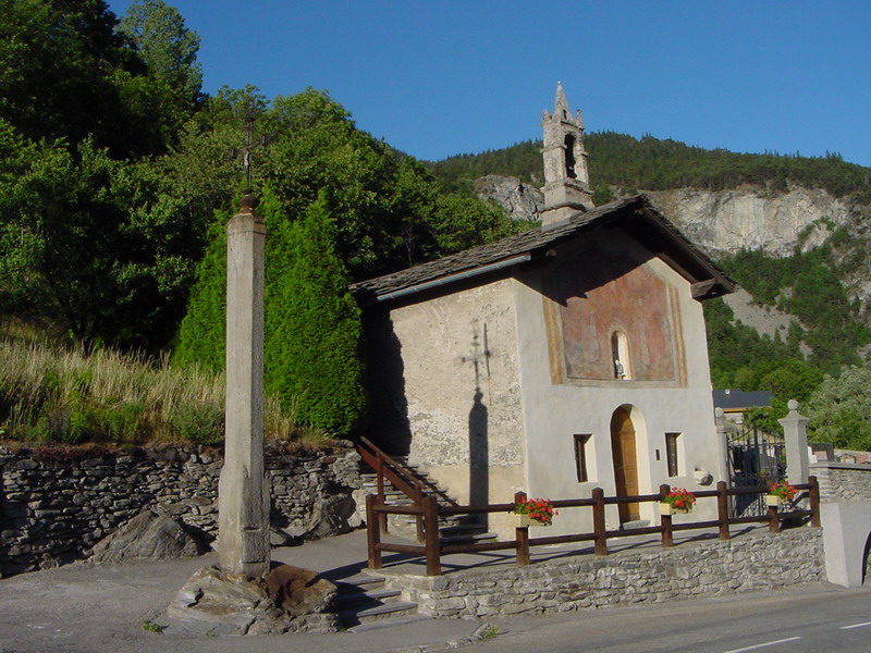
Fourneaux (Fourneaux)

- commune in Savoie, France
 Hiking in Fourneaux
Fourneaux, located in the Savoie region of the French Alps, offers a variety of hiking opportunities for outdoor enthusiasts. The area is characterized by stunning alpine scenery, including mountains, valleys, and lush forests. Here are some key points to consider if you're planning a hiking trip in Fourneaux:
Hiking Trails
- Local Trails: There are numerous well-marked trails in and around Fourneaux, catering to different skill levels. You can find gentle walks as well as challenging hikes.
- Mont Cenis: A popular hiking destination near Fourneaux is Mont Cenis, which offers breathtaking views and a network of trails that can lead you to various scenic spots.
- Vanoise National Park: A short distance away, this park features miles of trails surrounded by impressive landscapes and diverse wildlife.
Scenic Features
- Alpine Flora and Fauna: The area is rich in biodiversity, and you may spot a variety of wildflowers, alpine birds, and even marmots along the trails.
- Panoramic Views: Many hikes provide stunning views of the surrounding peaks and valleys, especially on higher elevation trails.
Difficulty Levels
- Trails in the area range from easy, family-friendly paths to more strenuous routes suitable for experienced hikers. Be sure to choose hikes appropriate to your skill level and physical condition.
Tips for Hiking in Fourneaux
- Weather: The weather can change rapidly in the Alps, so be prepared with appropriate clothing and gear.
- Maps and Guides: Consider obtaining a hiking map or using a GPS device, as some trails may not be well marked.
- Stay Hydrated and Snack Ready: Always carry enough water and snacks, especially on longer hikes.
Best Times to Visit
The best time to hike in the region is during the late spring through early autumn (May to September) when the weather is generally mild and trails are more accessible.
Conclusion
Hiking in Fourneaux, Savoie provides a wonderful opportunity to experience the natural beauty of the French Alps. Whether you're a beginner or an experienced hiker, the region offers trails that can cater to your adventure level while providing stunning landscapes to enjoy along the way. Always check current trail conditions and local recommendations before heading out!
- Country:

- Postal Code: 73500
- Coordinates: 45° 11' 29" N, 6° 39' 6" E


- GPS tracks (wikiloc): [Link]
- Area: 5.04 sq km
- Population: 666
- Wikipedia en: wiki(en)
- Wikipedia: wiki(fr)
- Wikidata storage: Wikidata: Q736485
- Wikipedia Commons Category: [Link]
- Freebase ID: [/m/03qlmfk]
- GeoNames ID: Alt: [6613607]
- SIREN number: [217301175]
- BnF ID: [15274051h]
- INSEE municipality code: 73117
Shares border with regions:

Saint-André
- commune in Savoie, France
Hiking in Saint-André
Saint-André, located in the Savoie region of the French Alps, is an excellent destination for hiking enthusiasts. With its stunning alpine scenery, diverse trails, and rich natural biodiversity, the area offers various hiking opportunities suitable for all skill levels....
- Country:
- Postal Code: 73500
- Coordinates: 45° 12' 4" N, 6° 37' 9" E
- GPS tracks (wikiloc): [Link]
- Area: 30.84 sq km
- Population: 476


Freney
- commune in Savoie, France
Hiking in Freney
Freney, often associated with the broader region of the French Alps, offers stunning scenery and a variety of hiking opportunities. The area is known for its striking mountain landscapes, glacial lakes, and picturesque valleys. Here are some key highlights and tips for hiking in and around Freney:...
- Country:
- Postal Code: 73500
- Coordinates: 45° 11' 38" N, 6° 37' 37" E
- GPS tracks (wikiloc): [Link]
- Area: 11.13 sq km
- Population: 105
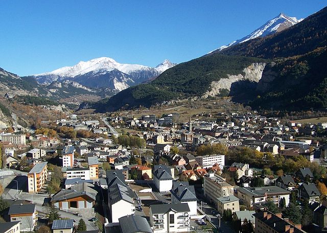

Modane
- commune in Savoie, France
Hiking in Modane
Modane is a picturesque town located in the Savoie region of the French Alps, known for its stunning landscapes and proximity to various outdoor activities, including hiking. Here are some key points to consider if you're planning to hike in and around Modane:...
- Country:
- Postal Code: 73500
- Coordinates: 45° 12' 5" N, 6° 40' 24" E
- GPS tracks (wikiloc): [Link]
- AboveSeaLevel: 1000 м m
- Area: 71.04 sq km
- Population: 3180
- Web site: [Link]