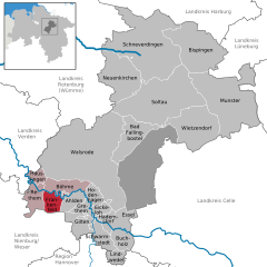
Frankenfeld (Frankenfeld)
- municipality of Germany
Frankenfeld is a charming region that offers various hiking opportunities, although it might not be as widely known as some other hiking destinations. If you're planning to hike in this area, here are some aspects to consider:
Terrain and Trails
- Diverse Landscapes: Frankenfeld often features picturesque landscapes, including rolling hills, wooded areas, and open fields. The terrain might be relatively gentle, making it suitable for both beginner and experienced hikers.
- Marked Trails: Look for marked trails that are maintained by local hiking clubs or parks. These trails can range in difficulty and often offer beautiful views of the surrounding nature.
- Guided Hikes: Depending on the time of year, there might be guided hikes available that provide insights into the local flora, fauna, and history of the area.
Best Times to Hike
- Spring and Fall: These seasons generally provide mild temperatures and stunning scenery, as wildflowers bloom in spring and leaves change color in fall.
- Summer: While summer can be enjoyable, ensure you have plenty of water and sun protection since temperatures can rise.
Wildlife and Flora
- Be on the lookout for various species of birds and wildlife. Depending on the specific trails, you might encounter local wildlife and beautiful flora native to the region.
Preparation Tips
- Footwear: Ensure you have sturdy, comfortable hiking boots or shoes to handle various terrains.
- Pack Essentials: Bring enough water, snacks, a first-aid kit, and weather-appropriate clothing. Always check the weather before heading out.
- Navigation: Even if trails are marked, a map or GPS device can be helpful, especially if you're venturing into less frequented areas.
Local Resources
- Look for local hiking clubs or visitor centers that provide trail maps, information, and possibly group hiking events. Engaging with local communities can enhance your hiking experience.
Before you head out, make sure to research specific trails in Frankenfeld, as conditions and available routes can change. Enjoy your hiking adventure in this lovely area!
- Country:

- Postal Code: 27336
- Local Dialing Code: 05165
- Licence Plate Code: SFA
- Coordinates: 52° 46' 0" N, 9° 25' 0" E


- GPS tracks (wikiloc): [Link]
- AboveSeaLevel: 18 м m
- Area: 24.26 sq km
- Population: 502
- Web site: http://www.rethem.net/
- Wikipedia en: wiki(en)
- Wikipedia: wiki(de)
- Wikidata storage: Wikidata: Q670982
- Wikipedia Commons Category: [Link]
- Freebase ID: [/m/02rzzgg]
- GeoNames ID: Alt: [6552770]
- VIAF ID: Alt: [240525187]
- OSM relation ID: [1799472]
- German municipality key: 03358009

