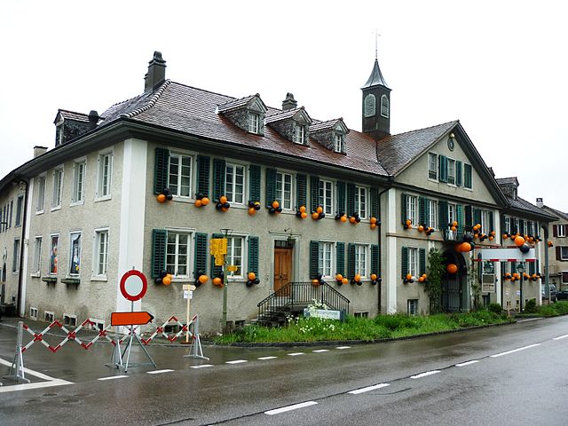
Frauenfeld (Frauenfeld)

- town in, and capital of, the Swiss canton of Thurgau
 Hiking in Frauenfeld
Frauenfeld, the capital of the Canton of Thurgau in Switzerland, offers a range of beautiful hiking opportunities that cater to various skill levels, from leisurely walks to challenging hikes. Here are some key points to consider when hiking in and around Frauenfeld:
Trails and Routes
-
Säntisblick Trail: This popular route offers stunning views of the Säntis mountain and the surrounding landscape. It's a moderate hike that is well-marked and suitable for families.
-
Thur Valley: The Thur River runs through Frauenfeld, providing a scenic backdrop for easy riverside walks. The paths along the river are generally flat and great for beginners or those looking for a more leisurely outing.
-
Hiking in the Castle Park: The Frauenfeld Castle is surrounded by beautiful parkland. You can explore the park’s pathways and enjoy pleasant strolls through its gardens and forested areas.
-
Towards the Wülflingen: Heading towards the nearby village of Wülflingen, you can find trails that take you through rolling hills and vineyards, showcasing the beautiful Thurgau countryside.
-
Nature Trails: Several marked nature trails highlight the local flora and fauna, perfect for nature enthusiasts and families interested in learning about the environment.
Tips for Hiking in Frauenfeld
-
Seasonal Considerations: Spring and summer are the best times for hiking, but be aware of the weather conditions, especially in autumn or winter, as paths can be slippery or snow-covered.
-
Maps and Signage: Swiss hiking trails are well-marked with signs. However, it's wise to carry a map or download a hiking app for navigation.
-
Equipment: Wear proper hiking shoes and dress in layers, as temperatures can change throughout the day.
-
Water and Snacks: Carry enough water and snacks, especially if you plan on hiking longer trails.
-
Respect Nature: Stick to marked paths and follow Leave No Trace principles to preserve the natural beauty of the area.
Nearby Attractions
-
Historical Sites: Aside from natural beauty, Frauenfeld offers historical sites worth visiting, such as the Frauenfeld Castle and local museums, which can enhance your hiking experience.
-
Wine Trails: The region is known for its vineyards. Some trails combine hiking with wine tasting, providing a unique experience.
Conclusion
Hiking in Frauenfeld allows you to experience the beauty of the Swiss countryside, with a mix of easy walks and more challenging hikes. Always be prepared, respect the local environment, and enjoy the stunning views that this charming area has to offer!
- Country:

- Postal Code: 8500
- Local Dialing Code: 052
- Licence Plate Code: TG
- Coordinates: 47° 33' 21" N, 8° 53' 47" E


- GPS tracks (wikiloc): [Link]
- AboveSeaLevel: 417 м m
- Area: 27.4 sq km
- Population: 25442
- Web site: https://www.frauenfeld.ch
- Wikipedia en: wiki(en)
- Wikipedia: wiki(de)
- Wikidata storage: Wikidata: Q68120
- Wikipedia Commons Gallery: [Link]
- Wikipedia Commons Category: [Link]
- Freebase ID: [/m/05sx7q]
- GeoNames ID: Alt: [2660727]
- BnF ID: [12486387z]
- VIAF ID: Alt: [160734435]
- OSM relation ID: [1684522]
- GND ID: Alt: [4018220-4]
- archINFORM location ID: [9797]
- Library of Congress authority ID: Alt: [n81018174]
- MusicBrainz area ID: [61ebc007-0ab4-419b-a187-d6916dfc1d96]
- Quora topic ID: [Frauenfeld]
- Encyclopædia Britannica Online ID: [place/Frauenfeld]
- HDS ID: [1898]
- EMLO location ID: [df2d1319-1783-47a5-84f0-4ef4c25a04e8]
- Swiss municipality code: [4566]
- NKCR AUT ID: [ge972974]
Shares border with regions:


Felben-Wellhausen
- municipality in Switzerland
Hiking in Felben-Wellhausen
Felben-Wellhausen is a charming municipality located in the canton of Thurgau in Switzerland. While it's a small area, it offers a serene environment for hiking enthusiasts who wish to explore the scenic landscapes of the region. Here are some highlights for anyone looking to hike in and around Felben-Wellhausen:...
- Country:
- Postal Code: 8552
- Local Dialing Code: 052
- Licence Plate Code: TG
- Coordinates: 47° 34' 37" N, 8° 56' 34" E
- GPS tracks (wikiloc): [Link]
- AboveSeaLevel: 395 м m
- Area: 7.3 sq km
- Population: 2799
- Web site: [Link]

Gachnang
- municipality in Switzerland
Hiking in Gachnang
Gachnang, located in the scenic region of Switzerland, offers a variety of hiking opportunities that cater to different skill levels and preferences. The area is characterized by its stunning landscapes, which include lush forests, rolling hills, and picturesque views of the surrounding mountains....
- Country:
- Postal Code: 8525, 8547
- Local Dialing Code: 052
- Licence Plate Code: TG
- Coordinates: 47° 32' 53" N, 8° 51' 14" E
- GPS tracks (wikiloc): [Link]
- AboveSeaLevel: 439 м m
- Area: 9.7 sq km
- Population: 4287
- Web site: [Link]


Thundorf
- municipality in Switzerland
Hiking in Thundorf
Thundorf is a charming village located in the Thurgau region of Switzerland, surrounded by beautiful landscapes that are perfect for hiking enthusiasts. While it might not be as well-known as some other Swiss hiking destinations, it offers a variety of trails that take you through serene nature, vineyards, and picturesque countryside....
- Country:
- Postal Code: 8512
- Local Dialing Code: 052
- Licence Plate Code: TG
- Coordinates: 47° 32' 50" N, 8° 57' 52" E
- GPS tracks (wikiloc): [Link]
- AboveSeaLevel: 546 м m
- Area: 15.6 sq km
- Population: 1452
- Web site: [Link]

Wiesendangen
- municipality in Switzerland
Hiking in Wiesendangen
Wiesendangen, located in the canton of Zurich in Switzerland, is a beautiful area for hiking enthusiasts. Nestled within the picturesque Swiss landscape, it offers a variety of trails suitable for different skill levels. Here are some key points to consider if you're planning a hiking trip in Wiesendangen:...
- Country:
- Postal Code: 8542, 8543
- Local Dialing Code: 052
- Licence Plate Code: ZH
- Coordinates: 47° 31' 20" N, 8° 47' 28" E
- GPS tracks (wikiloc): [Link]
- AboveSeaLevel: 469 м m
- Area: 9.68 sq km
- Population: 6380
- Web site: [Link]


Matzingen
- municipality in Switzerland
Hiking in Matzingen
Matzingen, located in the canton of Thurgau in Switzerland, offers some lovely hiking opportunities, often accompanied by beautiful landscapes, rolling hills, and picturesque countryside. Here’s an overview to help you with your hiking plans:...
- Country:
- Postal Code: 9548
- Local Dialing Code: 052
- Licence Plate Code: TG
- Coordinates: 47° 31' 36" N, 8° 55' 46" E
- GPS tracks (wikiloc): [Link]
- AboveSeaLevel: 480 м m
- Area: 7.7 sq km
- Population: 2857
- Web site: [Link]

Ellikon an der Thur
- municipality in Switzerland
Hiking in Ellikon an der Thur
Ellikon an der Thur is a picturesque village located in the canton of Zurich, Switzerland. Nestled in a scenic area along the banks of the Thur River, it offers various hiking opportunities that cater to different skill levels. Here are some highlights of hiking in and around Ellikon an der Thur:...
- Country:
- Postal Code: 8548
- Local Dialing Code: 052
- Licence Plate Code: ZH
- Coordinates: 47° 33' 51" N, 8° 49' 32" E
- GPS tracks (wikiloc): [Link]
- AboveSeaLevel: 399 м m
- Area: 4.92 sq km
- Population: 903
- Web site: [Link]


Uesslingen-Buch
- municipality in Switzerland
Hiking in Uesslingen-Buch
Uesslingen-Buch, located in the canton of Zurich, Switzerland, isn't as widely known as some larger hiking destinations, but it offers a charming landscape for outdoor enthusiasts. The region features rolling hills, lush forests, and beautiful farmland, making it a picturesque setting for hiking....
- Country:
- Postal Code: 8524
- Local Dialing Code: 052
- Licence Plate Code: TG
- Coordinates: 47° 34' 59" N, 8° 49' 0" E
- GPS tracks (wikiloc): [Link]
- AboveSeaLevel: 465 м m
- Area: 14.0 sq km
- Population: 1094
- Web site: [Link]

Hagenbuch
- municipality in Switzerland
Hiking in Hagenbuch
Hagenbuch, while not a widely recognized hiking destination, offers beautiful natural landscapes and opportunities for outdoor activities. If you're planning to hike in the area, here are some general tips and information you might find useful:...
- Country:
- Postal Code: 8523
- Local Dialing Code: 052
- Licence Plate Code: ZH
- Coordinates: 47° 30' 59" N, 8° 52' 32" E
- GPS tracks (wikiloc): [Link]
- AboveSeaLevel: 606 м m
- Area: 8.17 sq km
- Population: 1105
- Web site: [Link]


Warth-Weiningen
- municipality in Switzerland
Hiking in Warth-Weiningen
Warth-Weiningen is a beautiful region in the Swiss Alps, known for its stunning scenery and excellent hiking opportunities. Here are some key highlights and considerations for hiking in this area:...
- Country:
- Postal Code: 8532
- Local Dialing Code: 052
- Licence Plate Code: TG
- Coordinates: 47° 34' 59" N, 8° 51' 59" E
- GPS tracks (wikiloc): [Link]
- AboveSeaLevel: 445 м m
- Area: 8.3 sq km
- Population: 1317
- Web site: [Link]


Aadorf
- municipality in Switzerland
Hiking in Aadorf
Aadorf, located in the canton of Thurgau in Switzerland, offers some beautiful hiking opportunities that cater to various skill levels. The region is characterized by its picturesque landscapes, rolling hills, and lush greenery. Here are some key aspects of hiking in Aadorf:...
- Country:
- Postal Code: 8355
- Local Dialing Code: 052
- Licence Plate Code: TG
- Coordinates: 47° 29' 35" N, 8° 54' 37" E
- GPS tracks (wikiloc): [Link]
- AboveSeaLevel: 534 м m
- Area: 20.0 sq km
- Population: 8885
- Web site: [Link]