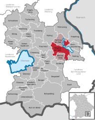
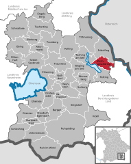
Fridolfing (Fridolfing)
- municipality of Germany
Fridolfing is a small municipality located in Bavaria, Germany, near the border with Austria. While it may not be as widely known as other hiking destinations, it offers some charming natural landscapes and opportunities for outdoor activities. Here are some points to consider when hiking in and around Fridolfing:
Hiking Trails
- Local Trails: There are various trails in and around Fridolfing that cater to different skill levels. You can find routes that take you through picturesque forests, meadows, and hills.
- Bavarian Countryside: The area features beautiful scenery, including rolling hills and scenic views. Look for trails that offer panoramic vistas of the surrounding countryside.
Nearby Hiking Areas
- Salzburg Alps: A short drive from Fridolfing will take you to the Salzburg Alps, where you can find more challenging hikes and well-marked trails.
- Berchtesgaden National Park: This stunning national park, known for its dramatic mountain scenery and pristine lakes, is about an hour away and offers extensive hiking options.
Trail Conditions and Preparation
- Always check the trail conditions before setting out, as weather can change rapidly in mountainous areas.
- Make sure to wear appropriate hiking footwear and bring plenty of water, snacks, and a first-aid kit.
- Consider using a hiking app or GPS to navigate unfamiliar trails.
Nature and Wildlife
- The region is rich in flora and fauna, and you may encounter various wildlife species. Keep a respectful distance from animals and follow local guidelines.
Local Amenities
- Fridolfing has basic amenities, including accommodations and food options. However, you may want to plan your meals or pack a picnic, especially if you’re heading out on a longer hike.
Conclusion
Hiking in Fridolfing can be a peaceful and enjoyable experience, allowing you to connect with nature in a less crowded environment. Whether you opt for local trails or take a day trip to more renowned hiking areas, make sure to enjoy the scenic beauty of Bavaria!
- Country:

- Postal Code: 83413
- Local Dialing Code: 08684
- Licence Plate Code: TS
- Coordinates: 48° 0' 0" N, 12° 49' 0" E


- GPS tracks (wikiloc): [Link]
- AboveSeaLevel: 388 м m
- Area: 44.22 sq km
- Population: 3326
- Web site: http://www.fridolfing.de
- Wikipedia en: wiki(en)
- Wikipedia: wiki(de)
- Wikidata storage: Wikidata: Q259202
- Wikipedia Commons Category: [Link]
- Freebase ID: [/m/02q8jr8]
- GeoNames ID: Alt: [2924819]
- VIAF ID: Alt: [135072863]
- OSM relation ID: [941659]
- GND ID: Alt: [4306667-7]
- Library of Congress authority ID: Alt: [n2004038296]
- Bavarikon ID: [ODB_A00001358]
- German municipality key: 09189118
Shares border with regions:


Laufen, Germany
- town in Bavaria, Germany
Laufen, Germany, located in the scenic district of Berchtesgadener Land, offers a variety of hiking opportunities for both beginners and experienced hikers. The region is known for its beautiful landscapes, ranging from rolling hills to more rugged mountain terrain. Here are some key highlights about hiking in and around Laufen:...
- Country:

- Postal Code: 83410
- Local Dialing Code: 08682
- Coordinates: 47° 56' 0" N, 12° 56' 0" E


- GPS tracks (wikiloc): [Link]
- AboveSeaLevel: 423 м m
- Area: 35.31 sq km
- Population: 6954
- Web site: [Link]

St. Pantaleon
- municipality in Austria
Sankt Pantaleon is a picturesque village situated in the Austrian region of Salzburg. It is a great destination for hiking enthusiasts, offering stunning natural landscapes and various trails suitable for different skill levels. Here are some highlights and tips for hiking in the area:...
- Country:

- Postal Code: 5120
- Local Dialing Code: 06277
- Licence Plate Code: BR
- Coordinates: 48° 0' 26" N, 12° 53' 44" E


- GPS tracks (wikiloc): [Link]
- AboveSeaLevel: 436 м m
- Area: 18.32 sq km
- Population: 3085
- Web site: [Link]


Waging am See
- municipality in the district of Traunstein in Bavaria, Germany.
Waging am See is a picturesque town in Bavaria, Germany, known for its beautiful landscapes, serene lake, and extensive hiking opportunities. Here’s an overview of what you can expect when hiking in this lovely area:...
- Country:

- Postal Code: 83329
- Local Dialing Code: 08681
- Licence Plate Code: TS
- Coordinates: 47° 56' 0" N, 12° 44' 0" E


- GPS tracks (wikiloc): [Link]
- AboveSeaLevel: 465 м m
- Area: 48.86 sq km
- Population: 5317
- Web site: [Link]


Kirchanschöring
- municipality of Germany
Kirchanschöring is a scenic area located in Bavaria, Germany, offering a range of hiking opportunities through the beautiful Bavarian countryside. Here are some highlights about hiking in and around Kirchanschöring:...
- Country:

- Postal Code: 83417
- Local Dialing Code: 08685
- Licence Plate Code: TS
- Coordinates: 47° 57' 0" N, 12° 50' 0" E


- GPS tracks (wikiloc): [Link]
- AboveSeaLevel: 417 м m
- Area: 25.23 sq km
- Population: 2577
- Web site: [Link]


Tittmoning
- town in Bavaria, Germany
Tittmoning, located in Bavaria, Germany, is a charming town set against the backdrop of the picturesque Chiemgau Alps, making it an attractive destination for hikers. The region offers a variety of trails catering to different skill levels, from leisurely walks to more challenging hikes....
- Country:

- Postal Code: 84529
- Local Dialing Code: 08683
- Licence Plate Code: TS
- Coordinates: 48° 3' 47" N, 12° 46' 1" E


- GPS tracks (wikiloc): [Link]
- AboveSeaLevel: 388 м m
- Area: 72.01 sq km
- Population: 4947
- Web site: [Link]

Ostermiething
- municipality in Austria
Ostermiething, a charming municipality located in Upper Austria, offers beautiful landscapes and a variety of hiking opportunities for nature lovers. The region is characterized by its scenic countryside, rolling hills, and lush forests, making it a great destination for both casual walkers and more experienced hikers....
- Country:

- Postal Code: 5121
- Local Dialing Code: 06278
- Licence Plate Code: BR
- Coordinates: 48° 2' 50" N, 12° 49' 50" E


- GPS tracks (wikiloc): [Link]
- AboveSeaLevel: 423 м m
- Area: 21.76 sq km
- Population: 3296
- Web site: [Link]

