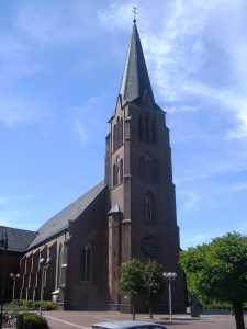
Friesoythe (Friesoythe)
- municipality of Germany
Friesoythe, a charming town in Lower Saxony, Germany, offers several opportunities for hiking enthusiasts to explore the scenic countryside and enjoy the region's natural beauty. Here are a few key points to consider when hiking in and around Friesoythe:
Trails and Routes
-
Local Trails: There may be various local hiking trails that allow you to explore the beautiful landscapes, including forests, fields, and lakes. Check out the surrounding areas for designated hiking paths.
-
Nature Reserves: Nearby nature reserves often provide well-marked trails where you can appreciate local wildlife and plant species. Keep an eye out for official signs that denote hiking routes.
-
Cycle and Hike: Some routes are shared with cyclists, which can be an interesting way to experience the landscape. Just be cautious and respectful of other trail users.
Terrain and Difficulty
- The terrain in and around Friesoythe tends to be relatively flat, making it suitable for hikers of all skill levels.
- There are options for both leisurely walks and more challenging hikes, depending on how far you're willing to go and the routes you choose.
Scenic Spots
- Look for nearby rivers, lakes, and forested areas for picturesque views. These locations often provide opportunities for photography, birdwatching, and enjoying the tranquility of nature.
Best Time to Hike
- Spring and fall are generally the best times for hiking in the region, with mild weather and beautiful foliage. Summer can be warm, and winter may bring snowy or muddy conditions, so pack accordingly.
Preparation
- Always check the weather before heading out.
- Bring plenty of water, snacks, and appropriate gear.
- A good map or a hiking app can be beneficial to navigate the local trails.
Local Amenities
- Friesoythe has various amenities, including cafes and restaurants where hikers can rest and refuel after a long day on the trails.
Wildlife and Environment
- Respect the local environment and wildlife. Stay on marked paths to minimize your impact on nature.
Overall, hiking in Friesoythe can be a delightful experience, filled with opportunities to connect with nature and explore the beauty of Lower Saxony. Check local resources or visitor centers for specific trails and maps to make the most of your hike!
- Country:

- Postal Code: 26169
- Local Dialing Code: 04497; 04496; 04493; 04491; 04405
- Licence Plate Code: CLP
- Coordinates: 53° 1' 14" N, 7° 51' 31" E


- GPS tracks (wikiloc): [Link]
- AboveSeaLevel: 6 м m
- Area: 247.14 sq km
- Population: 21918
- Web site: https://www.friesoythe.de/
- Wikipedia en: wiki(en)
- Wikipedia: wiki(de)
- Wikidata storage: Wikidata: Q559637
- Wikipedia Commons Category: [Link]
- Wikipedia Commons Maps Category: [Link]
- Freebase ID: [/m/0c454t]
- GeoNames ID: Alt: [2924360]
- VIAF ID: Alt: [126772474]
- OSM relation ID: [1109689]
- GND ID: Alt: [4018617-9]
- Library of Congress authority ID: Alt: [n88094711]
- MusicBrainz area ID: [d809a7c6-04de-406f-902b-cd99ea4d94a1]
- WOEID: [650900]
- German municipality key: 03453007
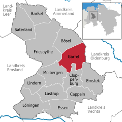
Shares border with regions:


Saterland
- municipality in the district of Cloppenburg, in Lower Saxony, Germany
Saterland, located in Lower Saxony, Germany, is known for its picturesque landscapes and charming countryside, making it a delightful destination for hiking enthusiasts. Here are some key highlights for hiking in the Saterland region:...
- Country:

- Postal Code: 26683
- Local Dialing Code: 04498; 04492
- Licence Plate Code: CLP
- Coordinates: 53° 2' 0" N, 7° 43' 0" E


- GPS tracks (wikiloc): [Link]
- AboveSeaLevel: 5 м m
- Area: 123.62 sq km
- Population: 13539
- Web site: [Link]


Barßel
- municipality of Germany
Barßel is a charming municipality located in the Lower Saxony region of Germany, nestled in the district of Friesland. While it isn't widely known for hiking in the way that some larger national parks or mountain ranges might be, there are still opportunities for enjoying nature and walking in and around Barßel....
- Country:

- Postal Code: 26676
- Local Dialing Code: 04499
- Licence Plate Code: CLP
- Coordinates: 53° 10' 13" N, 7° 44' 48" E


- GPS tracks (wikiloc): [Link]
- AboveSeaLevel: 2 м m
- Area: 84 sq km
- Population: 12495
- Web site: [Link]


Bösel
- municipality of Germany
Bösel is a small town located in Lower Saxony, Germany. While it may not be as widely known as some other hiking destinations, it does offer charming trails and landscapes that are worth exploring. Here are some points of interest for hiking in and around Bösel:...
- Country:

- Postal Code: 26219
- Local Dialing Code: 04494
- Licence Plate Code: CLP
- Coordinates: 53° 0' 0" N, 7° 57' 0" E


- GPS tracks (wikiloc): [Link]
- AboveSeaLevel: 13 м m
- Area: 100.1 sq km
- Population: 7709
- Web site: [Link]


Garrel
- municipality of Germany
Garrel, a charming town located in Lower Saxony, Germany, is surrounded by scenic landscapes and provides several opportunities for hiking enthusiasts. Here’s what you need to know about hiking in this area:...
- Country:

- Postal Code: 49681
- Local Dialing Code: 04474; 04471
- Licence Plate Code: CLP
- Coordinates: 52° 57' 0" N, 8° 1' 0" E


- GPS tracks (wikiloc): [Link]
- AboveSeaLevel: 20 м m
- Area: 113.23 sq km
- Population: 14918
- Web site: [Link]
Molbergen
- municipality of Germany
Molbergen, located in Lower Saxony, Germany, is a small countryside town surrounded by beautiful natural landscapes. While it may not be as well-known as some larger hiking destinations, it does offer a number of opportunities for outdoor enthusiasts. Here are some key points to consider if you’re planning to hike in Molbergen:...
- Country:

- Postal Code: 49696
- Local Dialing Code: 04479; 04475
- Licence Plate Code: CLP
- Coordinates: 52° 52' 0" N, 7° 56' 0" E


- GPS tracks (wikiloc): [Link]
- AboveSeaLevel: 43 м m
- Area: 102.52 sq km
- Population: 8653
- Web site: [Link]

