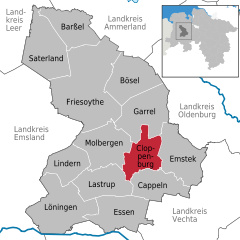
Cloppenburg (Landkreis Cloppenburg)


- district in Lower Saxony, Germany
 Hiking in Cloppenburg
Cloppenburg district, located in Lower Saxony, Germany, offers a variety of picturesque landscapes and natural beauty, making it a great destination for hiking enthusiasts. Here are some highlights and tips for hiking in the region:
Trails and Parks
-
Wildeshauser Geest Nature Park: This park features diverse landscapes, including forests, heathlands, and meadows. There are several well-marked trails for different skill levels, allowing you to experience the rich flora and fauna.
-
Niedersächsisches Moorzentrum: For those interested in unique ecosystems, the Moorzentrum offers trails that explore moorlands and wetlands. Look for guided walks that explain the significance of these habitats.
-
Local Trails: The Cloppenburg district is also home to numerous local trails that can be explored. These often connect small villages and scenic countryside, allowing hikers to enjoy local culture and cuisine along the way.
Tips for Hiking in Cloppenburg
-
Choose Suitable Trails: Whether you are a beginner or an experienced hiker, choose trails that match your skill level. Local maps can provide information on trail difficulties.
-
Weather Preparedness: The weather can be variable; it’s wise to check the forecast before heading out. Dress in layers and be prepared for rain.
-
Bring Hydration and Snacks: Always carry enough water and some snacks to keep your energy up during your hike.
-
Respect Nature: Follow local guidelines for preserving the environment. Stay on marked paths and leave no trace.
-
Use Local Resources: Check with the Cloppenburg tourism office or local hiking clubs for recommendations on trails, events, and guided tours.
Cultural and Historical Aspects
While hiking, you may come across historical landmarks or traditional farms, which can provide insight into the region's agricultural history and culture.
Conclusion
Hiking in Cloppenburg district offers a mix of natural beauty, cultural experiences, and diverse trail options. Whether you're traversing forest paths or exploring unique wetland ecosystems, the area provides an enjoyable outdoor experience for hikers of all levels.
- Country:

- Capital: Cloppenburg
- Licence Plate Code: CLP
- Coordinates: 52° 49' 48" N, 8° 0' 0" E


- GPS tracks (wikiloc): [Link]
- AboveSeaLevel: 27 м m
- Area: 1418.00 sq km
- Population: 165930
- Web site: http://www.lkclp.de/
- Wikipedia en: wiki(en)
- Wikipedia: wiki(de)
- Wikidata storage: Wikidata: Q5945
- Wikipedia Commons Gallery: [Link]
- Wikipedia Commons Category: [Link]
- Wikipedia Commons Maps Category: [Link]
- Freebase ID: [/m/013sp6]
- GeoNames ID: Alt: [3221064]
- VIAF ID: Alt: [140899130]
- OSM relation ID: [62597]
- GND ID: Alt: [4010304-3]
- archINFORM location ID: [2366]
- Library of Congress authority ID: Alt: [n98031510]
- TGN ID: [7076846]
- National Library of Israel ID: [001051094]
- NUTS code: [DE948]
- BabelNet ID: [00737474n]
- German district key: 03453
Includes regions:

Cloppenburg
- town in Lower Saxony, Germany
Hiking in Cloppenburg
Cloppenburg, located in Lower Saxony, Germany, offers several beautiful hiking opportunities, mainly characterized by picturesque landscapes, lush forests, and serene countryside. Here are some highlights and tips for hiking in the Cloppenburg area:...
- Country:
- Postal Code: 49661
- Local Dialing Code: 04471
- Licence Plate Code: CLP
- Coordinates: 52° 50' 52" N, 8° 2' 38" E
- GPS tracks (wikiloc): [Link]
- AboveSeaLevel: 39 м m
- Area: 70.6 sq km
- Population: 34216
- Web site: [Link]


Saterland
- municipality in the district of Cloppenburg, in Lower Saxony, Germany
Hiking in Saterland
Saterland, located in Lower Saxony, Germany, is known for its picturesque landscapes and charming countryside, making it a delightful destination for hiking enthusiasts. Here are some key highlights for hiking in the Saterland region:...
- Country:
- Postal Code: 26683
- Local Dialing Code: 04498; 04492
- Licence Plate Code: CLP
- Coordinates: 53° 2' 0" N, 7° 43' 0" E
- GPS tracks (wikiloc): [Link]
- AboveSeaLevel: 5 м m
- Area: 123.62 sq km
- Population: 13539
- Web site: [Link]


Emstek
- municipality of Germany
Hiking in Emstek
Emstek is a small town located in Lower Saxony, Germany, and while it may not be as renowned for hiking as larger national parks or mountain ranges, there are still opportunities for enjoyable walks and hikes in and around the area....
- Country:
- Postal Code: 49685
- Local Dialing Code: 04447; 04473
- Licence Plate Code: CLP
- Coordinates: 52° 49' 0" N, 8° 9' 0" E
- GPS tracks (wikiloc): [Link]
- AboveSeaLevel: 62 м m
- Area: 108.13 sq km
- Population: 11859
- Web site: [Link]


Barßel
- municipality of Germany
Hiking in Barßel
Barßel is a charming municipality located in the Lower Saxony region of Germany, nestled in the district of Friesland. While it isn't widely known for hiking in the way that some larger national parks or mountain ranges might be, there are still opportunities for enjoying nature and walking in and around Barßel....
- Country:
- Postal Code: 26676
- Local Dialing Code: 04499
- Licence Plate Code: CLP
- Coordinates: 53° 10' 13" N, 7° 44' 48" E
- GPS tracks (wikiloc): [Link]
- AboveSeaLevel: 2 м m
- Area: 84 sq km
- Population: 12495
- Web site: [Link]


Cappeln
- municipality of Germany
Hiking in Cappeln
Cappeln, located in Lower Saxony, Germany, is a charming small village that offers a variety of outdoor activities, including hiking. While it may not be as widely recognized as some of Germany's larger hiking destinations, it has its own unique appeal and scenic landscapes for those looking to explore the outdoors....
- Country:
- Postal Code: 49692
- Local Dialing Code: 04478
- Licence Plate Code: CLP
- Coordinates: 52° 48' 44" N, 8° 6' 52" E
- GPS tracks (wikiloc): [Link]
- AboveSeaLevel: 46 м m
- Area: 76.2 sq km
- Population: 6561
- Web site: [Link]


Löningen
- municipality of Germany
Hiking in Löningen
Löningen is a picturesque town located in Lower Saxony, Germany, which offers some lovely hiking opportunities. The surrounding area is characterized by a mix of woodlands, heathlands, and agricultural fields, making it perfect for nature enthusiasts....
- Country:
- Postal Code: 49624
- Local Dialing Code: 05964; 05962; 05437; 05434; 05432
- Licence Plate Code: CLP
- Coordinates: 52° 43' 0" N, 7° 46' 0" E
- GPS tracks (wikiloc): [Link]
- AboveSeaLevel: 24 м m
- Area: 143 sq km
- Population: 13366
- Web site: [Link]


Lindern
- municipality of Germany
Hiking in Lindern
Lindern, located in the Lower Saxony region of Germany, offers a charming setting for hiking enthusiasts. While it's a smaller village, its surrounding areas provide opportunities for enjoying nature and experiencing the tranquility of the countryside....
- Country:
- Postal Code: 49699
- Local Dialing Code: 05957
- Licence Plate Code: CLP
- Coordinates: 52° 50' 42" N, 7° 46' 41" E
- GPS tracks (wikiloc): [Link]
- AboveSeaLevel: 37 м m
- Area: 65.81 sq km
- Population: 4817
- Web site: [Link]

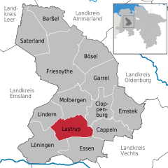
Lastrup
- municipality of Germany
Hiking in Lastrup
Lastrup, a small town in Lower Saxony, Germany, offers a range of outdoor activities including hiking. While it may not be as widely known for hiking as some larger locations, it still presents opportunities to explore the scenic countryside....
- Country:
- Postal Code: 49688
- Local Dialing Code: 04472
- Licence Plate Code: CLP
- Coordinates: 52° 46' 0" N, 7° 50' 0" E
- GPS tracks (wikiloc): [Link]
- AboveSeaLevel: 45 м m
- Area: 85 sq km
- Population: 6985
- Web site: [Link]


Bösel
- municipality of Germany
Hiking in Bösel
Bösel is a small town located in Lower Saxony, Germany. While it may not be as widely known as some other hiking destinations, it does offer charming trails and landscapes that are worth exploring. Here are some points of interest for hiking in and around Bösel:...
- Country:
- Postal Code: 26219
- Local Dialing Code: 04494
- Licence Plate Code: CLP
- Coordinates: 53° 0' 0" N, 7° 57' 0" E
- GPS tracks (wikiloc): [Link]
- AboveSeaLevel: 13 м m
- Area: 100.1 sq km
- Population: 7709
- Web site: [Link]
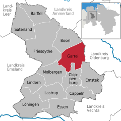
Garrel
- municipality of Germany
Hiking in Garrel
Garrel, a charming town located in Lower Saxony, Germany, is surrounded by scenic landscapes and provides several opportunities for hiking enthusiasts. Here’s what you need to know about hiking in this area:...
- Country:
- Postal Code: 49681
- Local Dialing Code: 04474; 04471
- Licence Plate Code: CLP
- Coordinates: 52° 57' 0" N, 8° 1' 0" E
- GPS tracks (wikiloc): [Link]
- AboveSeaLevel: 20 м m
- Area: 113.23 sq km
- Population: 14918
- Web site: [Link]
Molbergen
- municipality of Germany
Hiking in Molbergen
Molbergen, located in Lower Saxony, Germany, is a small countryside town surrounded by beautiful natural landscapes. While it may not be as well-known as some larger hiking destinations, it does offer a number of opportunities for outdoor enthusiasts. Here are some key points to consider if you’re planning to hike in Molbergen:...
- Country:
- Postal Code: 49696
- Local Dialing Code: 04479; 04475
- Licence Plate Code: CLP
- Coordinates: 52° 52' 0" N, 7° 56' 0" E
- GPS tracks (wikiloc): [Link]
- AboveSeaLevel: 43 м m
- Area: 102.52 sq km
- Population: 8653
- Web site: [Link]


Friesoythe
- municipality of Germany
Hiking in Friesoythe
Friesoythe, a charming town in Lower Saxony, Germany, offers several opportunities for hiking enthusiasts to explore the scenic countryside and enjoy the region's natural beauty. Here are a few key points to consider when hiking in and around Friesoythe:...
- Country:
- Postal Code: 26169
- Local Dialing Code: 04497; 04496; 04493; 04491; 04405
- Licence Plate Code: CLP
- Coordinates: 53° 1' 14" N, 7° 51' 31" E
- GPS tracks (wikiloc): [Link]
- AboveSeaLevel: 6 м m
- Area: 247.14 sq km
- Population: 21918
- Web site: [Link]
Shares border with regions:
Cappeln
- municipality of Germany
Hiking in Cappeln
Cappeln, located in Lower Saxony, Germany, is a charming small village that offers a variety of outdoor activities, including hiking. While it may not be as widely recognized as some of Germany's larger hiking destinations, it has its own unique appeal and scenic landscapes for those looking to explore the outdoors....
- Country:
- Postal Code: 49692
- Local Dialing Code: 04478
- Licence Plate Code: CLP
- Coordinates: 52° 48' 44" N, 8° 6' 52" E
- GPS tracks (wikiloc): [Link]
- AboveSeaLevel: 46 м m
- Area: 76.2 sq km
- Population: 6561
- Web site: [Link]
Lastrup
- municipality of Germany
Hiking in Lastrup
Lastrup, a small town in Lower Saxony, Germany, offers a range of outdoor activities including hiking. While it may not be as widely known for hiking as some larger locations, it still presents opportunities to explore the scenic countryside....
- Country:
- Postal Code: 49688
- Local Dialing Code: 04472
- Licence Plate Code: CLP
- Coordinates: 52° 46' 0" N, 7° 50' 0" E
- GPS tracks (wikiloc): [Link]
- AboveSeaLevel: 45 м m
- Area: 85 sq km
- Population: 6985
- Web site: [Link]


Leer
- district in Lower Saxony, Germany
Hiking in Leer
Leer is a district located in the Lower Saxony region of Germany, and it offers a variety of opportunities for hiking enthusiasts. The landscape is characterized by flat terrain, picturesque wetlands, canals, and rivers, making it a unique area for outdoor activities....
- Country:
- Licence Plate Code: LER
- Coordinates: 53° 15' 0" N, 7° 30' 0" E
- GPS tracks (wikiloc): [Link]
- AboveSeaLevel: 1 м m
- Area: 1086.00 sq km
- Population: 168253
- Web site: [Link]


Osnabrück
- district in Lower Saxony, Germany
Hiking in Osnabrück
Osnabrück district, located in Lower Saxony, Germany, offers a variety of hiking opportunities that cater to different skill levels and preferences. The region is characterized by its rolling hills, lush forests, and picturesque landscapes, making it an appealing destination for outdoor enthusiasts....
- Country:
- Capital: Osnabrück
- Licence Plate Code: OS
- Coordinates: 52° 19' 48" N, 8° 10' 12" E
- GPS tracks (wikiloc): [Link]
- AboveSeaLevel: 57 м m
- Area: 2122.00 sq km
- Population: 354807
- Web site: [Link]


Vechta
- district in Lower Saxony, Germany
Hiking in Vechta
Vechta is a district located in Lower Saxony, Germany, known for its picturesque landscapes and rural charm. While it may not be as mountainous as other regions in Germany, it offers several opportunities for hiking, especially for those who enjoy gentle walks through nature....
- Country:
- Licence Plate Code: VEC
- Coordinates: 52° 40' 12" N, 8° 15' 0" E
- GPS tracks (wikiloc): [Link]
- AboveSeaLevel: 27 м m
- Area: 813.00 sq km
- Population: 139671
- Web site: [Link]

Ammerland
- district in Lower Saxony, Germany
Hiking in Ammerland
Ammerland, located in Lower Saxony, Germany, is a scenic region known for its beautiful landscapes, lush greenery, and peaceful lakes. While it may not be as mountainous as other regions in Germany, it offers a variety of trails that are perfect for hiking enthusiasts of all levels. Here are some key aspects to consider when hiking in Ammerland:...
- Country:
- Licence Plate Code: WST
- Coordinates: 53° 15' 0" N, 7° 55' 12" E
- GPS tracks (wikiloc): [Link]
- AboveSeaLevel: 7 м m
- Area: 728.00 sq km
- Population: 122698
- Web site: [Link]


Oldenburg
- district of Lower Saxony, Germany
Hiking in Oldenburg
Oldenburg District, located in Lower Saxony, Germany, offers a variety of landscapes and trails suitable for hiking enthusiasts. While it may not be as mountainous as other regions in Germany, its scenic countryside, woodlands, and lakes provide a wonderful backdrop for outdoor activities....
- Country:
- Licence Plate Code: OL
- Coordinates: 53° 0' 0" N, 8° 25' 12" E
- GPS tracks (wikiloc): [Link]
- AboveSeaLevel: 25 м m
- Area: 1063.00 sq km
- Population: 129484
- Web site: [Link]