Gémenos (Gémenos)

- commune in Bouches-du-Rhône, France
- Country:

- Postal Code: 13420
- Coordinates: 43° 17' 46" N, 5° 37' 37" E


- GPS tracks (wikiloc): [Link]
- Area: 32.75 sq km
- Population: 6387
- Web site: http://www.mairie-gemenos.fr
- Wikipedia en: wiki(en)
- Wikipedia: wiki(fr)
- Wikidata storage: Wikidata: Q264277
- Wikipedia Commons Category: [Link]
- Freebase ID: [/m/0281nhk]
- GeoNames ID: Alt: [6447129]
- SIREN number: [211300421]
- BnF ID: [15247324j]
- VIAF ID: Alt: [235109982]
- TGN ID: [7009198]
- INSEE municipality code: 13042
Shares border with regions:
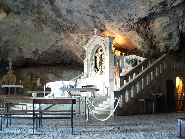

Plan-d'Aups-Sainte-Baume
- commune in Var, France
 Hiking in Plan-d'Aups-Sainte-Baume
Plan-d'Aups-Sainte-Baume is a beautiful destination for hiking enthusiasts, located in the Var department of the Provence-Alpes-Côte d'Azur region of southeastern France. Nestled at the foot of the Sainte-Baume mountain range, this area offers a range of trails that vary in difficulty and scenery....
- Country:
- Postal Code: 83640
- Coordinates: 43° 19' 48" N, 5° 43' 3" E
- GPS tracks (wikiloc): [Link]
- AboveSeaLevel: 700 м m
- Area: 24.91 sq km
- Population: 2067

Aubagne
- commune in Bouches-du-Rhône, France
- Country:
- Postal Code: 13400
- Coordinates: 43° 17' 27" N, 5° 34' 15" E
- GPS tracks (wikiloc): [Link]
- Area: 54.9 sq km
- Population: 45410
- Web site: [Link]

Auriol
- commune in Bouches-du-Rhône, France
Hiking in Auriol
Auriol, located in the Bouches-du-Rhône department in the Provence-Alpes-Côte d'Azur region of southern France, offers a variety of scenic hiking opportunities. Nestled between the Sainte-Baume mountains and the Calanques National Park, Auriol provides a beautiful backdrop with diverse landscapes, from hills and forests to rugged cliffs and Mediterranean flora....
- Country:
- Postal Code: 13390
- Coordinates: 43° 22' 10" N, 5° 37' 53" E
- GPS tracks (wikiloc): [Link]
- Area: 44.64 sq km
- Population: 11538
- Web site: [Link]


Cuges-les-Pins
- commune in Bouches-du-Rhône, France
- Country:
- Postal Code: 13780
- Coordinates: 43° 16' 35" N, 5° 42' 2" E
- GPS tracks (wikiloc): [Link]
- Area: 38.81 sq km
- Population: 5007
- Web site: [Link]

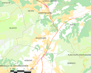
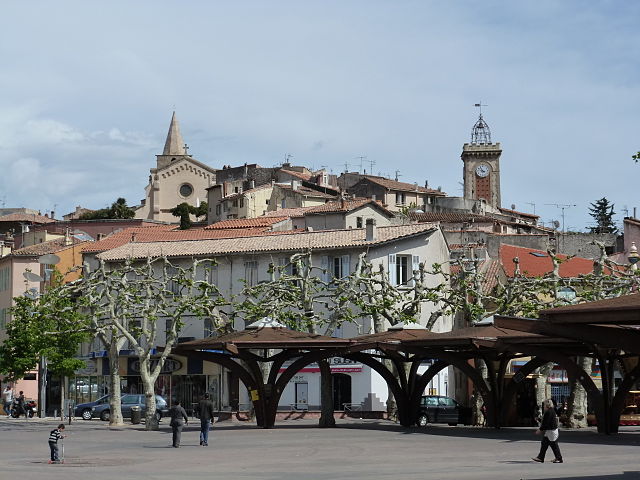
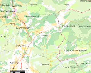
Roquevaire
- commune in Bouches-du-Rhône, France
Hiking in Roquevaire
Roquevaire is a charming commune located in the Provence-Alpes-Côte d'Azur region of France, known for its beautiful landscapes and rich natural environment. Here are some highlights and tips for hiking in Roquevaire:...
- Country:
- Postal Code: 13360
- Coordinates: 43° 20' 58" N, 5° 36' 17" E
- GPS tracks (wikiloc): [Link]
- AboveSeaLevel: 160 м m
- Area: 23.83 sq km
- Population: 8939
- Web site: [Link]


Roquefort-la-Bédoule
- commune in Bouches-du-Rhône, France
- Country:
- Postal Code: 13830
- Coordinates: 43° 14' 51" N, 5° 35' 27" E
- GPS tracks (wikiloc): [Link]
- Area: 31.15 sq km
- Population: 5528
- Web site: [Link]