Génissac (Génissac)

- commune in Gironde, France
- Country:

- Postal Code: 33420
- Coordinates: 44° 51' 30" N, 0° 15' 27" E


- GPS tracks (wikiloc): [Link]
- Area: 13.04 sq km
- Population: 1922
- Web site: http://mairie-genissac.fr
- Wikipedia en: wiki(en)
- Wikipedia: wiki(fr)
- Wikidata storage: Wikidata: Q453629
- Wikipedia Commons Category: [Link]
- Freebase ID: [/m/03nrzlg]
- GeoNames ID: Alt: [6454002]
- SIREN number: [213301856]
- BnF ID: [15256237k]
- INSEE municipality code: 33185
Shares border with regions:


Tizac-de-Curton
- commune in Gironde, France
- Country:
- Postal Code: 33420
- Coordinates: 44° 49' 16" N, 0° 15' 2" E
- GPS tracks (wikiloc): [Link]
- Area: 3.97 sq km
- Population: 313
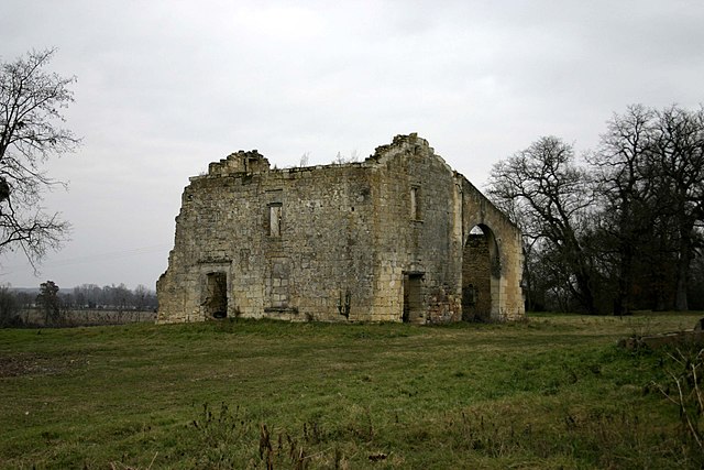
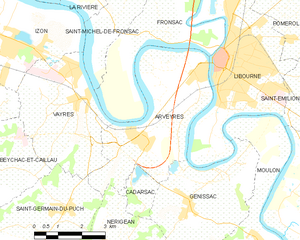
Arveyres
- commune in Gironde, France
- Country:
- Postal Code: 33500
- Coordinates: 44° 53' 3" N, 0° 17' 0" E
- GPS tracks (wikiloc): [Link]
- Area: 17.27 sq km
- Population: 1930
- Web site: [Link]


Libourne
- commune in Gironde, France
- Country:
- Postal Code: 33500
- Coordinates: 44° 54' 55" N, 0° 14' 38" E
- GPS tracks (wikiloc): [Link]
- AboveSeaLevel: 15 м m
- Area: 20.63 sq km
- Population: 24866
- Web site: [Link]


Nérigean
- commune in Gironde, France
- Country:
- Postal Code: 33750
- Coordinates: 44° 50' 29" N, 0° 17' 21" E
- GPS tracks (wikiloc): [Link]
- Area: 9.98 sq km
- Population: 840
- Web site: [Link]


Cadarsac
- commune in Gironde, France
- Country:
- Postal Code: 33750
- Coordinates: 44° 51' 38" N, 0° 17' 10" E
- GPS tracks (wikiloc): [Link]
- Area: 2.28 sq km
- Population: 342


Moulon
- commune in Gironde, France
- Country:
- Postal Code: 33420
- Coordinates: 44° 50' 50" N, 0° 13' 14" E
- GPS tracks (wikiloc): [Link]
- AboveSeaLevel: 30 м m
- Area: 13.25 sq km
- Population: 994