Libourne (Libourne)

- commune in Gironde, France
- Country:

- Postal Code: 33500
- Coordinates: 44° 54' 55" N, 0° 14' 38" E


- GPS tracks (wikiloc): [Link]
- AboveSeaLevel: 15 м m
- Area: 20.63 sq km
- Population: 24866
- Web site: http://www.ville-libourne.fr
- Wikipedia en: wiki(en)
- Wikipedia: wiki(fr)
- Wikidata storage: Wikidata: Q6544
- Wikipedia Commons Category: [Link]
- Freebase ID: [/m/08fmw9]
- GeoNames ID: Alt: [2998517]
- SIREN number: [213302433]
- BnF ID: [15256295r]
- VIAF ID: Alt: [128870804]
- GND ID: Alt: [4469727-2]
- Library of Congress authority ID: Alt: [n82077985]
- MusicBrainz area ID: [b4e9c71d-a18b-4b17-9dd3-bd6f5e4c5590]
- Encyclopædia Britannica Online ID: [place/Libourne]
- Gran Enciclopèdia Catalana ID: [0037179]
- National Library of Israel ID: [000993249]
- INSEE municipality code: 33243
Shares border with regions:

Lalande-de-Pomerol
- commune in Gironde, France
- Country:
- Postal Code: 33500
- Coordinates: 44° 57' 20" N, 0° 12' 33" E
- GPS tracks (wikiloc): [Link]
- AboveSeaLevel: 10 м m
- Area: 8.25 sq km
- Population: 669
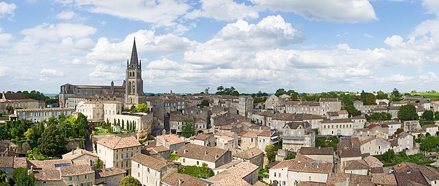

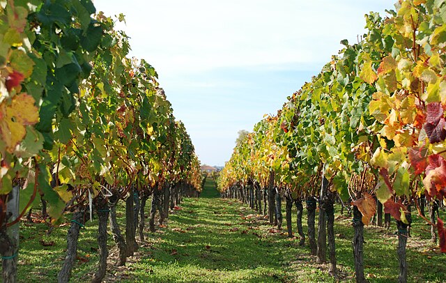
Saint-Émilion
- commune in Gironde, France
- Country:
- Postal Code: 33330
- Coordinates: 44° 53' 34" N, 0° 9' 21" E
- GPS tracks (wikiloc): [Link]
- AboveSeaLevel: 23 м m
- Area: 27.02 sq km
- Population: 1878
- Web site: [Link]

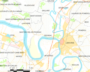
Fronsac
- commune in Gironde, France
- Country:
- Postal Code: 33126
- Coordinates: 44° 55' 25" N, 0° 16' 22" E
- GPS tracks (wikiloc): [Link]
- Area: 15.29 sq km
- Population: 1182
- Web site: [Link]


Génissac
- commune in Gironde, France
- Country:
- Postal Code: 33420
- Coordinates: 44° 51' 30" N, 0° 15' 27" E
- GPS tracks (wikiloc): [Link]
- Area: 13.04 sq km
- Population: 1922
- Web site: [Link]
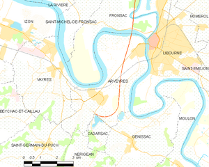
Arveyres
- commune in Gironde, France
- Country:
- Postal Code: 33500
- Coordinates: 44° 53' 3" N, 0° 17' 0" E
- GPS tracks (wikiloc): [Link]
- Area: 17.27 sq km
- Population: 1930
- Web site: [Link]

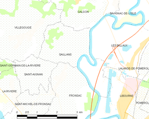
Saillans
- commune in Gironde, France
- Country:
- Postal Code: 33141
- Coordinates: 44° 57' 38" N, 0° 16' 33" E
- GPS tracks (wikiloc): [Link]
- Area: 6.22 sq km
- Population: 396
- Web site: [Link]


Les Billaux
- commune in Gironde, France
- Country:
- Postal Code: 33500
- Coordinates: 44° 57' 9" N, 0° 14' 13" E
- GPS tracks (wikiloc): [Link]
- Area: 6.26 sq km
- Population: 1196
- Web site: [Link]


Moulon
- commune in Gironde, France
- Country:
- Postal Code: 33420
- Coordinates: 44° 50' 50" N, 0° 13' 14" E
- GPS tracks (wikiloc): [Link]
- AboveSeaLevel: 30 м m
- Area: 13.25 sq km
- Population: 994


Pomerol
- commune in Gironde, France
- Country:
- Postal Code: 33500
- Coordinates: 44° 55' 55" N, 0° 12' 1" E
- GPS tracks (wikiloc): [Link]
- Area: 6.24 sq km
- Population: 642