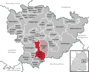
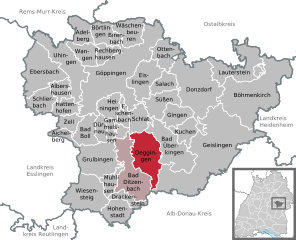
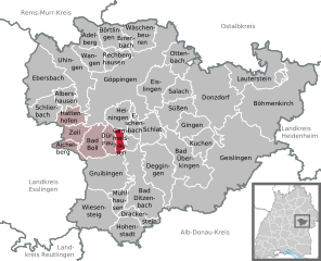
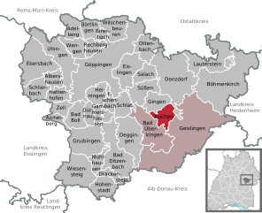
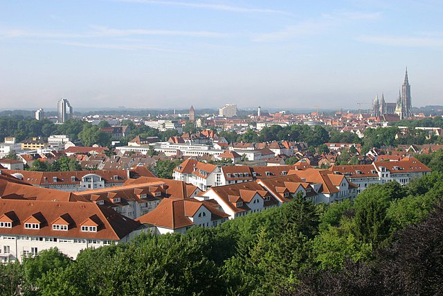
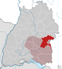
Göppingen (Landkreis Göppingen)

- district in Baden-Württemberg, Germany
 Hiking in Göppingen
Göppingen district, located in the Baden-Württemberg region of Germany, is a fantastic area for hiking enthusiasts. The landscape is characterized by a mix of rolling hills, forests, and charming villages, making it an ideal destination for various levels of hikers.
Hiking Trails
-
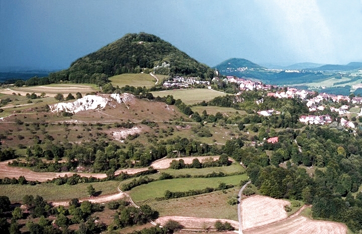
Swabian Jura (Schwäbische Alb): This natural limestone plateau offers numerous hiking trails. The well-marked paths lead you through stunning landscapes, featuring beautiful rock formations and panoramic views of the surrounding valleys. The trails range from easy walks to more challenging hikes.
-
Göppingen Forest (Göppinger Wald): This area is perfect for leisurely hikes. There are several trails winding through thick forests where you can enjoy nature, wildflowers, and perhaps spot some wildlife. The forest is well-maintained and suitable for families as well.
-
Teck Mountain (Burg Teck): A popular destination, this mountain offers a trail to the ruins of Teck Castle, which gives hikers breathtaking views of the surrounding area. The hike can be a bit steep but rewards you with stunning landscapes and a sense of history.
-
Fils Valley (Fils Tal): Following the Fils River, this area provides picturesque views and has well-marked trails that are great for both hiking and cycling. It's an excellent spot for a relaxing day out in nature.
Tips for Hiking in Göppingen
- Trail Conditions: Always check the trail conditions before you set out, especially in wetter months, as some paths can become muddy or slippery.
- Weather: The weather can change rapidly, so it's advisable to dress in layers and bring weather-appropriate gear.
- Hydration and Snacks: Carry enough water and snacks, especially for longer hikes, as some trails may lead you far from any facilities.
- Local Maps: Consider acquiring local hiking maps or using a hiking app, as they often provide detailed information about trails, their levels of difficulty, and points of interest.
- Respect Nature: Follow Leave No Trace principles to preserve the natural beauty of the area.
Accessibility
Göppingen district is well connected by public transport, with several key access points to popular hiking areas. If you're traveling from nearby cities like Stuttgart, it's easy to reach the trails by train or bus.
Conclusion
Hiking in Göppingen district allows you to immerse yourself in the natural beauty of Baden-Württemberg while offering a variety of trails suitable for all hiking levels. Whether you’re looking for a peaceful walk in the woods or a challenging mountain hike, you’ll find plenty of options to explore this beautiful region.
- Country:

- Capital: Göppingen
- Licence Plate Code: GP
- Coordinates: 48° 42' 0" N, 9° 39' 0" E


- GPS tracks (wikiloc): [Link]
- AboveSeaLevel: 349 м m
- Area: 642.36 sq km
- Population: 252749
- Web site: http://www.landkreis-goeppingen.de/
- Wikipedia en: wiki(en)
- Wikipedia: wiki(de)
- Wikidata storage: Wikidata: Q8525
- Wikipedia Commons Category: [Link]
- Freebase ID: [/m/01jn65]
- GeoNames ID: Alt: [2919053]
- VIAF ID: Alt: [140787050]
- OSM relation ID: [2812852]
- GND ID: Alt: [4021435-7]
- archINFORM location ID: [2428]
- Library of Congress authority ID: Alt: [n85175124]
- TGN ID: [7185576]
- ISNI: Alt: [0000 0004 0555 8679]
- NUTS code: [DE114]
- German district key: 08117
Includes regions:


Aichelberg
- municipality in Germany
Hiking in Aichelberg
Aichelberg, a scenic municipality located in the Swabian Jura region of Germany, offers several beautiful hiking opportunities that cater to various skill levels. The area is characterized by its picturesque landscapes, rolling hills, forests, and stunning views of the surrounding countryside. Here are some key points about hiking in Aichelberg:...
- Country:
- Postal Code: 73101
- Local Dialing Code: 07164
- Licence Plate Code: GP
- Coordinates: 48° 38' 16" N, 9° 33' 51" E
- GPS tracks (wikiloc): [Link]
- AboveSeaLevel: 434 м m
- Area: 4.01 sq km
- Population: 1279
- Web site: [Link]

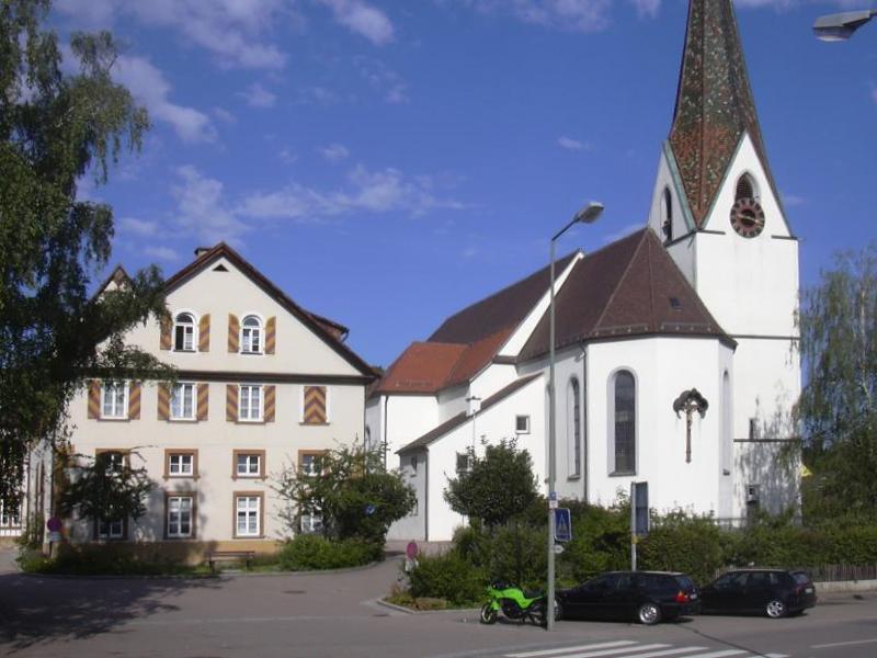
Göppingen
- town in Göppingen District, Stuttgart, Baden-Württemberg, Germany
Hiking in Göppingen
Göppingen, located in the Baden-Württemberg region of Germany, is surrounded by beautiful landscapes and offers a variety of hiking opportunities, making it a great destination for outdoor enthusiasts. Here are some highlights about hiking in and around Göppingen:...
- Country:
- Postal Code: 73116; 73037; 73035; 73033
- Local Dialing Code: 07165; 07163; 07161
- Licence Plate Code: GP
- Coordinates: 48° 42' 9" N, 9° 39' 10" E
- GPS tracks (wikiloc): [Link]
- AboveSeaLevel: 323 м m
- Area: 59.23 sq km
- Population: 55846
- Web site: [Link]
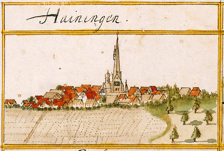

Heiningen
- municipality in Baden-Württemberg, Germany
Hiking in Heiningen
Heiningen is a small town in Germany, located in the state of Baden-Württemberg. While it might not be widely known for its hiking trails, the surrounding landscapes offer a variety of opportunities for outdoor enthusiasts....
- Country:
- Postal Code: 73092
- Local Dialing Code: 07161
- Licence Plate Code: GP
- Coordinates: 48° 39' 43" N, 9° 38' 54" E
- GPS tracks (wikiloc): [Link]
- AboveSeaLevel: 381 м m
- Area: 12.45 sq km
- Population: 5005
- Web site: [Link]

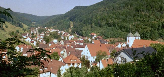
Zell unter Aichelberg
- municipality in Germany
Hiking in Zell unter Aichelberg
Zell unter Aichelberg is a picturesque village located in the Swabian region of Germany, which offers several hiking opportunities in its surrounding natural landscapes. Here are a few highlights for hiking in this area:...
- Country:
- Postal Code: 73119
- Local Dialing Code: 07164
- Licence Plate Code: GP
- Coordinates: 48° 38' 59" N, 9° 34' 31" E
- GPS tracks (wikiloc): [Link]
- AboveSeaLevel: 384 м m
- Area: 6.39 sq km
- Population: 3027
- Web site: [Link]

Bad Ditzenbach
- municipality in Germany
Hiking in Bad Ditzenbach
Bad Ditzenbach is a charming town located in the Swabian Jura region of Germany, known for its beautiful landscapes, rich natural features, and various hiking opportunities. The area offers a mix of scenic woodland paths, rolling hills, and stunning views of the surrounding countryside, making it an excellent destination for hikers of all skill levels....
- Country:
- Postal Code: 73342
- Local Dialing Code: 07334
- Licence Plate Code: GP
- Coordinates: 48° 35' 9" N, 9° 41' 31" E
- GPS tracks (wikiloc): [Link]
- AboveSeaLevel: 509 м m
- Area: 25.45 sq km
- Population: 3645
- Web site: [Link]


Birenbach
- municipality in Germany
Hiking in Birenbach
Birenbach, located in the scenic region of Baden-Württemberg in Germany, offers a picturesque environment for hiking enthusiasts. The area is characterized by its rolling hills, lush forests, and charming villages, making it a great destination for both casual walkers and experienced hikers....
- Country:
- Postal Code: 73102
- Local Dialing Code: 07161
- Licence Plate Code: GP
- Coordinates: 48° 44' 51" N, 9° 39' 48" E
- GPS tracks (wikiloc): [Link]
- AboveSeaLevel: 375 м m
- Area: 2.5 sq km
- Population: 1877
- Web site: [Link]

Deggingen
- municipality in Germany
Hiking in Deggingen
Deggingen is a charming town located in the Swabian Jura region of Baden-Württemberg, Germany. It offers a variety of hiking opportunities that cater to different skill levels and preferences. Here are some key points about hiking in and around Deggingen:...
- Country:
- Postal Code: 73326
- Local Dialing Code: 07334
- Licence Plate Code: GP
- Coordinates: 48° 35' 50" N, 9° 43' 8" E
- GPS tracks (wikiloc): [Link]
- AboveSeaLevel: 490 м m
- Area: 22.7 sq km
- Population: 5222
- Web site: [Link]
Gammelshausen
- municipality in Germany
Hiking in Gammelshausen
Gammelshausen is a picturesque municipality in Baden-Württemberg, Germany, known for its beautiful landscapes and outdoor recreational opportunities. Here are some highlights for hiking enthusiasts:...
- Country:
- Postal Code: 73108
- Local Dialing Code: 07164
- Licence Plate Code: GP
- Coordinates: 48° 38' 30" N, 9° 39' 1" E
- GPS tracks (wikiloc): [Link]
- AboveSeaLevel: 442 м m
- Area: 3.31 sq km
- Population: 1422
- Web site: [Link]
Adelberg
- municipality in Germany
Hiking in Adelberg
Adelberg, a small town in Baden-Württemberg, Germany, is situated in a picturesque environment that offers various hiking opportunities. Here are some highlights for hiking in and around Adelberg:...
- Country:
- Postal Code: 73099
- Local Dialing Code: 07166
- Licence Plate Code: GP
- Coordinates: 48° 45' 43" N, 9° 35' 59" E
- GPS tracks (wikiloc): [Link]
- AboveSeaLevel: 472 м m
- Area: 9.49 sq km
- Population: 1948
- Web site: [Link]


Gingen an der Fils
- municipality in Germany
Hiking in Gingen an der Fils
Gingen an der Fils, located in the Baden-Württemberg region of Germany, offers a variety of hiking opportunities for outdoor enthusiasts. The beautiful landscapes around the town, characterized by hills, forests, and valleys, make it a delightful spot for hiking....
- Country:
- Postal Code: 73333
- Local Dialing Code: 07162
- Licence Plate Code: GP
- Coordinates: 48° 39' 35" N, 9° 46' 51" E
- GPS tracks (wikiloc): [Link]
- AboveSeaLevel: 379 м m
- Area: 10.01 sq km
- Population: 4485
- Web site: [Link]
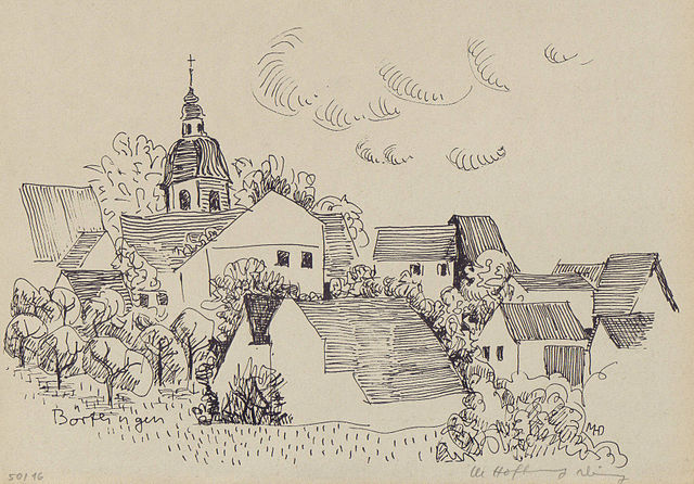

Börtlingen
- municipality in Germany
Hiking in Börtlingen
Börtlingen is a quaint village located in the region of Baden-Württemberg, Germany, nestled in the Swabian Jura. While it may not be as widely known as some major hiking destinations, its surrounding area offers a variety of scenic trails and natural beauty ideal for hikers....
- Country:
- Postal Code: 73104
- Local Dialing Code: 07161
- Licence Plate Code: GP
- Coordinates: 48° 45' 13" N, 9° 37' 55" E
- GPS tracks (wikiloc): [Link]
- AboveSeaLevel: 450 м m
- Area: 8.26 sq km
- Population: 1709
- Web site: [Link]


Mühlhausen im Täle
- municipality in Germany
Hiking in Mühlhausen im Täle
Mühlhausen im Täle is a picturesque village located in the state of Baden-Württemberg, Germany. It is surrounded by beautiful landscapes, making it a great destination for hiking enthusiasts. Here are some key points to consider when hiking in this area:...
- Country:
- Postal Code: 73347
- Local Dialing Code: 07335
- Licence Plate Code: GP
- Coordinates: 48° 34' 44" N, 9° 39' 30" E
- GPS tracks (wikiloc): [Link]
- AboveSeaLevel: 545 м m
- Area: 6.33 sq km
- Population: 1069
- Web site: [Link]


Böhmenkirch
- municipality in Germany
Hiking in Böhmenkirch
Böhmenkirch is a small town located in the Baden-Württemberg region of Germany, near the foothills of the Swabian Jura. It’s a picturesque location that offers various hiking opportunities, thanks to its beautiful landscapes, forests, and rolling hills. Here are some highlights and tips for hiking in the Böhmenkirch area:...
- Country:
- Postal Code: 89558
- Local Dialing Code: 07332
- Licence Plate Code: GP
- Coordinates: 48° 41' 4" N, 9° 56' 2" E
- GPS tracks (wikiloc): [Link]
- AboveSeaLevel: 696 м m
- Area: 51.08 sq km
- Population: 5519
- Web site: [Link]
Schlierbach
- municipality in Germany
Hiking in Schlierbach
Schlierbach, a municipality in the Göppingen district of Baden-Württemberg, Germany, is surrounded by picturesque landscapes that are ideal for hiking enthusiasts. The region features rolling hills, lush forests, and scenic views that provide a tranquil hiking experience....
- Country:
- Postal Code: 73278
- Local Dialing Code: 07021
- Licence Plate Code: GP
- Coordinates: 48° 40' 26" N, 9° 31' 5" E
- GPS tracks (wikiloc): [Link]
- AboveSeaLevel: 355 м m
- Area: 10.97 sq km
- Population: 3941
- Web site: [Link]


Salach
- municipality in Germany
Hiking in Salach
Salach is a small town in Baden-Württemberg, Germany, known for its beautiful landscapes and proximity to various nature trails and hiking opportunities. While the town itself might not be as famous as larger hiking destinations, it serves as a great starting point for exploring the surrounding areas, particularly the Swabian Jura, which offers a range of hiking trails suitable for all levels....
- Country:
- Postal Code: 73084
- Local Dialing Code: 07162
- Licence Plate Code: GP
- Coordinates: 48° 41' 31" N, 9° 44' 14" E
- GPS tracks (wikiloc): [Link]
- AboveSeaLevel: 354 м m
- Area: 8.32 sq km
- Population: 7951
- Web site: [Link]


Ottenbach
- municipality in Germany
Hiking in Ottenbach
Ottenbach, located in the district of Göppingen in Baden-Württemberg, offers a variety of hiking opportunities amidst its picturesque landscapes. Nestled in the Swabian Jura, the region features rolling hills, forests, and scenic viewpoints, making it a great destination for outdoor enthusiasts....
- Country:
- Postal Code: 73113
- Local Dialing Code: 07165
- Licence Plate Code: GP
- Coordinates: 48° 44' 5" N, 9° 44' 52" E
- GPS tracks (wikiloc): [Link]
- AboveSeaLevel: 399 м m
- Area: 11.9 sq km
- Population: 2442
- Web site: [Link]
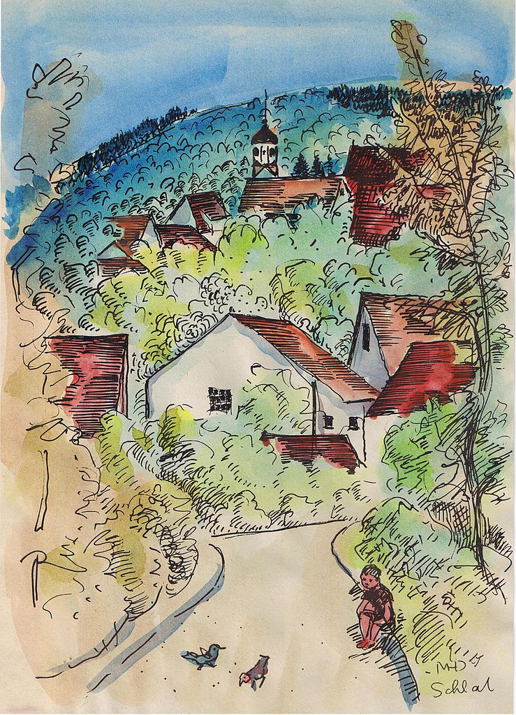

Schlat
- municipality in Germany
Hiking in Schlat
Schlat, a small town in the Baden-Württemberg region of Germany, offers a peaceful setting for hiking enthusiasts. Nestled in the picturesque Swabian Jura, this area features a variety of trails suitable for different experience levels. Here's what you can expect when hiking around Schlat:...
- Country:
- Postal Code: 73114
- Local Dialing Code: 07161
- Coordinates: 48° 39' 12" N, 9° 42' 22" E
- GPS tracks (wikiloc): [Link]
- AboveSeaLevel: 418 м m
- Area: 9.68 sq km
- Population: 1664
- Web site: [Link]

Kuchen
- town in Germany
Hiking in Kuchen
Kuchen, located in Baden-Württemberg, Germany, is a charming village situated in a picturesque landscape, making it a great spot for hiking enthusiasts. The region around Kuchen offers a variety of trails that cater to different skill levels, allowing for both leisurely walks and more challenging hikes....
- Country:
- Postal Code: 73329
- Local Dialing Code: 07331
- Licence Plate Code: GP
- Coordinates: 48° 38' 21" N, 9° 47' 57" E
- GPS tracks (wikiloc): [Link]
- AboveSeaLevel: 407 м m
- Area: 8.95 sq km
- Population: 5495
- Web site: [Link]


Wangen
- municipality in Germany
Hiking in Wangen
Wangen, a district of Göppingen in Baden-Württemberg, Germany, offers beautiful hiking opportunities nestled in the Swabian Jura hills. This region is characterized by its scenic landscapes, rich forests, and charming villages. Here are some details about hiking in and around Wangen:...
- Country:
- Postal Code: 73117
- Local Dialing Code: 07161
- Licence Plate Code: GP
- Coordinates: 48° 43' 46" N, 9° 36' 41" E
- GPS tracks (wikiloc): [Link]
- AboveSeaLevel: 379 м m
- Area: 9.68 sq km
- Population: 3056
- Web site: [Link]


Dürnau
- municipality in Göppingen district, Baden-Württemberg, Germany
Hiking in Dürnau
Dürnau is a charming village in the Göppingen district of Baden-Württemberg, Germany. The surrounding area offers a variety of hiking opportunities that showcase the natural beauty of the Swabian countryside. Whether you're a novice hiker or an experienced trekker, you can find trails that suit your level of experience....
- Country:
- Postal Code: 73105
- Local Dialing Code: 07164
- Licence Plate Code: GP
- Coordinates: 48° 38' 34" N, 9° 38' 16" E
- GPS tracks (wikiloc): [Link]
- AboveSeaLevel: 427 м m
- Area: 5.37 sq km
- Population: 2153
- Web site: [Link]


Lauterstein
- municipality in Germany
Hiking in Lauterstein
Lauterstein is a picturesque area located in the Swabian Jura region of Germany, known for its natural beauty, dense forests, and charming landscapes. Hiking in Lauterstein offers a variety of trails suitable for all levels of hikers, from families looking for a leisurely walk to more experienced hikers seeking challenging routes....
- Country:
- Postal Code: 73111
- Local Dialing Code: 07332
- Licence Plate Code: GP
- Coordinates: 48° 42' 36" N, 9° 51' 41" E
- GPS tracks (wikiloc): [Link]
- AboveSeaLevel: 468 м m
- Area: 23.32 sq km
- Population: 2574
- Web site: [Link]


Uhingen
- municipality in Germany
Hiking in Uhingen
Uhingen is a charming town located in the district of Göppingen in Baden-Württemberg, Germany. The surrounding region offers several opportunities for hiking enthusiasts, with picturesque landscapes and well-marked trails....
- Country:
- Postal Code: 73062–73066
- Local Dialing Code: 07163; 07161
- Licence Plate Code: GP
- Coordinates: 48° 42' 21" N, 9° 35' 31" E
- GPS tracks (wikiloc): [Link]
- AboveSeaLevel: 295 м m
- Area: 24.79 sq km
- Population: 13963
- Web site: [Link]


Geislingen an der Steige
- municipality in Germany
Hiking in Geislingen an der Steige
Geislingen an der Steige is located in the Swabian Jura region of Germany, providing a beautiful backdrop for hiking enthusiasts. The area is characterized by its stunning landscapes, diverse flora and fauna, and various trails suitable for different skill levels....
- Country:
- Postal Code: 73312
- Local Dialing Code: 07337; 07334; 07331
- Licence Plate Code: GP
- Coordinates: 48° 37' 28" N, 9° 49' 50" E
- GPS tracks (wikiloc): [Link]
- AboveSeaLevel: 464 м m
- Area: 75.83 sq km
- Population: 28021
- Web site: [Link]


Ebersbach an der Fils
- municipality in Baden-Württemberg, Germany
Hiking in Ebersbach an der Fils
Ebersbach an der Fils, located in Baden-Württemberg, Germany, offers some wonderful hiking opportunities that are ideal for nature enthusiasts and outdoor adventurers alike. The area is characterized by rolling hills, lush forests, and the scenic Fils River, which provides a picturesque backdrop for various trails....
- Country:
- Postal Code: 73061
- Local Dialing Code: 07163
- Licence Plate Code: GP
- Coordinates: 48° 42' 53" N, 9° 31' 25" E
- GPS tracks (wikiloc): [Link]
- AboveSeaLevel: 292 м m
- Area: 26.27 sq km
- Population: 15386
- Web site: [Link]


Süßen
- municipality in Germany
Hiking in Süßen
Süßen, located in the state of Baden-Württemberg, Germany, is surrounded by beautiful landscapes and offers various hiking opportunities. Here are some highlights and tips for hiking in and around Süßen:...
- Country:
- Postal Code: 73079
- Local Dialing Code: 07162
- Licence Plate Code: GP
- Coordinates: 48° 40' 47" N, 9° 45' 27" E
- GPS tracks (wikiloc): [Link]
- AboveSeaLevel: 364 м m
- Area: 12.78 sq km
- Population: 10250
- Web site: [Link]

Wiesensteig
- municipality in Germany
Hiking in Wiesensteig
Wiesensteig, located in the Swabian Jura region of Germany, is a picturesque town that offers beautiful hiking opportunities amidst stunning landscapes. The area is characterized by its rolling hills, dense forests, and rocky outcrops, making it a great destination for nature enthusiasts....
- Country:
- Postal Code: 73349
- Local Dialing Code: 07335
- Licence Plate Code: GP
- Coordinates: 48° 33' 42" N, 9° 37' 31" E
- GPS tracks (wikiloc): [Link]
- AboveSeaLevel: 592 м m
- Area: 23.40 sq km
- Population: 2053
- Web site: [Link]

Donzdorf
- town in southern Germany
Hiking in Donzdorf
Donzdorf is located in the picturesque region of Baden-Württemberg, Germany, surrounded by beautiful landscapes that are perfect for hiking enthusiasts. The area is known for its rolling hills, dense forests, and scenic views, making it an excellent destination for outdoor activities....
- Country:
- Postal Code: 73072
- Local Dialing Code: 07162
- Licence Plate Code: GP
- Coordinates: 48° 41' 0" N, 9° 49' 0" E
- GPS tracks (wikiloc): [Link]
- AboveSeaLevel: 407 м m
- Area: 39.82 sq km
- Population: 10737
- Web site: [Link]


Rechberghausen
- municipality in Germany
Hiking in Rechberghausen
Rechberghausen, located in the Baden-Württemberg region of Germany, offers a variety of delightful hiking opportunities for outdoor enthusiasts. Nestled in the scenic Swabian Jura, the area is characterized by rolling hills, lush forests, and picturesque landscapes....
- Country:
- Postal Code: 73098
- Local Dialing Code: 07161
- Licence Plate Code: GP
- Coordinates: 48° 43' 50" N, 9° 38' 23" E
- GPS tracks (wikiloc): [Link]
- AboveSeaLevel: 339 м m
- Area: 6.40 sq km
- Population: 5479
- Web site: [Link]


Drackenstein
- municipality in Germany
Hiking in Drackenstein
The Drakensberg Mountains, often referred to as the Drakensberg range, is one of South Africa's most spectacular hiking destinations. The term "Drackenstein" seems to be a mix-up with the Drakensberg name, but I'll provide information on the Drakensberg region since it encompasses breathtaking landscapes and diverse hiking opportunities....
- Country:
- Postal Code: 73345
- Local Dialing Code: 07335
- Licence Plate Code: GP
- Coordinates: 48° 33' 25" N, 9° 40' 43" E
- GPS tracks (wikiloc): [Link]
- AboveSeaLevel: 741 м m
- Area: 5.69 sq km
- Population: 419
- Web site: [Link]


Eschenbach
- town in Germany
Hiking in Eschenbach
Eschenbach, located in the Göppingen district of Baden-Württemberg, Germany, offers a charming environment for hiking enthusiasts. The region is characterized by picturesque landscapes, rolling hills, and scenic woodlands, making it an ideal destination for both casual walkers and seasoned hikers....
- Country:
- Postal Code: 73107
- Local Dialing Code: 07161
- Licence Plate Code: GP
- Coordinates: 48° 39' 30" N, 9° 40' 11" E
- GPS tracks (wikiloc): [Link]
- AboveSeaLevel: 458 м m
- Area: 4.80 sq km
- Population: 2202
- Web site: [Link]


Bad Boll
- municipality in Germany
Hiking in Bad Boll
Hiking in Bad Boll, a charming town in the Swabian region of Germany, is a delightful experience, especially for those who enjoy scenic landscapes and tranquil surroundings. Nestled at the foot of the Swabian Jura, Bad Boll offers a variety of hiking trails suitable for all levels, ranging from leisurely strolls to more challenging hikes....
- Country:
- Postal Code: 73085–73807
- Local Dialing Code: 07164
- Licence Plate Code: GP
- Coordinates: 48° 38' 22" N, 9° 36' 56" E
- GPS tracks (wikiloc): [Link]
- AboveSeaLevel: 411 м m
- Area: 10.95 sq km
- Population: 5163
- Web site: [Link]


Hattenhofen
- municipality in Baden-Württemberg, Germany
Hiking in Hattenhofen
Hattenhofen is a charming village located in Baden-Württemberg, Germany, and is surrounded by beautiful landscapes that provide excellent hiking opportunities. While the area may not be as widely known as some larger hiking destinations, it offers a peaceful setting and varied trails perfect for hikers of all skills and preferences....
- Country:
- Postal Code: 73110
- Local Dialing Code: 07164
- Licence Plate Code: GP
- Coordinates: 48° 40' 0" N, 9° 34' 19" E
- GPS tracks (wikiloc): [Link]
- AboveSeaLevel: 366 м m
- Area: 7.64 sq km
- Population: 2977
- Web site: [Link]


Eislingen/Fils
- municipality in Germany
Hiking in Eislingen/Fils
Eislingen, located in Baden-Württemberg, Germany, offers a charming experience for hikers with its picturesque landscapes, scenic trails, and proximity to nature. Here are some highlights and insights for hiking in the area:...
- Country:
- Postal Code: 73054
- Local Dialing Code: 07165; 07161
- Licence Plate Code: GP
- Coordinates: 48° 41' 36" N, 9° 42' 24" E
- GPS tracks (wikiloc): [Link]
- AboveSeaLevel: 336 м m
- Area: 16.41 sq km
- Population: 19948
- Web site: [Link]


Gruibingen
- municipality in Germany
Hiking in Gruibingen
Gruibingen is a small town located in Baden-Württemberg, Germany, that provides access to a variety of scenic hiking opportunities in the surrounding Swabian Jura. The region is characterized by its picturesque landscapes, including rolling hills, rocky outcrops, and dense forests, which make it an attractive destination for both novice and experienced hikers....
- Country:
- Postal Code: 73344
- Local Dialing Code: 07335
- Licence Plate Code: GP
- Coordinates: 48° 35' 41" N, 9° 38' 38" E
- GPS tracks (wikiloc): [Link]
- AboveSeaLevel: 566 м m
- Area: 23.05 sq km
- Population: 2208
- Web site: [Link]


Wäschenbeuren
- municipality in Germany
Hiking in Wäschenbeuren
Wäschenbeuren is a small town in Baden-Württemberg, Germany, situated near the Swabian Jura. This area offers a range of hiking opportunities with beautiful landscapes, rolling hills, and scenic views. Here are some aspects to consider when hiking in Wäschenbeuren:...
- Country:
- Postal Code: 73116
- Local Dialing Code: 07172
- Licence Plate Code: GP
- Coordinates: 48° 45' 37" N, 9° 41' 17" E
- GPS tracks (wikiloc): [Link]
- AboveSeaLevel: 442 м m
- Area: 12.95 sq km
- Population: 3889
- Web site: [Link]


Albershausen
- municipality in Germany
Hiking in Albershausen
Albershausen is a picturesque town located in the Baden-Württemberg region of Germany, near the Swabian Jura—a great area for hiking enthusiasts. The surrounding landscape features rolling hills, lush forests, and various trails suitable for different skill levels. Here are some highlights for hiking in and around Albershausen:...
- Country:
- Postal Code: 73095
- Local Dialing Code: 07161
- Licence Plate Code: GP
- Coordinates: 48° 41' 29" N, 9° 33' 54" E
- GPS tracks (wikiloc): [Link]
- AboveSeaLevel: 318 м m
- Area: 6.50 sq km
- Population: 4313
- Web site: [Link]


Bad Überkingen
- municipality in Germany
Hiking in Bad Überkingen
Bad Überkingen is a picturesque village located in the Geislinger Alb region of Germany, known for its natural beauty and outdoor activities, including hiking. The area offers a variety of trails that cater to different skill levels, making it a great destination for both beginners and more experienced hikers....
- Country:
- Postal Code: 73334–73337
- Local Dialing Code: 07331
- Licence Plate Code: GP
- Coordinates: 48° 36' 1" N, 9° 47' 56" E
- GPS tracks (wikiloc): [Link]
- AboveSeaLevel: 455 м m
- Area: 24.02 sq km
- Population: 3788
- Web site: [Link]

Hohenstadt
- municipality in Germany
Hiking in Hohenstadt
Hohenstadt, located in Germany, is a beautiful area known for its picturesque landscapes and scenic hiking trails. Nestled in the Swabian Jura, it's a great destination for both novice and experienced hikers looking to explore nature....
- Country:
- Postal Code: 73345
- Local Dialing Code: 07335
- Licence Plate Code: GP
- Coordinates: 48° 32' 40" N, 9° 39' 50" E
- GPS tracks (wikiloc): [Link]
- AboveSeaLevel: 814 м m
- Area: 11.64 sq km
- Population: 831
- Web site: [Link]
Shares border with regions:
Alb-Donau-Kreis
- district in Baden-Württemberg, Germany
Hiking in Alb-Donau-Kreis
The Alb-Donau-Kreis is a beautiful district located in Baden-Württemberg, Germany, known for its diverse landscapes, rich nature, and historical sites. Hiking in this area offers a range of trails suitable for all levels of hikers, from beginners to more experienced trekkers. Here are some highlights and tips for hiking in Alb-Donau-Kreis:...
- Country:
- Capital: Ulm
- Licence Plate Code: UL
- Coordinates: 48° 24' 0" N, 9° 51' 0" E
- GPS tracks (wikiloc): [Link]
- AboveSeaLevel: 670 м m
- Area: 1358.67 sq km
- Population: 192104
- Web site: [Link]