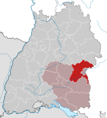
Alb-Donau-Kreis (Alb-Donau-Kreis)
- district in Baden-Württemberg, Germany
The Alb-Donau-Kreis is a beautiful district located in Baden-Württemberg, Germany, known for its diverse landscapes, rich nature, and historical sites. Hiking in this area offers a range of trails suitable for all levels of hikers, from beginners to more experienced trekkers. Here are some highlights and tips for hiking in Alb-Donau-Kreis:
Scenic Trails
-
Donau Valley: One of the most picturesque areas in the Alb-Donau-Kreis, following the Danube River, offers varied terrain with stunning views. The trails along the river often feature lush forests, rolling hills, and charming villages.
-
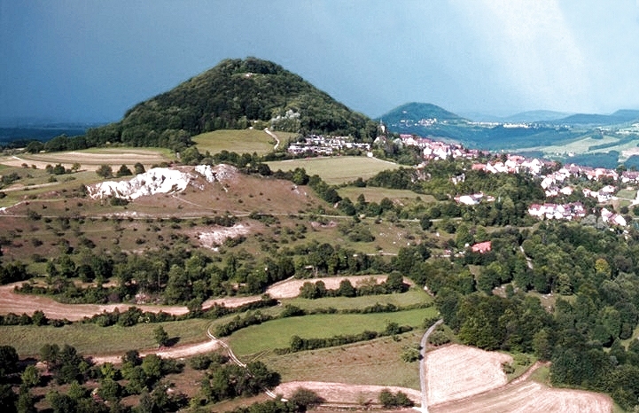
Swabian Jura (Schwäbische Alb): This UNESCO Biosphere Reserve is known for its dramatic limestone cliffs, deep gorges, and karst formations. The trails here offer a mix of challenging hikes and leisurely walks, often with spectacular views.
-
Historical Trails: Many trails in the area lead to historical sites, such as castles and ancient ruins. The trails can provide both a physical challenge and a cultural experience.
Popular Hiking Routes
-
The Albtrauf Trail (Albtraufweg): This famous hiking path along the edge of the Swabian Jura offers breathtaking views and is well-marked. It’s part of a longer route that showcases both natural beauty and geological features.
-
The Danube Path (Donauweg): A scenic route that closely follows the river and provides an opportunity to experience the natural beauty of the Danube, as well as the local flora and fauna.
Preparation Tips
- Check Trail Conditions: Before heading out, check the local weather conditions and trail reports, as paths can be affected by weather changes.
- Wear Proper Gear: Good hiking boots and weather-appropriate clothing are essential. If you plan to hike in the colder months, ensure your gear is suited for wet or snowy conditions.
- Pack Essentials: Always carry water, snacks, a map or GPS device, a first-aid kit, and possibly a hiking stick, especially for more rugged trails.
Local Culture and Flora/Fauna
Keep an eye out for the region’s diverse wildlife, including various bird species and deer. The area is also rich in plant life, particularly in spring and summer when wildflowers bloom. Additionally, don't miss the chance to enjoy local cuisine in nearby towns after a day of hiking.
Conclusion
Hiking in the Alb-Donau-Kreis combines natural beauty, adventure, and a touch of history, making it a perfect destination for outdoor enthusiasts. Whether you're hiking along the beautiful Danube or exploring the Swabian Jura, there’s something for everyone to enjoy in this scenic part of Germany.
- Country:

- Capital: Ulm
- Licence Plate Code: UL
- Coordinates: 48° 24' 0" N, 9° 51' 0" E


- GPS tracks (wikiloc): [Link]
- AboveSeaLevel: 670 м m
- Area: 1358.67 sq km
- Population: 192104
- Web site: http://www.alb-donau-kreis.de
- Wikipedia en: wiki(en)
- Wikipedia: wiki(de)
- Wikidata storage: Wikidata: Q8221
- Wikipedia Commons Category: [Link]
- Freebase ID: [/m/019_l5]
- GeoNames ID: Alt: [3220786]
- VIAF ID: Alt: [132724496]
- OSM relation ID: [2804078]
- GND ID: Alt: [4001032-6]
- archINFORM location ID: [2646]
- Library of Congress authority ID: Alt: [n84045530]
- TGN ID: [7077330]
- NUTS code: [DE145]
- German district key: 08425
Includes regions:

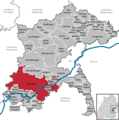
Ehingen
- town in the Alb-Donau district of Baden-Württemberg, Germany
Ehingen, located in the Swabian Jura region of Germany, offers a variety of beautiful hiking opportunities characterized by its picturesque landscapes, charming villages, and rich natural heritage. Here are some highlights and tips for hiking in and around Ehingen:...
- Country:

- Postal Code: 89584; 7930
- Local Dialing Code: 07391
- Licence Plate Code: UL; EHI
- Coordinates: 48° 17' 0" N, 9° 43' 25" E


- GPS tracks (wikiloc): [Link]
- AboveSeaLevel: 515 м m
- Area: 178.37 sq km
- Population: 24862
- Web site: [Link]


Holzkirch
- municipality in Baden-Württemberg, Germany
Holzkirchen, located in Bavaria, Germany, is surrounded by stunning natural landscapes that are ideal for hiking enthusiasts. The region boasts a variety of trails suitable for different skill levels, from gentle walks to more challenging routes....
- Country:

- Postal Code: 89183
- Local Dialing Code: 07340
- Licence Plate Code: UL
- Coordinates: 48° 31' 50" N, 9° 59' 43" E


- GPS tracks (wikiloc): [Link]
- AboveSeaLevel: 579 м m
- Area: 8.14 sq km
- Population: 264
- Web site: [Link]


Dietenheim
- town in Baden-Württemberg, Germany
Dietenheim, located in the state of Bavaria, Germany, offers a variety of hiking opportunities amidst beautiful natural scenery and cultural attractions. While the area may not be as widely known for hiking as some other regions in Germany, there are still scenic trails and paths suitable for hiking enthusiasts. Here are some aspects to consider for a hiking adventure in Dietenheim:...
- Country:

- Postal Code: 89165
- Local Dialing Code: 07347
- Licence Plate Code: UL
- Coordinates: 48° 12' 43" N, 10° 4' 24" E


- GPS tracks (wikiloc): [Link]
- AboveSeaLevel: 513 м m
- Area: 18.76 sq km
- Population: 6604
- Web site: [Link]


Altheim (Alb)
- municipality in Baden-Württemberg, Germany
Altheim, located in the Swabian Jura region of Germany, offers several scenic hiking opportunities. The area is characterized by beautiful rolling hills, lush forests, and diverse flora and fauna. Here are some key points to consider if you’re planning a hiking trip in Altheim:...
- Country:

- Postal Code: 89174
- Local Dialing Code: 07340
- Licence Plate Code: UL
- Coordinates: 48° 34' 54" N, 10° 1' 37" E


- GPS tracks (wikiloc): [Link]
- AboveSeaLevel: 609 м m
- Area: 25.77 sq km
- Population: 1694
- Web site: [Link]


Öllingen
- municipality in Baden-Württemberg, Germany
Öllingen is a small village in the region of Baden-Württemberg, Germany. While it may not be as well-known as larger hiking destinations, it offers a quaint and picturesque setting for outdoor enthusiasts. The surrounding area typically features a mix of forested paths, scenic countryside, and rural landscapes, making it ideal for hiking....
- Country:

- Postal Code: 89129
- Local Dialing Code: 07345
- Licence Plate Code: UL
- Coordinates: 48° 31' 40" N, 10° 8' 51" E


- GPS tracks (wikiloc): [Link]
- AboveSeaLevel: 534 м m
- Area: 8.09 sq km
- Population: 542
- Web site: [Link]

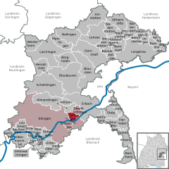
Öpfingen
- municipality in Baden-Württemberg, Germany
Öpfingen is a charming village located in the Upper Swabia region of Germany, known for its picturesque landscapes and outdoor activities. While it may not be as widely recognized as some major hiking destinations, it offers several appealing options for hiking enthusiasts....
- Country:

- Postal Code: 89614
- Local Dialing Code: 07391
- Licence Plate Code: UL
- Coordinates: 48° 17' 11" N, 9° 48' 11" E


- GPS tracks (wikiloc): [Link]
- AboveSeaLevel: 504 м m
- Area: 8.88 sq km
- Population: 2364
- Web site: [Link]


Bernstadt
- municipality in Baden-Württemberg, Germany
Bernstadt (Alb) is a small town located in the state of Baden-Württemberg, Germany, nestled in the Swabian Jura region. This area offers a variety of hiking opportunities that are ideal for both beginners and more experienced hikers. Here’s some information about hiking in and around Bernstadt (Alb):...
- Country:

- Postal Code: 89182
- Local Dialing Code: 07348
- Licence Plate Code: UL
- Coordinates: 48° 29' 58" N, 10° 1' 33" E


- GPS tracks (wikiloc): [Link]
- AboveSeaLevel: 561 м m
- Area: 13.95 sq km
- Population: 2110
- Web site: [Link]
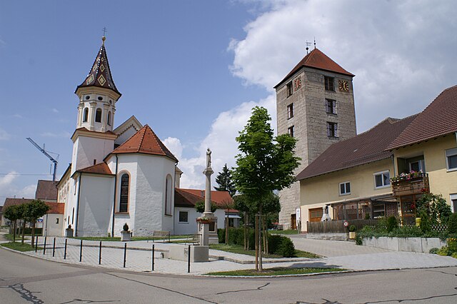

Emerkingen
- municipality in Baden-Württemberg, Germany
Emerkingen is a charming small village located in the Alb-Donau district of Baden-Württemberg, Germany, known for its picturesque landscapes and access to nature. Hiking in this area can be quite rewarding, as there are various trails that offer beautiful views of the Swabian Jura mountains and the surrounding countryside....
- Country:

- Postal Code: 89607
- Local Dialing Code: 07393
- Licence Plate Code: UL
- Coordinates: 48° 12' 43" N, 9° 39' 23" E


- GPS tracks (wikiloc): [Link]
- AboveSeaLevel: 532 м m
- Area: 7.4 sq km
- Population: 827
- Web site: [Link]

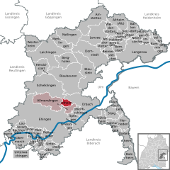
Altheim
- municipality in Alb-Donau-Kreis, Baden-Württemberg, Germany
Altheim, in the Ehingen area of Germany, offers a variety of hiking opportunities that showcase the beauty of the Swabian Jura and its diverse landscapes. Here are some tips and highlights for hiking in the Altheim region:...
- Country:

- Postal Code: 89605
- Local Dialing Code: 07391
- Licence Plate Code: UL
- Coordinates: 48° 19' 43" N, 9° 46' 16" E


- GPS tracks (wikiloc): [Link]
- AboveSeaLevel: 606 м m
- Area: 7.80 sq km
- Population: 611
- Web site: [Link]

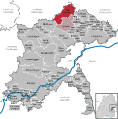
Amstetten
- municipality in Baden-Württemberg, Germany
Amstetten, located in the state of Baden-Württemberg in Germany, offers various hiking opportunities that encompass scenic views and beautiful landscapes. The region is characterized by its rolling hills, wooded areas, and charming villages, making it a great place for outdoor enthusiasts. Here are some key points about hiking in and around Amstetten:...
- Country:

- Postal Code: 73340
- Local Dialing Code: 07331
- Licence Plate Code: UL
- Coordinates: 48° 34' 46" N, 9° 52' 28" E


- GPS tracks (wikiloc): [Link]
- AboveSeaLevel: 628 м m
- Area: 49.8 sq km
- Population: 3953
- Web site: [Link]


Breitingen
- municipality in Baden-Württemberg, Germany
Breitingen, a quaint area often characterized by its picturesque landscapes and scenic trails, offers a great environment for hiking enthusiasts. While the specifics may vary depending on the exact location and available trails, I can give you a general idea of what to expect when hiking in such regions....
- Country:

- Postal Code: 89183
- Local Dialing Code: 07340
- Licence Plate Code: UL
- Coordinates: 48° 31' 2" N, 9° 59' 32" E


- GPS tracks (wikiloc): [Link]
- AboveSeaLevel: 533 м m
- Area: 2.89 sq km
- Population: 309
- Web site: [Link]


Erbach
- town in Baden-Württemberg, Germany
Erbach an der Donau is a charming town in southern Germany, nestled along the picturesque Danube River. It's a great destination for hiking enthusiasts, as it offers a variety of scenic trails that cater to different skill levels. Here are some highlights of hiking in this region:...
- Country:

- Postal Code: 89155
- Local Dialing Code: 07394; 07344; 07305
- Licence Plate Code: UL
- Coordinates: 48° 19' 41" N, 9° 53' 16" E


- GPS tracks (wikiloc): [Link]
- AboveSeaLevel: 529 м m
- Area: 63.29 sq km
- Population: 13204
- Web site: [Link]


Blaubeuren
- town in Baden-Württemberg, Germany
Blaubeuren is a picturesque town in Baden-Württemberg, Germany, known for its stunning landscapes and rich history. Hiking in and around Blaubeuren offers a variety of trails that showcase the natural beauty of the Swabian Jura region, as well as cultural and historical sites....
- Country:

- Postal Code: 89143
- Local Dialing Code: 07344
- Licence Plate Code: UL
- Coordinates: 48° 24' 43" N, 9° 47' 6" E


- GPS tracks (wikiloc): [Link]
- AboveSeaLevel: 516 м m
- Area: 79.15 sq km
- Population: 12401
- Web site: [Link]


Hausen am Bussen
- municipality in Baden-Württemberg, Germany
Hausen am Bussen is a picturesque village located in the Swabian region of Germany, known for its beautiful landscapes and hiking opportunities. Nestled near the Bussen Mountain, it offers a variety of trails that cater to different skill levels, making it a great destination for hikers....
- Country:

- Postal Code: 89597
- Local Dialing Code: 07393
- Licence Plate Code: UL
- Coordinates: 48° 12' 42" N, 9° 37' 31" E


- GPS tracks (wikiloc): [Link]
- AboveSeaLevel: 532 м m
- Area: 3.52 sq km
- Population: 253
- Web site: [Link]


Beimerstetten
- municipality in Baden-Württemberg, Germany
Beimerstetten is a small municipality located in Germany, surrounded by beautiful landscapes, making it a great spot for hiking enthusiasts. The area offers a variety of trails suitable for different skill levels, which allow you to enjoy the serene countryside, lush forests, and scenic views....
- Country:

- Postal Code: 89179
- Local Dialing Code: 07348
- Licence Plate Code: UL
- Coordinates: 48° 29' 3" N, 9° 58' 52" E


- GPS tracks (wikiloc): [Link]
- AboveSeaLevel: 587 м m
- Area: 14.34 sq km
- Population: 2543
- Web site: [Link]


Schelklingen
- town in Baden-Württemberg, Germany
Schelklingen, located in the Swabian Jura region of Germany, is a fantastic destination for hiking enthusiasts. This area is known for its stunning landscapes, featuring limestone cliffs, deep valleys, and rich forests. Here are some key points to consider when hiking in Schelklingen:...
- Country:

- Postal Code: 89598–89601
- Local Dialing Code: 07394; 07384
- Coordinates: 48° 22' 32" N, 9° 43' 57" E


- GPS tracks (wikiloc): [Link]
- AboveSeaLevel: 540 м m
- Area: 75.8 sq km
- Population: 6765
- Web site: [Link]


Balzheim
- municipality in Baden-Württemberg, Germany
Balzheim is a small village located in the southern part of Germany, not far from the city of Ulm in the state of Baden-Württemberg. While it may not be a widely recognized hiking destination, the surrounding region offers access to picturesque landscapes and opportunities for various outdoor activities....
- Country:

- Postal Code: 88481
- Local Dialing Code: 07347
- Licence Plate Code: UL
- Coordinates: 48° 10' 17" N, 10° 4' 38" E


- GPS tracks (wikiloc): [Link]
- AboveSeaLevel: 519 м m
- Area: 17.58 sq km
- Population: 2046
- Web site: [Link]

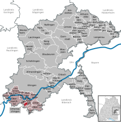
Unterwachingen
- municipality in Baden-Württemberg, Germany
Unterwachingen is a small village located in the southwestern part of Germany, specifically in the state of Baden-Württemberg. It is part of the Landkreis (district) of Alb-Donau-Kreis and is characterized by beautiful landscapes that include rolling hills, forests, and agricultural land....
- Country:

- Postal Code: 89597
- Local Dialing Code: 07393
- Licence Plate Code: UL
- Coordinates: 48° 12' 11" N, 9° 38' 37" E


- GPS tracks (wikiloc): [Link]
- AboveSeaLevel: 520 м m
- Area: 2.60 sq km
- Population: 202
- Web site: [Link]


Munderkingen
- town in Baden-Württemberg, Germany
Munderkingen is a charming town located in the state of Baden-Württemberg, Germany. Nestled along the banks of the Danube River, it provides access to a variety of beautiful hiking opportunities, particularly for those who enjoy natural landscapes and historical routes. Here are some things to know about hiking in and around Munderkingen:...
- Country:

- Postal Code: 89597
- Local Dialing Code: 07393
- Licence Plate Code: UL
- Coordinates: 48° 14' 7" N, 9° 38' 38" E


- GPS tracks (wikiloc): [Link]
- AboveSeaLevel: 516 м m
- Area: 13.08 sq km
- Population: 5249
- Web site: [Link]

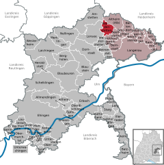
Weidenstetten
- municipality in Baden-Württemberg, Germany
Weidenstetten is a small town located in the southwestern part of Germany, specifically in the state of Baden-Württemberg. It is situated near the scenic Swabian Jura, which offers diverse hiking opportunities. Here are some key points about hiking in and around Weidenstetten:...
- Country:

- Postal Code: 89197
- Local Dialing Code: 07340
- Licence Plate Code: UL
- Coordinates: 48° 33' 9" N, 9° 59' 46" E


- GPS tracks (wikiloc): [Link]
- AboveSeaLevel: 585 м m
- Area: 17.21 sq km
- Population: 1360
- Web site: [Link]


Berghülen
- municipality in Baden-Württemberg, Germany
Berghülen, located in the Swabian region of Germany, is known for its picturesque landscapes and scenic hiking opportunities. While it may not be a widely recognized hiking destination, it offers a variety of trails that showcase the beauty of the surrounding countryside and natural features....
- Country:

- Postal Code: 89180
- Local Dialing Code: 07344
- Licence Plate Code: UL
- Coordinates: 48° 27' 50" N, 9° 45' 40" E


- GPS tracks (wikiloc): [Link]
- AboveSeaLevel: 693 м m
- Area: 26.13 sq km
- Population: 1917
- Web site: [Link]

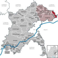
Asselfingen
- municipality in Baden-Württemberg, Germany
Asselfingen is a quaint village located in the state of Baden-Württemberg, Germany. While it may not be as widely recognized as other hiking destinations, it offers several opportunities for outdoor enthusiasts who enjoy scenic and peaceful nature experiences....
- Country:

- Postal Code: 89176
- Local Dialing Code: 07345
- Licence Plate Code: UL
- Coordinates: 48° 31' 46" N, 10° 11' 34" E


- GPS tracks (wikiloc): [Link]
- AboveSeaLevel: 497 м m
- Area: 12.85 sq km
- Population: 1048
- Web site: [Link]


Oberdischingen
- municipality in Baden-Württemberg, Germany
Oberdischingen is a charming village located in the state of Baden-Württemberg, Germany. While it may not be as widely recognized as some major hiking destinations, it offers various opportunities for outdoor enthusiasts, particularly those who appreciate scenic countryside and the charm of smaller trails....
- Country:

- Postal Code: 89610
- Local Dialing Code: 07305
- Licence Plate Code: UL
- Coordinates: 48° 18' 0" N, 9° 50' 0" E


- GPS tracks (wikiloc): [Link]
- AboveSeaLevel: 491 м m
- Area: 8.84 sq km
- Population: 2080
- Web site: [Link]

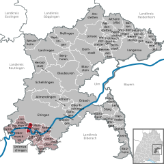
Untermarchtal
- municipality in Baden-Württemberg, Germany
Untermarchtal, located in the picturesque Swabian Jura region of Germany, offers a variety of hiking opportunities for outdoor enthusiasts. The area is renowned for its striking landscapes, rich biodiversity, and historical sites. Here are some key points to consider when hiking in Untermarchtal:...
- Country:

- Postal Code: 89617
- Local Dialing Code: 07393
- Licence Plate Code: UL
- Coordinates: 48° 14' 21" N, 9° 36' 35" E


- GPS tracks (wikiloc): [Link]
- AboveSeaLevel: 506 м m
- Area: 5.62 sq km
- Population: 877
- Web site: [Link]

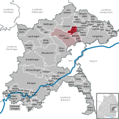
Westerstetten
- municipality in Baden-Württemberg, Germany
Westerstetten, located in the southern part of Germany in the state of Baden-Württemberg, is a charming village surrounded by picturesque landscapes that make it an excellent spot for hiking enthusiasts....
- Country:

- Postal Code: 89198
- Local Dialing Code: 07348; 07336; 0731
- Licence Plate Code: UL
- Coordinates: 48° 31' 13" N, 9° 57' 19" E


- GPS tracks (wikiloc): [Link]
- AboveSeaLevel: 544 м m
- Area: 13.09 sq km
- Population: 2180
- Web site: [Link]


Laichingen
- town in Baden-Württemberg, Germany
Laichingen, located in the Swabian region of Germany, offers a variety of scenic hiking opportunities, showcasing the beauty of its natural landscapes. Here are some highlights and tips for hiking in Laichingen:...
- Country:

- Postal Code: 89144–89150
- Local Dialing Code: 07333
- Licence Plate Code: UL
- Coordinates: 48° 29' 23" N, 9° 41' 10" E


- GPS tracks (wikiloc): [Link]
- AboveSeaLevel: 755 м m
- Area: 69.84 sq km
- Population: 11175
- Web site: [Link]


Illerrieden
- municipality in Baden-Württemberg, Germany
Illerrieden is a charming village located in Bavaria, Germany, near the Iller River. The region offers a variety of hiking opportunities that can cater to different skill levels and preferences. Here are some points to consider if you're planning a hiking trip in Illerrieden:...
- Country:

- Postal Code: 89186
- Local Dialing Code: 07306
- Licence Plate Code: UL
- Coordinates: 48° 16' 13" N, 10° 3' 6" E


- GPS tracks (wikiloc): [Link]
- AboveSeaLevel: 500 м m
- Area: 18.17 sq km
- Population: 3278
- Web site: [Link]

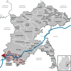
Emeringen
- municipality in Baden-Württemberg, Germany
Emeringen, although it might not be widely recognized as a major hiking destination, likely offers scenic views and various trails suitable for outdoor enthusiasts. Since specific details about Emeringen might be limited, I'd recommend checking local resources for accurate trail maps and conditions....
- Country:

- Postal Code: 88499
- Local Dialing Code: 07373
- Licence Plate Code: UL
- Coordinates: 48° 12' 2" N, 9° 31' 4" E


- GPS tracks (wikiloc): [Link]
- AboveSeaLevel: 579 м m
- Area: 7.54 sq km
- Population: 136
- Web site: [Link]

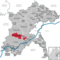
Allmendingen
- municipality in Baden-Württemberg, Germany
Allmendingen is a charming village located in the state of Baden-Württemberg, Germany. It offers picturesque landscapes and access to several hiking trails that cater to various skill levels. Here’s an overview to help you enjoy hiking in and around Allmendingen:...
- Country:

- Postal Code: 89604
- Local Dialing Code: 07391; 07384
- Licence Plate Code: UL; EHI
- Coordinates: 48° 19' 41" N, 9° 43' 14" E


- GPS tracks (wikiloc): [Link]
- AboveSeaLevel: 518 м m
- Area: 45.90 sq km
- Population: 4403
- Web site: [Link]

Rottenacker
- municipality in Baden-Württemberg, Germany
Rottenacker is a small village located in Baden-Württemberg, Germany, known for its picturesque landscapes and opportunities for outdoor activities, including hiking. The surrounding area features beautiful countryside, vineyards, and forests, making it an excellent location for hiking enthusiasts....
- Country:

- Postal Code: 89616
- Local Dialing Code: 07393
- Licence Plate Code: UL
- Coordinates: 48° 14' 5" N, 9° 41' 22" E


- GPS tracks (wikiloc): [Link]
- AboveSeaLevel: 523 м m
- Area: 10.29 sq km
- Population: 2111
- Web site: [Link]
Hüttisheim
- municipality in Baden-Württemberg, Germany
Hüttisheim, a small municipality in the Baden-Württemberg region of Germany, is surrounded by beautiful landscapes that offer various hiking opportunities. Here are some insights into hiking in and around Hüttisheim:...
- Country:

- Postal Code: 89185
- Local Dialing Code: 07305
- Licence Plate Code: UL
- Coordinates: 48° 16' 47" N, 9° 56' 34" E


- GPS tracks (wikiloc): [Link]
- AboveSeaLevel: 538 м m
- Area: 10.35 sq km
- Population: 1440
- Web site: [Link]
Heroldstatt
- municipality in Baden-Württemberg, Germany
Heroldstatt, located in the Swabian Jura of Baden-Württemberg, Germany, offers a variety of hiking opportunities for both casual walkers and more experienced hikers. The region is characterized by its picturesque landscapes, limestone cliffs, and diverse flora and fauna, making it an appealing destination for nature enthusiasts....
- Country:

- Postal Code: 72535
- Local Dialing Code: 07389
- Licence Plate Code: UL
- Coordinates: 48° 26' 47" N, 9° 40' 18" E


- GPS tracks (wikiloc): [Link]
- AboveSeaLevel: 770 м m
- Area: 22.58 sq km
- Population: 2866
- Web site: [Link]
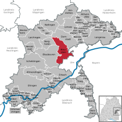
Blaustein
- municipality in Baden-Württemberg, Germany
Blaustein, located in Germany’s Baden-Württemberg region, offers a variety of beautiful hiking opportunities, particularly due to its scenic landscapes and proximity to the Swabian Jura. Here are some key points about hiking in Blaustein:...
- Country:

- Postal Code: 89134
- Local Dialing Code: 0731; 07304
- Licence Plate Code: UL
- Coordinates: 48° 24' 59" N, 9° 55' 8" E


- GPS tracks (wikiloc): [Link]
- AboveSeaLevel: 494 м m
- Area: 55.61 sq km
- Population: 15965
- Web site: [Link]
Grundsheim
- municipality in Baden-Württemberg, Germany
Grundsheim, though not widely known as a hiking destination, is situated in a region that can offer some lovely outdoor experiences. Depending on its surrounding landscape, you might find a mix of forested areas, rolling hills, and potentially scenic routes along rivers or through nature reserves....
- Country:

- Postal Code: 89613
- Local Dialing Code: 07357
- Licence Plate Code: UL
- Coordinates: 48° 10' 0" N, 9° 40' 0" E


- GPS tracks (wikiloc): [Link]
- AboveSeaLevel: 557 м m
- Area: 3.7 sq km
- Population: 216
- Web site: [Link]


Lonsee
- municipality in Baden-Württemberg, Germany
Lonsee is a charming village located in the Baden-Württemberg region of Germany, not far from the city of Ulm. The area is known for its picturesque landscapes, rolling hills, and serene natural surroundings, making it a perfect destination for hiking enthusiasts....
- Country:

- Postal Code: 89173
- Local Dialing Code: 07336
- Licence Plate Code: UL
- Coordinates: 48° 32' 36" N, 9° 55' 12" E


- GPS tracks (wikiloc): [Link]
- AboveSeaLevel: 575 м m
- Area: 43.32 sq km
- Population: 4778
- Web site: [Link]
Neenstetten
- municipality in Baden-Württemberg, Germany
Neenstetten is a small village located in the state of Baden-Württemberg, Germany. While it may not be as widely known as other hiking destinations, the surrounding region offers beautiful landscapes and outdoor opportunities for hiking enthusiasts. Here are some points to consider when hiking around Neenstetten:...
- Country:

- Postal Code: 89189
- Local Dialing Code: 07340
- Licence Plate Code: UL
- Coordinates: 48° 32' 50" N, 10° 1' 9" E


- GPS tracks (wikiloc): [Link]
- AboveSeaLevel: 572 м m
- Area: 8.3 sq km
- Population: 805
- Web site: [Link]


Westerheim
- municipality in Baden-Württemberg, Germany
Westerheim, located in the Swabian Jura region of Baden-Württemberg, Germany, is a charming village that offers a variety of hiking opportunities amidst beautiful natural landscapes. The area is characterized by its rolling hills, forests, and unique geological formations, making it an excellent destination for outdoor enthusiasts....
- Country:

- Postal Code: 72589
- Local Dialing Code: 07333
- Licence Plate Code: UL
- Coordinates: 48° 30' 54" N, 9° 37' 25" E


- GPS tracks (wikiloc): [Link]
- AboveSeaLevel: 815 м m
- Area: 22.93 sq km
- Population: 2935
- Web site: [Link]


Ballendorf
- municipality in Baden-Württemberg, Germany
Ballendorf, located in Germany's Swabian Jura region, offers a variety of hiking opportunities with stunning natural landscapes. The area is characterized by picturesque limestone cliffs, lush forests, and winding trails that make it ideal for both casual walkers and more experienced hikers....
- Country:

- Postal Code: 89177
- Local Dialing Code: 07340
- Licence Plate Code: UL
- Coordinates: 48° 33' 15" N, 10° 4' 37" E


- GPS tracks (wikiloc): [Link]
- AboveSeaLevel: 546 м m
- Area: 14.21 sq km
- Population: 644
- Web site: [Link]
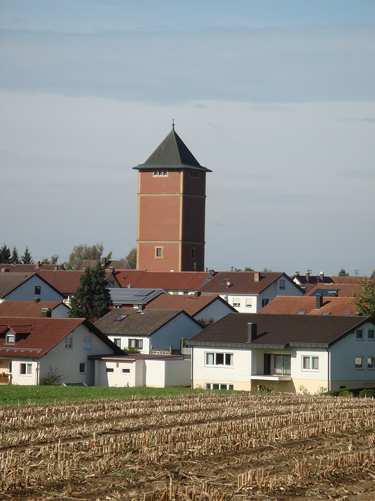

Staig
- municipality in Baden-Württemberg, Germany
Hiking in Staig, a charming area situated in southern Germany, offers a delightful experience for outdoor enthusiasts with its picturesque landscapes and well-maintained trails. The region is characterized by rolling hills, dense forests, and scenic views, making it an excellent choice for both casual walkers and experienced hikers....
- Country:

- Postal Code: 89195
- Local Dialing Code: 07346
- Licence Plate Code: UL
- Coordinates: 48° 18' 0" N, 9° 59' 29" E


- GPS tracks (wikiloc): [Link]
- AboveSeaLevel: 502 м m
- Area: 17.74 sq km
- Population: 3101
- Web site: [Link]

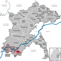
Unterstadion
- municipality in Baden-Württemberg, Germany
Unterstadion is a charming region in Germany known for its picturesque landscapes and stunning hiking trails. Nestled in the Swabian Jura, it offers a range of hiking opportunities suitable for various skill levels. Here’s what you need to know if you’re planning a hiking trip in this area:...
- Country:

- Postal Code: 89619
- Local Dialing Code: 07393
- Licence Plate Code: UL
- Coordinates: 48° 12' 11" N, 9° 41' 18" E


- GPS tracks (wikiloc): [Link]
- AboveSeaLevel: 508 м m
- Area: 8.84 sq km
- Population: 746
- Web site: [Link]


Obermarchtal
- municipality in Baden-Württemberg, Germany
Obermarchtal is a picturesque village located in the Alb-Donau district of Baden-Württemberg, Germany. The surrounding region is characterized by beautiful landscapes, rolling hills, and lush forests, making it ideal for hiking. Here are some highlights about hiking in Obermarchtal:...
- Country:

- Postal Code: 89611
- Local Dialing Code: 07375
- Licence Plate Code: UL
- Coordinates: 48° 13' 58" N, 9° 34' 20" E


- GPS tracks (wikiloc): [Link]
- AboveSeaLevel: 535 м m
- Area: 26.59 sq km
- Population: 1266
- Web site: [Link]
Griesingen
- municipality in Baden-Württemberg, Germany
Griesingen, a small area located in Germany, is not typically well-known for extensive hiking trails compared to larger national parks or mountainous regions. However, it does offer some opportunities for outdoor enthusiasts to explore the natural beauty of the surrounding countryside....
- Country:

- Postal Code: 89608
- Local Dialing Code: 07391
- Licence Plate Code: UL
- Coordinates: 48° 16' 0" N, 9° 46' 57" E


- GPS tracks (wikiloc): [Link]
- AboveSeaLevel: 506 м m
- Area: 8.16 sq km
- Population: 1034
- Web site: [Link]

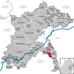
Schnürpflingen
- municipality in Baden-Württemberg, Germany
Schnürpflingen is a small town located in the state of Baden-Württemberg, Germany. While it may not be as renowned as some larger hiking destinations in the region, there are nevertheless opportunities for outdoor enthusiasts to enjoy the natural beauty that surrounds the area....
- Country:

- Postal Code: 89194
- Local Dialing Code: 07346
- Licence Plate Code: UL
- Coordinates: 48° 16' 22" N, 9° 59' 35" E


- GPS tracks (wikiloc): [Link]
- AboveSeaLevel: 537 м m
- Area: 10.71 sq km
- Population: 1385
- Web site: [Link]

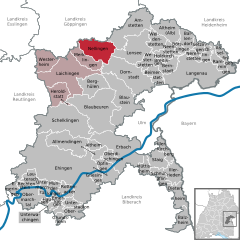
Nellingen
- municipality in Baden-Württemberg, Germany
Nellingen is a picturesque village located in the Baden-Württemberg region of Germany, close to the Swabian Jura mountain range. The surrounding area offers a variety of hiking opportunities that cater to different skill levels. Here are some key points about hiking in and around Nellingen:...
- Country:

- Postal Code: 89191
- Local Dialing Code: 07337
- Licence Plate Code: UL
- Coordinates: 48° 32' 31" N, 9° 47' 26" E


- GPS tracks (wikiloc): [Link]
- AboveSeaLevel: 691 м m
- Area: 35.78 sq km
- Population: 1992
- Web site: [Link]
Rammingen
- municipality in Baden-Württemberg, Germany
Rammingen is a small village in Bavaria, Germany, located near the Danube River. While it may not be widely known for extensive hiking trails, the surrounding area offers some beautiful opportunities for hiking enthusiasts....
- Country:

- Postal Code: 89192
- Local Dialing Code: 07345
- Licence Plate Code: UL
- Coordinates: 48° 31' 5" N, 10° 10' 21" E


- GPS tracks (wikiloc): [Link]
- AboveSeaLevel: 512 м m
- Area: 14.03 sq km
- Population: 1274
- Web site: [Link]


Oberstadion
- municipality in Baden-Württemberg, Germany
Oberstadion, a small town located in the state of Baden-Württemberg, Germany, offers beautiful landscapes and a variety of hiking opportunities. While it may not be as famous as some larger hiking destinations in the country, it still provides a great experience for hiking enthusiasts looking for scenic routes and less crowded trails....
- Country:

- Postal Code: 89613
- Local Dialing Code: 07393; 07357
- Licence Plate Code: UL
- Coordinates: 48° 11' 0" N, 9° 41' 0" E


- GPS tracks (wikiloc): [Link]
- AboveSeaLevel: 540 м m
- Area: 15.8 sq km
- Population: 1520
- Web site: [Link]


Rechtenstein
- municipality in Baden-Württemberg, Germany
Hiking in Liechtenstein offers stunning landscapes, diverse trails, and a rich cultural experience. This small alpine country, nestled between Switzerland and Austria, features a variety of hiking opportunities that cater to different skill levels....
- Country:

- Postal Code: 89611
- Local Dialing Code: 07375
- Licence Plate Code: UL
- Coordinates: 48° 14' 27" N, 9° 32' 44" E


- GPS tracks (wikiloc): [Link]
- AboveSeaLevel: 538 м m
- Area: 3.78 sq km
- Population: 278
- Web site: [Link]


Langenau
- town in Baden-Württemberg, Germany
Langenau, a small town in Baden-Württemberg, Germany, offers a variety of beautiful hiking options. The surrounding landscape includes forests, hills, and meadows that are perfect for outdoor activities. Here are some details about hiking in and around Langenau:...
- Country:

- Postal Code: 89129
- Local Dialing Code: 07345
- Licence Plate Code: UL
- Coordinates: 48° 29' 58" N, 10° 7' 16" E


- GPS tracks (wikiloc): [Link]
- AboveSeaLevel: 458 м m
- Area: 75 sq km
- Population: 14526
- Web site: [Link]


Illerkirchberg
- municipality in Baden-Württemberg, Germany
Illerkirchberg is a picturesque village located in the state of Baden-Württemberg, Germany, near the city of Ulm. The area is characterized by scenic landscapes, rolling hills, and the nearby Iller River, making it a great destination for hiking enthusiasts....
- Country:

- Postal Code: 89171
- Local Dialing Code: 07346
- Licence Plate Code: UL
- Coordinates: 48° 19' 16" N, 10° 1' 12" E


- GPS tracks (wikiloc): [Link]
- AboveSeaLevel: 513 м m
- Area: 11.45 sq km
- Population: 4716
- Web site: [Link]


Dornstadt
- municipality in Baden-Württemberg, Germany
Dornstadt is a charming village located in the Swabian region of Baden-Württemberg, Germany. While it might not be as widely known as some other hiking destinations, it offers access to beautiful natural landscapes and picturesque trails suitable for various skill levels....
- Country:

- Postal Code: 89160
- Local Dialing Code: 07304; 07336; 07348
- Licence Plate Code: UL
- Coordinates: 48° 28' 1" N, 9° 56' 40" E


- GPS tracks (wikiloc): [Link]
- AboveSeaLevel: 594 м m
- Area: 59.24 sq km
- Population: 8589
- Web site: [Link]


Lauterach
- municipality in Baden-Württemberg, Germany
Lauterach is a small town located in the picturesque state of Baden-Württemberg, Germany. While it may not be as widely known as some of the larger hiking destinations in the region, it offers beautiful landscapes and serene trails that are perfect for hiking enthusiasts. Here are a few insights about hiking in and around Lauterach:...
- Country:

- Postal Code: 89584
- Local Dialing Code: 07375
- Licence Plate Code: UL
- Coordinates: 48° 15' 20" N, 9° 34' 54" E


- GPS tracks (wikiloc): [Link]
- AboveSeaLevel: 518 м m
- Area: 13.78 sq km
- Population: 580
- Web site: [Link]
Setzingen
- municipality in Baden-Württemberg, Germany
Setzingen, a small village in the region of Baden-Württemberg, Germany, offers picturesque landscapes and peaceful hiking opportunities. The area is characterized by rolling hills, lush greenery, and scenic views that are perfect for nature lovers....
- Country:

- Postal Code: 89129
- Local Dialing Code: 07345
- Licence Plate Code: UL
- Coordinates: 48° 32' 17" N, 10° 7' 51" E


- GPS tracks (wikiloc): [Link]
- AboveSeaLevel: 501 м m
- Area: 8.42 sq km
- Population: 663
- Web site: [Link]
Nerenstetten
- municipality in Baden-Württemberg, Germany
Nerenstetten, a small village in the state of Bavaria, Germany, is surrounded by beautiful landscapes ideal for hiking enthusiasts. While the village itself isn't widely known for extensive hiking trails, the surrounding Swabian Jura and nearby natural parks offer a variety of options for hikers of all skill levels....
- Country:

- Postal Code: 89129
- Local Dialing Code: 07345
- Licence Plate Code: UL
- Coordinates: 48° 31' 44" N, 10° 5' 57" E


- GPS tracks (wikiloc): [Link]
- AboveSeaLevel: 513 м m
- Area: 6.09 sq km
- Population: 344
- Web site: [Link]


Börslingen
- municipality in Baden-Württemberg, Germany
Börslingen, located in Germany, is a charming place for hiking enthusiasts, particularly those who appreciate the natural beauty of the Swabian Jura region. The area offers a variety of trails that cater to different levels of experience and fitness. Here are some points to consider if you're planning a hiking adventure in Börslingen:...
- Country:

- Postal Code: 89177
- Local Dialing Code: 07340
- Licence Plate Code: UL
- Coordinates: 48° 32' 22" N, 10° 3' 45" E


- GPS tracks (wikiloc): [Link]
- AboveSeaLevel: 565 м m
- Area: 6.29 sq km
- Population: 174


Merklingen
- municipality in Baden-Württemberg, Germany
Merklingen, a quaint village in the Baden-Württemberg region of Germany, offers some delightful hiking opportunities amidst its scenic landscapes. The area is characterized by rolling hills, dense forests, and picturesque farmland, making it a great spot for both casual walkers and more experienced hikers....
- Country:

- Postal Code: 89188
- Local Dialing Code: 07337
- Licence Plate Code: UL
- Coordinates: 48° 30' 41" N, 9° 45' 18" E


- GPS tracks (wikiloc): [Link]
- AboveSeaLevel: 709 м m
- Area: 21.31 sq km
- Population: 1943
- Web site: [Link]
Shares border with regions:

Neu-Ulm
- district in Bavaria, Germany
Neu-Ulm, located in Bavaria, Germany, offers several options for hiking enthusiasts. The region is known for its picturesque landscapes, combining rivers, hills, and forests. Here are some key points about hiking in Neu-Ulm:...
- Country:

- Capital: Neu-Ulm
- Licence Plate Code: NU; ILL
- Coordinates: 48° 20' 0" N, 10° 10' 0" E


- GPS tracks (wikiloc): [Link]
- AboveSeaLevel: 474 м m
- Area: 515.00 sq km
- Population: 140666
- Web site: [Link]


Günzburg
- district in Bavaria, Germany
Günzburg district, located in Bavaria, Germany, offers various hiking opportunities that showcase the beautiful landscapes of southern Germany. Here are some highlights about hiking in the area:...
- Country:

- Capital: Günzburg
- Licence Plate Code: KRU; GZ
- Coordinates: 48° 19' 48" N, 10° 19' 48" E


- GPS tracks (wikiloc): [Link]
- AboveSeaLevel: 537 м m
- Area: 763.00 sq km
- Population: 107120
- Web site: [Link]
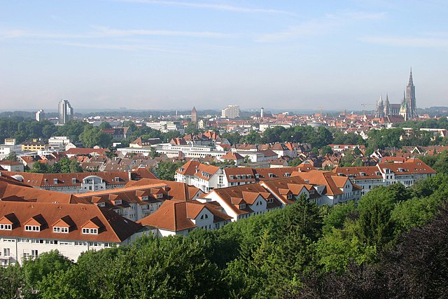

Ulm
- city in Baden-Württemberg
Ulm, located in the state of Baden-Württemberg in Germany, is not only rich in history and culture but also offers beautiful natural landscapes that are perfect for hiking enthusiasts. Here are some key points to consider when hiking in and around Ulm:...
- Country:

- Postal Code: 89079; 89077; 89075; 89073; 89081
- Local Dialing Code: 07305; 07346; 0731
- Licence Plate Code: UL
- Coordinates: 48° 23' 54" N, 9° 59' 30" E


- GPS tracks (wikiloc): [Link]
- AboveSeaLevel: 478 м m
- Area: 118.68 sq km
- Population: 123953
- Web site: [Link]


Reutlingen
- district of Baden-Württemberg, Germany
Reutlingen district, located in the southwest of Germany in the state of Baden-Württemberg, offers a variety of hiking experiences suitable for different skill levels, surrounded by beautiful landscapes, charming villages, and historical sites. Here are some highlights and tips for hiking in this area:...
- Country:

- Capital: Reutlingen
- Licence Plate Code: RT
- Coordinates: 48° 30' 0" N, 9° 12' 36" E


- GPS tracks (wikiloc): [Link]
- AboveSeaLevel: 661 м m
- Area: 1.09 sq km
- Population: 274691
- Web site: [Link]


Biberach district
- district in Baden-Württemberg, Germany
Biberach district, located in Baden-Württemberg, Germany, is an excellent destination for hikers, offering a blend of picturesque landscapes, cultural heritage, and diverse trails suitable for all skill levels....
- Country:

- Capital: Biberach an der Riss
- Licence Plate Code: BC
- Coordinates: 48° 4' 48" N, 9° 49' 48" E


- GPS tracks (wikiloc): [Link]
- AboveSeaLevel: 581 м m
- Area: 1409.82 sq km
- Population: 194019
- Web site: [Link]

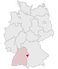
Heidenheim
- district in Baden-Württemberg, Germany
Heidenheim, located in Baden-Württemberg, Germany, is a region that offers a variety of hiking opportunities amidst beautiful landscapes, historical sites, and natural attractions. Here are some aspects to consider when hiking in Heidenheim and its surroundings:...
- Country:

- Licence Plate Code: HDH
- Coordinates: 48° 38' 24" N, 10° 7' 12" E


- GPS tracks (wikiloc): [Link]
- AboveSeaLevel: 599 м m
- Area: 627.13 sq km
- Population: 130527
- Web site: [Link]
Göppingen
- district in Baden-Württemberg, Germany
Göppingen district, located in the Baden-Württemberg region of Germany, is a fantastic area for hiking enthusiasts. The landscape is characterized by a mix of rolling hills, forests, and charming villages, making it an ideal destination for various levels of hikers....
- Country:

- Capital: Göppingen
- Licence Plate Code: GP
- Coordinates: 48° 42' 0" N, 9° 39' 0" E


- GPS tracks (wikiloc): [Link]
- AboveSeaLevel: 349 м m
- Area: 642.36 sq km
- Population: 252749
- Web site: [Link]
