
Gaeta (Gaeta)
.svg)
- Italian comune
 Hiking in Gaeta
Gaeta, located along the Tyrrhenian Sea in Italy's Lazio region, is a beautiful coastal town that offers stunning views, rich history, and excellent hiking opportunities. Here are some highlights regarding hiking in the Gaeta area:
Scenic Trails
-
Montagna Spaccata:
- This iconic site features dramatic cliffs and views over the Gulf of Gaeta. The name means "Split Mountain," and you can hike along trails that lead to breathtaking vantage points. The pathways are generally well-marked, and you can explore the natural landscape as well as historical sites like the Sanctuary of Montagna Spaccata.
-
Regional Park of Monte Orlando:
- This park provides several hiking trails with varying levels of difficulty. One popular route takes you to the summit of Monte Orlando, where you’ll be rewarded with panoramic views of the coastline and surrounding mountains. The park is also home to historical fortifications and diverse flora and fauna.
-
Via Francigena:
- Portions of this ancient pilgrimage route pass near Gaeta. You can hike segments of the trail, which offers both natural beauty and historical significance, connecting various towns in the region.
-
Cori and the Aurunci Mountains:
- A bit further from Gaeta, the Aurunci Mountains provide more challenging hikes with lush landscapes and rewarding vistas. The trails here often take you through dense forests, rocky terrain, and offer the chance to see local wildlife.
Hiking Considerations
-
Season: Spring (March to May) and fall (September to November) are ideal times to hike in Gaeta, offering mild weather. Summer can be hot, especially in exposed areas, while winter may bring cooler temperatures and occasional rain.
-
Preparation: Make sure to wear comfortable hiking shoes, carry plenty of water, and pack snacks. A map or GPS device is recommended, as some trails may not be clearly marked.
-
Cultural Sites: Combine your hikes with visits to local historical sites, like the medieval Gaeta Castle and the beautiful beaches along the coast.
Enjoying Nature and History
Hiking in Gaeta not only allows you to appreciate the stunning natural beauty of the region but also to engage with its rich history. Whether you're taking in the cliffs of Montagna Spaccata, exploring the trails of Monte Orlando, or walking along the ancient paths of the Via Francigena, there’s a wealth of experiences awaiting you in this picturesque part of Italy.
Always check local resources or visitor centers for updated trail information and safety tips before heading out. Happy hiking!
- Country:

- Postal Code: 04024
- Local Dialing Code: 0771
- Licence Plate Code: LT
- Coordinates: 41° 13' 0" N, 13° 34' 0" E


- GPS tracks (wikiloc): [Link]
- AboveSeaLevel: 2 м m
- Area: 29.2 sq km
- Population: 20545
- Web site: http://www.gaeta.it
- Wikipedia en: wiki(en)
- Wikipedia: wiki(it)
- Wikidata storage: Wikidata: Q128089
- Wikipedia Commons Gallery: [Link]
- Wikipedia Commons Category: [Link]
- Wikipedia Commons Maps Category: [Link]
- Freebase ID: [/m/022n6t]
- GeoNames ID: Alt: [6542094]
- VIAF ID: Alt: [305114781]
- OSM relation ID: [41173]
- archINFORM location ID: [933]
- Quora topic ID: [Gaeta]
- UN/LOCODE: [ITGAE]
- Encyclopædia Britannica Online ID: [place/Gaeta]
- Gran Enciclopèdia Catalana ID: [0028632]
- Facebook Places ID: [106090042763966]
- Digital Atlas of the Roman Empire ID: [41788]
- ISTAT ID: 059009
- Italian cadastre code: D843
Shares border with regions:


Formia
- Italian comune
Hiking in Formia
Formia, located on the Tyrrhenian coast of Italy in the Lazio region, is a beautiful destination for hiking enthusiasts. The area is known for its stunning coastal scenery, historical sites, and a variety of trails that cater to different skill levels. Here are some key points about hiking in Formia:...
- Country:
- Postal Code: 04023
- Local Dialing Code: 0771
- Licence Plate Code: LT
- Coordinates: 41° 15' 23" N, 13° 36' 25" E
- GPS tracks (wikiloc): [Link]
- AboveSeaLevel: 19 м m
- Area: 74.17 sq km
- Population: 38032
- Web site: [Link]
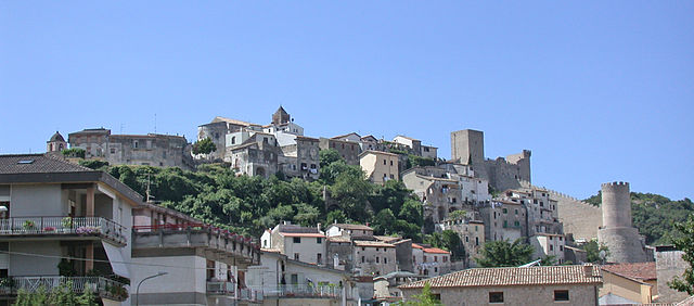

Itri
- Italian comune
Hiking in Itri
Itri, a charming town in the province of Latina in Italy, is surrounded by beautiful landscapes that make it a fantastic destination for hiking enthusiasts. Located near the Aurunci Mountains and close to the Tyrrhenian Sea, Itri offers a variety of trails that cater to different skill levels and preferences....
- Country:
- Postal Code: 04020
- Local Dialing Code: 0771
- Licence Plate Code: LT
- Coordinates: 41° 17' 0" N, 13° 32' 0" E
- GPS tracks (wikiloc): [Link]
- AboveSeaLevel: 170 м m
- Area: 101.1 sq km
- Population: 10761
- Web site: [Link]