.JPG)
Ganges (Ganges)

- commune in Hérault, France
- Country:

- Postal Code: 34190
- Coordinates: 43° 56' 3" N, 3° 42' 30" E


- GPS tracks (wikiloc): [Link]
- Area: 7.16 sq km
- Population: 3950
- Web site: http://www.ganges.fr
- Wikipedia en: wiki(en)
- Wikipedia: wiki(fr)
- Wikidata storage: Wikidata: Q734074
- Wikipedia Commons Category: [Link]
- Freebase ID: [/m/06fk4c]
- Freebase ID: [/m/06fk4c]
- Freebase ID: [/m/06fk4c]
- GeoNames ID: Alt: [3016714]
- GeoNames ID: Alt: [3016714]
- GeoNames ID: Alt: [3016714]
- SIREN number: [213401110]
- SIREN number: [213401110]
- SIREN number: [213401110]
- BnF ID: [15256712m]
- BnF ID: [15256712m]
- BnF ID: [15256712m]
- Library of Congress authority ID: Alt: [n89121312]
- Library of Congress authority ID: Alt: [n89121312]
- Library of Congress authority ID: Alt: [n89121312]
- WOEID: [592380]
- WOEID: [592380]
- WOEID: [592380]
- INSEE municipality code: 34111
- INSEE municipality code: 34111
- INSEE municipality code: 34111
Shares border with regions:


Cazilhac
- commune in Hérault, France
- Country:
- Postal Code: 34190
- Coordinates: 43° 55' 25" N, 3° 42' 6" E
- GPS tracks (wikiloc): [Link]
- Area: 11.69 sq km
- Population: 1493


Moulès-et-Baucels
- commune in Hérault, France
- Country:
- Postal Code: 34190
- Coordinates: 43° 56' 52" N, 3° 43' 58" E
- GPS tracks (wikiloc): [Link]
- Area: 22.78 sq km
- Population: 889
- Web site: [Link]

Saint-Julien-de-la-Nef
- commune in Gard, France
- Country:
- Postal Code: 30440
- Coordinates: 43° 57' 54" N, 3° 41' 18" E
- GPS tracks (wikiloc): [Link]
- Area: 8.83 sq km
- Population: 134


Sumène
- commune in Gard, France
- Country:
- Postal Code: 30440
- Coordinates: 43° 58' 51" N, 3° 42' 56" E
- GPS tracks (wikiloc): [Link]
- Area: 36.59 sq km
- Population: 1570
- Web site: [Link]

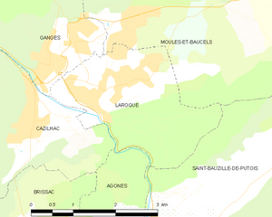
Laroque
- commune in Hérault, France
- Country:
- Postal Code: 34190
- Coordinates: 43° 55' 22" N, 3° 43' 28" E
- GPS tracks (wikiloc): [Link]
- Area: 6.63 sq km
- Population: 1610
- Web site: [Link]