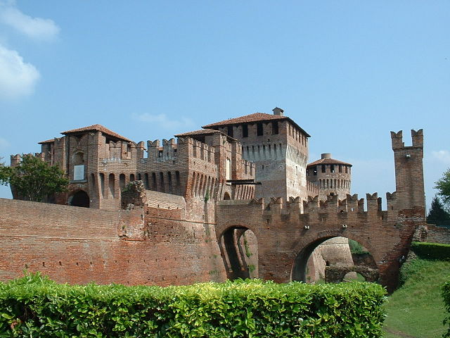
Genivolta (Genivolta)
.svg)
- Italian comune
 Hiking in Genivolta
Genivolta, located in Italy, is surrounded by beautiful landscapes ideal for hiking. The area boasts rolling hills, picturesque views, and various trails catering to different experience levels.
Key Trails and Features:
-
Variety of Trails: There are numerous paths to explore ranging from easy walks to more challenging hikes. Make sure to choose a trail that matches your fitness level.
-
Natural Beauty: The region is known for its stunning scenery, including forests, river valleys, and open meadows. Wildlife enthusiasts might also spot various local fauna and flora along the trails.
-
Cultural Significance: Many trails may lead to points of historical or cultural interest, such as old ruins, churches, or scenic overlooks that provide a glimpse into the local heritage.
-
Seasonal Considerations: Be mindful of seasonal changes that can affect trail conditions. Spring and fall are typically great times for hiking, with milder temperatures and beautiful natural displays.
Preparation Tips:
- Map and Information: It's advisable to carry a detailed map of the trails and information about the area. Local visitor centers can provide resources.
- Weather Check: Always check the weather forecast before heading out, as conditions can change rapidly.
- Pack Essentials: Bring sufficient water, snacks, a first aid kit, and suitable hiking gear. Good footwear is crucial due to varying terrain.
- Leave No Trace: Follow the principles of Leave No Trace to help preserve the natural beauty of the area.
Safety:
- Inform Someone: Always let someone know your hiking plans, including the trail you intend to take and your estimated return time.
- Buddy System: If possible, hike with a partner, especially on less traveled paths.
For a fulfilling hiking experience in Genivolta, immerse yourself in the natural beauty and remember to respect the environment!
- Country:

- Postal Code: 26020
- Local Dialing Code: 0374
- Licence Plate Code: CR
- Coordinates: 45° 20' 0" N, 9° 53' 0" E


- GPS tracks (wikiloc): [Link]
- AboveSeaLevel: 70 м m
- Area: 18.57 sq km
- Population: 1196
- Web site: http://www.comune.genivolta.gov.it
- Wikipedia en: wiki(en)
- Wikipedia: wiki(it)
- Wikidata storage: Wikidata: Q43058
- Wikipedia Commons Category: [Link]
- Freebase ID: [/m/0gjz0w]
- GeoNames ID: Alt: [6537213]
- VIAF ID: Alt: [244640284]
- OSM relation ID: [44701]
- MusicBrainz area ID: [4a6a4b30-c425-42bc-bb59-9c18d612a189]
- UN/LOCODE: [IT8CR]
- ISTAT ID: 019047
- Italian cadastre code: D966
Shares border with regions:
Villachiara
- Italian comune
Hiking in Villachiara
Villachiara is a small, picturesque area in Italy that offers various hiking opportunities, particularly for those seeking beautiful landscapes and a peaceful environment. While it's not as widely known as some of the more famous hiking destinations, it can be an excellent place for nature lovers and hikers looking for a more off-the-beaten-path experience....
- Country:
- Postal Code: 25030
- Local Dialing Code: 030
- Licence Plate Code: BS
- Coordinates: 45° 21' 0" N, 9° 56' 0" E
- GPS tracks (wikiloc): [Link]
- AboveSeaLevel: 75 м m
- Area: 16.87 sq km
- Population: 1416
- Web site: [Link]
Azzanello
- Italian comune
Hiking in Azzanello
Azzanello is a small town in the Lombardy region of Italy, situated near the banks of the Oglio River. While it may not be a widely recognized hiking destination, it offers opportunities for hiking and outdoor activities thanks to its picturesque natural surroundings and proximity to the river....
- Country:
- Postal Code: 26010
- Local Dialing Code: 0374
- Licence Plate Code: CR
- Coordinates: 45° 18' 47" N, 9° 55' 11" E
- GPS tracks (wikiloc): [Link]
- AboveSeaLevel: 68 м m
- Area: 11.12 sq km
- Population: 635
- Web site: [Link]


Cumignano sul Naviglio
- Italian comune
Hiking in Cumignano sul Naviglio
Cumignano sul Naviglio is a small town located in the Lombardy region of Italy, near the Naviglio River. While it may not be as famous for hiking as some other Italian destinations, it offers a peaceful environment with charming landscapes that can still provide a pleasant experience for nature lovers and hikers....
- Country:
- Postal Code: 26020
- Local Dialing Code: 0374
- Licence Plate Code: CR
- Coordinates: 45° 21' 0" N, 9° 50' 0" E
- GPS tracks (wikiloc): [Link]
- AboveSeaLevel: 73 м m
- Area: 6.77 sq km
- Population: 448
- Web site: [Link]
Casalmorano
- Italian comune
Hiking in Casalmorano
Casalmorano is a charming municipality in the province of Cremona, Lombardy, Italy. While it may not be as widely known as some of the larger hiking destinations, the surrounding areas provide opportunities for enjoyable hikes and outdoor activities....
- Country:
- Postal Code: 26020
- Local Dialing Code: 0374
- Licence Plate Code: CR
- Coordinates: 45° 17' 0" N, 9° 53' 0" E
- GPS tracks (wikiloc): [Link]
- AboveSeaLevel: 67 м m
- Area: 12.28 sq km
- Population: 1635
- Web site: [Link]


Soresina
- Italian comune
Hiking in Soresina
Soresina, located in the Lombardy region of Italy, is primarily known for its agricultural landscape and historical significance rather than traditional hiking trails. However, there are several options for enjoying the outdoors and exploring the surrounding areas....
- Country:
- Postal Code: 26015
- Local Dialing Code: 0374
- Licence Plate Code: CR
- Coordinates: 45° 17' 17" N, 9° 51' 31" E
- GPS tracks (wikiloc): [Link]
- AboveSeaLevel: 45 м m
- Area: 28.57 sq km
- Population: 8948
- Web site: [Link]

Soncino
- Italian comune
Hiking in Soncino
Soncino, located in the Lombardy region of northern Italy, is primarily known for its historical architecture, beautiful countryside, and the picturesque views of the surrounding areas. While it may not be as well-known as some of the more prominent hiking destinations in Lombardy, it does offer some opportunities for walking and hiking enthusiasts to explore the scenic landscapes....
- Country:
- Postal Code: 26029
- Local Dialing Code: 0374
- Licence Plate Code: CR
- Coordinates: 45° 24' 0" N, 9° 52' 0" E
- GPS tracks (wikiloc): [Link]
- AboveSeaLevel: 89 м m
- Area: 45.32 sq km
- Population: 7665
- Web site: [Link]