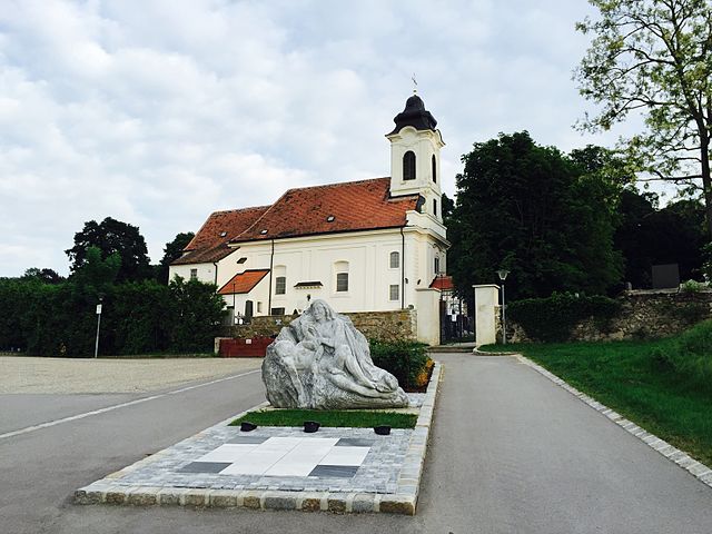
Gerasdorf bei Wien (Gerasdorf bei Wien)
- municipality in Austria
 Hiking in Gerasdorf bei Wien
Gerasdorf bei Wien is a small town located just north of Vienna, Austria. While it may not be as famous for hiking as larger national parks or mountainous areas, there are still some opportunities for outdoor enthusiasts to explore the natural surroundings.
Hiking Opportunities:
-
Nearby Natural Areas: The region around Gerasdorf offers several picturesque routes. The fields, forests, and small hills in the area can provide enjoyable hikes. Check local paths and trails that might lead into the Vienna Woods.
-
Danube River: The nearby Danube River offers scenic waterfront trails. You can explore areas along the riverbank which provide beautiful views and a relaxing atmosphere. A mix of walking paths and cycling routes can make for a pleasant day out.
-
Vienna Woods: Not far from Gerasdorf, the Vienna Woods (Wienerwald) is a vast forested area with numerous hiking trails, offering diverse landscapes and panoramas. It's a great option for day hikes and can be reached easily by public transport or car.
-
Local Parks: Within Gerasdorf, you might find parks and green spaces that are suitable for shorter walks and leisure hikes.
Preparation Tips:
- Weather Awareness: Always check the weather before going out for a hike, as conditions can change rapidly.
- Trail Maps: Consider getting local maps or using smartphone apps like Komoot or AllTrails to help you navigate the trails in the area.
- Proper Footwear: Wear appropriate hiking boots or shoes to ensure comfort and safety on variable terrain.
- Hydration: Bring enough water, especially for longer hikes, to stay hydrated.
- Local Regulations: Be aware of any local rules and guidelines, including respecting nature and wildlife.
Additional Suggestions:
- Public Transport: Gerasdorf is accessible via Vienna's public transport system, which can help you access more extensive hiking trails further in and around the Vienna Woods.
- Scenic Views: Look for viewpoints or lookout points in the nearby hills to enjoy the beautiful vistas of the surrounding landscapes.
While Gerasdorf might not be a major hiking destination, exploring the local nature and taking short hikes can be quite rewarding, especially if you enjoy quieter, less crowded areas close to Vienna. Happy hiking!
- Country:

- Postal Code: 2201
- Local Dialing Code: 02246
- Licence Plate Code: WU
- Coordinates: 48° 17' 42" N, 16° 28' 3" E


- GPS tracks (wikiloc): [Link]
- AboveSeaLevel: 165 м m
- Area: 35.26 sq km
- Population: 11155
- Web site: http://www.gerasdorf-wien.gv.at/
- Wikipedia en: wiki(en)
- Wikipedia: wiki(de)
- Wikidata storage: Wikidata: Q664293
- Wikipedia Commons Category: [Link]
- Freebase ID: [/m/03gsbcr]
- Freebase ID: [/m/03gsbcr]
- GeoNames ID: Alt: [2778690]
- GeoNames ID: Alt: [2778690]
- VIAF ID: Alt: [155158020]
- VIAF ID: Alt: [155158020]
- GND ID: Alt: [4527002-8]
- GND ID: Alt: [4527002-8]
- archINFORM location ID: [10092]
- archINFORM location ID: [10092]
- Austrian municipality key: [32404]
- Austrian municipality key: [32404]
Includes regions:
Kapellerfeld
- cadastral municipality of Gerasdorf bei Wien
Hiking in Kapellerfeld
Kapellerfeld, located in Lower Austria, is a charming region with a mix of rural landscapes and picturesque countryside, making it a delightful place for hiking enthusiasts. While it may not be as well-known as some of the larger hiking areas in Austria, it offers several scenic trails that are suitable for various skill levels....
- Country:
- Coordinates: 48° 18' 57" N, 16° 29' 51" E
- GPS tracks (wikiloc): [Link]
- Area: 800.98 sq km
Shares border with regions:


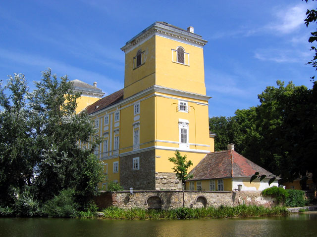
Großebersdorf
- municipality in Austria
Hiking in Großebersdorf
Großebersdorf is a small municipality in Austria, located northeast of Vienna. While it may not be as well-known as some of the more popular hiking destinations in the region, it offers potential for day hikes in a picturesque rural setting. Here are some points to consider for hiking in and around Großebersdorf:...
- Country:
- Postal Code: 2203
- Local Dialing Code: 02245
- Licence Plate Code: MI
- Coordinates: 48° 21' 44" N, 16° 28' 9" E
- GPS tracks (wikiloc): [Link]
- AboveSeaLevel: 193 м m
- Area: 18.03 sq km
- Population: 2236
- Web site: [Link]


Vienna
- capital and one of nine States of Austria
Hiking in Vienna
As a hiking instructor, I'd be happy to tell you about hiking opportunities in Vienna! While Vienna is primarily known for its rich history, art, and culture, it also offers beautiful natural spaces perfect for hiking. Here are some of the top spots:...
- Country:
- Postal Code: 1901; 1810; 1600–1601; 1502–1503; 1500; 1423; 1421; 1300–1301; 1251–1255; 1402; 1400; 1000–1239
- Local Dialing Code: 01
- Licence Plate Code: W
- Coordinates: 48° 12' 30" N, 16° 22' 23" E
- GPS tracks (wikiloc): [Link]
- AboveSeaLevel: 542 м m
- Area: 414.87 sq km
- Population: 1840573
- Web site: [Link]

Deutsch-Wagram
- municipality in Austria
Hiking in Deutsch-Wagram
Deutsch-Wagram is a charming town located in Lower Austria, just northeast of Vienna. While it may not be as widely known for hiking as some of the larger national parks or mountainous regions in Austria, there are still opportunities for hiking and enjoying the natural surroundings....
- Country:
- Postal Code: 2232
- Local Dialing Code: 02247
- Licence Plate Code: GF
- Coordinates: 48° 17' 58" N, 16° 33' 52" E
- GPS tracks (wikiloc): [Link]
- AboveSeaLevel: 159 м m
- Area: 30.61 sq km
- Population: 8651
- Web site: [Link]

Pillichsdorf
- municipality in Austria
Hiking in Pillichsdorf
Pillichsdorf is a small town located in Austria, nestled in the northeastern part of the country. While it may not be as widely known for hiking as some of the larger national parks or mountain areas in Austria, it offers some scenic trails and opportunities for outdoor enthusiasts to explore the beautiful countryside....
- Country:
- Postal Code: 2211
- Local Dialing Code: 02245
- Licence Plate Code: MI
- Coordinates: 48° 21' 47" N, 16° 32' 18" E
- GPS tracks (wikiloc): [Link]
- AboveSeaLevel: 167 м m
- Area: 14.33 sq km
- Population: 1157
- Web site: [Link]
Hagenbrunn
- municipality in Austria
Hiking in Hagenbrunn
Hagenbrunn is a picturesque area located in Austria, near the city of Vienna. It's a relatively quiet place, making it a perfect destination for hiking enthusiasts looking to escape the hustle and bustle of city life....
- Country:
- Postal Code: 2102
- Licence Plate Code: KO
- Coordinates: 48° 19' 59" N, 16° 24' 20" E
- GPS tracks (wikiloc): [Link]
- AboveSeaLevel: 216 м m
- Area: 13.49 sq km
- Population: 2227
- Web site: [Link]
Wolkersdorf im Weinviertel
- municipality in Austria
Hiking in Wolkersdorf im Weinviertel
Wolkersdorf im Weinviertel, located in the Lower Austria region, offers several charming hiking opportunities that showcase the beautiful landscapes of the Weinviertel wine region. Here are some key highlights and tips for hiking in this area:...
- Country:
- Postal Code: 2120
- Local Dialing Code: 02245
- Licence Plate Code: MI
- Coordinates: 48° 22' 0" N, 16° 31' 0" E
- GPS tracks (wikiloc): [Link]
- AboveSeaLevel: 178 м m
- Area: 44.38 sq km
- Population: 7201
- Web site: [Link]