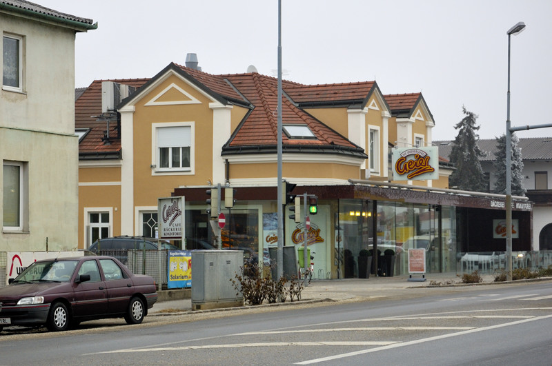
Deutsch-Wagram (Deutsch-Wagram)
- municipality in Austria
 Hiking in Deutsch-Wagram
Deutsch-Wagram is a charming town located in Lower Austria, just northeast of Vienna. While it may not be as widely known for hiking as some of the larger national parks or mountainous regions in Austria, there are still opportunities for hiking and enjoying the natural surroundings.
Hiking Opportunities:
-
Local Trails: The area around Deutsch-Wagram features several local walking and hiking trails. These walks often take you through scenic fields, forests, and along the banks of the nearby rivers.
-
Nearby Nature Parks: Not too far from Deutsch-Wagram, you can find regional nature parks like the Marchfeld Nature Park. These parks offer well-marked trails and the chance to see local flora and fauna.
-
Danube River: The nearby Danube River offers the possibility of hiking along the riverbanks. There are established walking paths that provide picturesque views and serene landscapes.
-
Cultural Walks: In addition to nature walks, consider exploring the cultural aspects of the area. Some trails may lead you to historical sites, vineyards, and charming villages, which can be incorporated into your hiking experience.
Tips for Hiking in Deutsch-Wagram:
- Know the Weather: Always check the weather forecast before heading out, as conditions can change quickly, especially in the spring and fall.
- Appropriate Gear: Wear comfortable walking shoes and dress in layers. The terrain can vary, and proper footwear is essential.
- Stay Hydrated: Bring enough water with you, especially on warmer days.
- Trail Maps: It’s a good idea to have a local hiking map or a GPS app on your phone. While many trails are marked, having a map can help ensure you stay on track.
- Wildlife Awareness: While exploring, be aware of local wildlife. Respect their habitats and maintain a safe distance.
Accessibility:
Since Deutsch-Wagram is close to Vienna, it's easily accessible via public transport, making it an excellent destination for a day hike if you're staying in the capital.
Overall, while Deutsch-Wagram may not offer extensive hiking options like some of Austria's mountainous regions, it provides lovely walking opportunities and a chance to enjoy the beautiful Lower Austrian countryside.
- Country:

- Postal Code: 2232
- Local Dialing Code: 02247
- Licence Plate Code: GF
- Coordinates: 48° 17' 58" N, 16° 33' 52" E


- GPS tracks (wikiloc): [Link]
- AboveSeaLevel: 159 м m
- Area: 30.61 sq km
- Population: 8651
- Web site: http://www.deutsch-wagram.gv.at
- Wikipedia en: wiki(en)
- Wikipedia: wiki(de)
- Wikidata storage: Wikidata: Q660921
- Wikipedia Commons Category: [Link]
- Freebase ID: [/m/08kn2p]
- GeoNames ID: Alt: [2781017]
- VIAF ID: Alt: [135067158]
- GND ID: Alt: [4094903-5]
- archINFORM location ID: [11136]
- Library of Congress authority ID: Alt: [n2003031612]
- MusicBrainz area ID: [a36f2678-beee-4681-bb0f-6de55bcf4dbb]
- WOEID: [541332]
- TGN ID: [7003179]
- Austrian municipality key: [30808]
Includes regions:
Stallingerfeld
- cadastral municipality of Deutsch-Wagram
Hiking in Stallingerfeld
Stallingerfeld is a beautiful area for hiking, offering stunning landscapes, diverse terrain, and various trails suitable for different skill levels. Nestled in the Austrian region, it typically features charming alpine meadows, thick woodlands, and scenic mountain views....
- Country:
- Coordinates: 48° 18' 3" N, 16° 31' 25" E
- GPS tracks (wikiloc): [Link]
- Area: 748.31 sq km
Shares border with regions:


Vienna
- capital and one of nine States of Austria
Hiking in Vienna
As a hiking instructor, I'd be happy to tell you about hiking opportunities in Vienna! While Vienna is primarily known for its rich history, art, and culture, it also offers beautiful natural spaces perfect for hiking. Here are some of the top spots:...
- Country:
- Postal Code: 1901; 1810; 1600–1601; 1502–1503; 1500; 1423; 1421; 1300–1301; 1251–1255; 1402; 1400; 1000–1239
- Local Dialing Code: 01
- Licence Plate Code: W
- Coordinates: 48° 12' 30" N, 16° 22' 23" E
- GPS tracks (wikiloc): [Link]
- AboveSeaLevel: 542 м m
- Area: 414.87 sq km
- Population: 1840573
- Web site: [Link]

Aderklaa
- municipality in Austria
Hiking in Aderklaa
Aderklaa is a small municipality located near Vienna, Austria. While it's not as widely known for hiking as some of the larger national parks or mountain ranges in the region, it can still offer some pleasant walking and hiking opportunities, especially for those looking to explore the picturesque countryside and local trails....
- Country:
- Postal Code: 2232
- Local Dialing Code: 02247
- Licence Plate Code: GF
- Coordinates: 48° 17' 6" N, 16° 32' 13" E
- GPS tracks (wikiloc): [Link]
- AboveSeaLevel: 157 м m
- Area: 8.62 sq km
- Population: 207

Gerasdorf bei Wien
- municipality in Austria
Hiking in Gerasdorf bei Wien
Gerasdorf bei Wien is a small town located just north of Vienna, Austria. While it may not be as famous for hiking as larger national parks or mountainous areas, there are still some opportunities for outdoor enthusiasts to explore the natural surroundings....
- Country:
- Postal Code: 2201
- Local Dialing Code: 02246
- Licence Plate Code: WU
- Coordinates: 48° 17' 42" N, 16° 28' 3" E
- GPS tracks (wikiloc): [Link]
- AboveSeaLevel: 165 м m
- Area: 35.26 sq km
- Population: 11155
- Web site: [Link]

Pillichsdorf
- municipality in Austria
Hiking in Pillichsdorf
Pillichsdorf is a small town located in Austria, nestled in the northeastern part of the country. While it may not be as widely known for hiking as some of the larger national parks or mountain areas in Austria, it offers some scenic trails and opportunities for outdoor enthusiasts to explore the beautiful countryside....
- Country:
- Postal Code: 2211
- Local Dialing Code: 02245
- Licence Plate Code: MI
- Coordinates: 48° 21' 47" N, 16° 32' 18" E
- GPS tracks (wikiloc): [Link]
- AboveSeaLevel: 167 м m
- Area: 14.33 sq km
- Population: 1157
- Web site: [Link]

Groß-Engersdorf
- municipality in Austria
Hiking in Groß-Engersdorf
Groß-Engersdorf, located in Lower Austria, near the borders of Vienna, offers several hiking opportunities that cater to different skill levels and preferences. Here are some highlights about hiking in and around this area:...
- Country:
- Postal Code: 2212
- Local Dialing Code: 02245
- Licence Plate Code: MI
- Coordinates: 48° 21' 0" N, 16° 34' 0" E
- GPS tracks (wikiloc): [Link]
- AboveSeaLevel: 164 м m
- Area: 15.57 sq km
- Population: 1478
- Web site: [Link]
Strasshof an der Nordbahn
- municipality in Austria
Hiking in Strasshof an der Nordbahn
Strasshof an der Nordbahn is a small town located north of Vienna, Austria, and while it may not be as famous as other hiking destinations, there is still potential for enjoyable outdoor activities in the surrounding areas....
- Country:
- Postal Code: 2231
- Local Dialing Code: 02587
- Licence Plate Code: GF
- Coordinates: 48° 19' 10" N, 16° 38' 51" E
- GPS tracks (wikiloc): [Link]
- AboveSeaLevel: 165 м m
- Area: 11.63 sq km
- Population: 10009
- Web site: [Link]

Bockfließ
- municipality in Austria
Hiking in Bockfließ
Bockfließ is a charming village located in the Lower Austria region of Austria, known for its picturesque landscapes and tranquil environment, making it a great destination for hiking enthusiasts. While it may not be as widely known as some of Austria’s more mountainous areas, it offers several opportunities for nature lovers to explore the surrounding countryside....
- Country:
- Postal Code: 2213
- Local Dialing Code: 02288
- Licence Plate Code: MI
- Coordinates: 48° 21' 0" N, 16° 36' 0" E
- GPS tracks (wikiloc): [Link]
- AboveSeaLevel: 168 м m
- Area: 22.87 sq km
- Population: 1348
- Web site: [Link]

Parbasdorf
- municipality in Austria
Hiking in Parbasdorf
Parbasdorf is a small locality located near Vienna in Austria, primarily known for its residential areas and proximity to larger green spaces and the Vienna Woods. While it may not be a major hiking destination itself, it serves as a good starting point for exploring nearby natural areas....
- Country:
- Postal Code: 2232
- Local Dialing Code: 02247
- Licence Plate Code: GF
- Coordinates: 48° 16' 44" N, 16° 35' 22" E
- GPS tracks (wikiloc): [Link]
- AboveSeaLevel: 156 м m
- Area: 10.23 sq km
- Population: 169
- Web site: [Link]

Markgrafneusiedl
- municipality in Austria
Hiking in Markgrafneusiedl
Markgrafneusiedl, a small village in Austria situated in the Burgenland region, offers a unique and enjoyable setting for hiking enthusiasts, especially those looking for a rural and tranquil experience. The region is characterized by its scenic landscapes, including rolling hills, expansive fields, and proximity to the Neusiedler See, which is a UNESCO World Heritage Site....
- Country:
- Postal Code: 2282
- Local Dialing Code: 0 22 48
- Licence Plate Code: GF
- Coordinates: 48° 16' 1" N, 16° 37' 55" E
- GPS tracks (wikiloc): [Link]
- AboveSeaLevel: 154 м m
- Area: 19.82 sq km
- Population: 832
- Web site: [Link]


Raasdorf
- municipality in Austria
Hiking in Raasdorf
Raasdorf is a charming small village located in Austria, near the border with Slovakia, and close to the capital city of Vienna. While it's not a major hiking destination on its own, the surrounding area offers some attractive opportunities for outdoor enthusiasts....
- Country:
- Postal Code: 2281
- Local Dialing Code: 0 2249
- Licence Plate Code: GF
- Coordinates: 48° 14' 48" N, 16° 33' 52" E
- GPS tracks (wikiloc): [Link]
- AboveSeaLevel: 156 м m
- Area: 13.21 sq km
- Population: 645
- Web site: [Link]