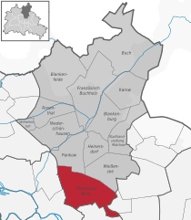
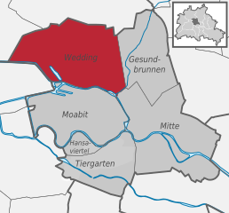
Gesundbrunnen (Gesundbrunnen)

- locality of Berlin
 Hiking in Gesundbrunnen
Gesundbrunnen is a neighborhood in Berlin, known more for its urban environment than traditional hiking trails. However, there are options for those looking to enjoy the outdoors and some nature walks in and around the area. Here are a few recommendations:
-
Parks and Green Spaces: While not hiking in the traditional sense, parks like the Volkspark Humboldthain offer a nice place to explore on foot. The park features trails, a rose garden, and some hills that afford views of the city skyline.
-
Nordbahnhof Park: Another urban green space, Nordbahnhof Park is a smaller area but offers walking paths and places to relax. It’s a good spot for a leisurely stroll.
-
Walking Along the Panke River: The Panke River flows through the district, and you can enjoy a walk along its banks. The paths alongside the river are pleasant, though they are not rugged trails. This route can lead you toward larger parks and green spaces in other parts of Berlin.
-
Explore Surrounding Areas: If you're looking for more traditional hiking experiences, consider venturing out to larger parks and forests in Berlin, like the Tiergarten or the Grunewald. These areas have well-marked trails and a more natural environment.
-
Public Transportation: Utilize Berlin’s excellent public transportation network to access more distant hiking spots if you want a full day of hiking. Areas like the Spreewald or the Müritz National Park can be reached with a train or bus.
While Gesundbrunnen may not offer extensive hiking opportunities within the neighborhood, it provides access to various outdoor experiences in the vicinity and serves as a good starting point for exploring the natural beauty in and around Berlin. Always remember to wear appropriate footwear, carry enough water, and check local resources for any updates on trail conditions or park accessibility!
- Country:

- Postal Code: 13409; 13359; 13357; 13355; 13353; 13347
- Coordinates: 52° 32' 55" N, 13° 23' 25" E


- GPS tracks (wikiloc): [Link]
- AboveSeaLevel: 53 м m
- Area: 6.13 sq km
- Population: 90748
- Wikipedia en: wiki(en)
- Wikipedia: wiki(de)
- Wikidata storage: Wikidata: Q644350
- Wikipedia Commons Gallery: [Link]
- Wikipedia Commons Category: [Link]
- Wikipedia Commons Maps Category: [Link]
- Freebase ID: [/m/05zvpc1]
- GeoNames ID: Alt: [2920789]
- VIAF ID: Alt: [236152336]
- GND ID: Alt: [7595184-8]
- archINFORM location ID: [43334]
Shares border with regions:


Mitte
- locality in the borough of Mitte, Berlin, Germany
Hiking in Mitte
Mitte is the central borough of Berlin, Germany, and while it is primarily an urban area known for its historical sites, museums, and vibrant culture, there are still opportunities for outdoor activities, including hiking, especially if you're willing to explore nearby green spaces and parks....
- Country:
- Postal Code: 10179; 10178; 10119; 10117; 10115
- Licence Plate Code: B
- Coordinates: 52° 31' 10" N, 13° 24' 24" E
- GPS tracks (wikiloc): [Link]
- AboveSeaLevel: 48 м m
- Area: 10.69 sq km
- Population: 89757

Prenzlauer Berg
- locality of Berlin
Hiking in Prenzlauer Berg
Prenzlauer Berg, a vibrant district in Berlin, is primarily known for its urban environment, charming architecture, and lively atmosphere rather than traditional hiking trails. However, there are plenty of opportunities for enjoyable walks and exploration in this area. Here are some aspects to consider if you're looking to hike or walk in Prenzlauer Berg:...
- Country:
- Coordinates: 52° 32' 3" N, 13° 25' 7" E
- GPS tracks (wikiloc): [Link]
- AboveSeaLevel: 54 м m
- Area: 11 sq km
- Population: 156910


Pankow
- locality of the borough Pankow of Berlin
Hiking in Pankow
Pankow is a district in northeastern Berlin, Germany, known for its charming neighborhoods, parks, and green areas. While it is more urban compared to rural hiking destinations, there are still opportunities for enjoyable walks and hikes within and around the area....
- Country:
- Coordinates: 52° 34' 0" N, 13° 24' 0" E
- GPS tracks (wikiloc): [Link]
- AboveSeaLevel: 47 м m
- Area: 5.66 sq km
- Population: 57113

Wedding
- locality in the borough of Mitte, Berlin, Germany
Hiking in Wedding
Hiking in Wedding, a district in the borough of Mitte, Berlin, might not be the first thing that comes to mind when you think of hiking, as it is primarily an urban area. However, there are several parks and green spaces within and around Wedding where you can enjoy short hikes or leisurely walks....
- Country:
- Postal Code: 13407; 13359; 13357; 13353; 13351; 13349; 13347
- Coordinates: 52° 33' 0" N, 13° 22' 0" E
- GPS tracks (wikiloc): [Link]
- AboveSeaLevel: 41 м m
- Area: 9.23 sq km
- Population: 83612


Reinickendorf
- locality of the borough Reinickendorf of Berlin
Hiking in Reinickendorf
Reinickendorf is a district located in the northern part of Berlin, Germany. While it's primarily an urban area, it offers several opportunities for hiking and outdoor activities, particularly in its parks and natural reserves....
- Country:
- Postal Code: 13409; 13407; 13403
- Coordinates: 52° 34' 0" N, 13° 20' 0" E
- GPS tracks (wikiloc): [Link]
- AboveSeaLevel: 42 м m
- Area: 10.5 sq km
- Population: 80687