
Prenzlauer Berg (Prenzlauer Berg)

- locality of Berlin
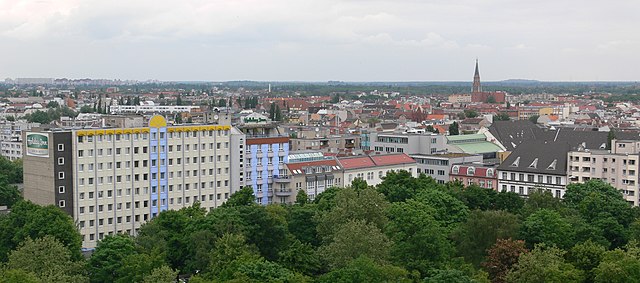
 Hiking in Prenzlauer Berg
Prenzlauer Berg, a vibrant district in Berlin, is primarily known for its urban environment, charming architecture, and lively atmosphere rather than traditional hiking trails. However, there are plenty of opportunities for enjoyable walks and exploration in this area. Here are some aspects to consider if you're looking to hike or walk in Prenzlauer Berg:
1. :
- Mauerpark: A popular park that was once part of the Berlin Wall. It’s a great place for a leisurely stroll, especially on Sundays when the flea market is in full swing.
- Friedrichshain Park: Close by, this park also offers great walking routes and is perfect for a more extended visit to enjoy nature.
2. :
- Prenzlauer Berg is rich in history, especially related to the GDR (East Germany). You can choose to walk through the former neighborhoods and explore historical landmarks, such as the old synagogue and the lively Kollwitzplatz.
3. :
- Consider joining a guided walking tour that focuses on the architecture and culture of Prenzlauer Berg. Many local guides offer themed tours that highlight the area’s unique charm, including its many cafés, shops, and galleries.
4. :
- The district is renowned for its vibrant street art scene. A walking tour focusing on murals and graffiti can be an exciting way to engage with the local culture. Many pieces are located in easy walking distance from each other.
5. :
- While Prenzlauer Berg itself doesn't offer traditional hiking trails, it connects to other districts through walking paths. Consider walking to nearby areas such as Friedrichshain or Mitte for a longer urban trek.
6. :
- Prenzlauer Berg is very accessible by public transport, making it easy to start your walking explorations from various points in the city.
Hiking Tips for Urban Walking:
- Comfortable Shoes: Wear sturdy walking shoes, especially if you plan to explore cobblestone streets or park trails.
- Stay Hydrated: Carry a water bottle, especially during warmer months.
- Explore Local Cafés: Take breaks in the many charming cafés along your route to really experience the local culture.
- Plan Your Route: Use a map or navigation app to help guide your exploration.
In summary, while Prenzlauer Berg doesn’t have hiking trails in the traditional sense, it's a fantastic place for walking and exploring urban nature and history. Enjoy your time discovering this unique slice of Berlin!
- Country:

- Coordinates: 52° 32' 3" N, 13° 25' 7" E


- GPS tracks (wikiloc): [Link]
- AboveSeaLevel: 54 м m
- Area: 11 sq km
- Population: 156910
- Wikipedia en: wiki(en)
- Wikipedia: wiki(de)
- Wikidata storage: Wikidata: Q313186
- Wikipedia Commons Gallery: [Link]
- Wikipedia Commons Category: [Link]
- Wikipedia Commons Maps Category: [Link]
- Freebase ID: [/m/02q42d]
- GeoNames ID: Alt: [2852217]
- BnF ID: [135116116]
- VIAF ID: Alt: [144854874]
- GND ID: Alt: [4194738-1]
- archINFORM location ID: [3422]
- Library of Congress authority ID: Alt: [n92096125]
- TGN ID: [1005372]
Shares border with regions:


Mitte
- locality in the borough of Mitte, Berlin, Germany
Hiking in Mitte
Mitte is the central borough of Berlin, Germany, and while it is primarily an urban area known for its historical sites, museums, and vibrant culture, there are still opportunities for outdoor activities, including hiking, especially if you're willing to explore nearby green spaces and parks....
- Country:
- Postal Code: 10179; 10178; 10119; 10117; 10115
- Licence Plate Code: B
- Coordinates: 52° 31' 10" N, 13° 24' 24" E
- GPS tracks (wikiloc): [Link]
- AboveSeaLevel: 48 м m
- Area: 10.69 sq km
- Population: 89757


Friedrichshain
- locality of Berlin
Hiking in Friedrichshain
Friedrichshain is a vibrant neighborhood in Berlin, Germany, known more for its urban atmosphere, parks, and nightlife than for traditional hiking trails. However, there are still plenty of opportunities for walking and enjoying the outdoors in this area....
- Country:
- Postal Code: 10317; 10179; 10178; 10249; 10247; 10245; 10243
- Coordinates: 52° 30' 57" N, 13° 27' 15" E
- GPS tracks (wikiloc): [Link]
- AboveSeaLevel: 41 м m
- Area: 9.78 sq km
- Population: 125169


Pankow
- locality of the borough Pankow of Berlin
Hiking in Pankow
Pankow is a district in northeastern Berlin, Germany, known for its charming neighborhoods, parks, and green areas. While it is more urban compared to rural hiking destinations, there are still opportunities for enjoyable walks and hikes within and around the area....
- Country:
- Coordinates: 52° 34' 0" N, 13° 24' 0" E
- GPS tracks (wikiloc): [Link]
- AboveSeaLevel: 47 м m
- Area: 5.66 sq km
- Population: 57113


Fennpfuhl
- locality of Berlin
Hiking in Fennpfuhl
Fennpfuhl is a neighborhood in Berlin, Germany, known more for urban exploration than traditional hiking. However, if you're looking for green spaces or walking routes, there are some nearby parks and pathways that can provide a nice urban escape....
- Country:
- Coordinates: 52° 31' 42" N, 13° 28' 27" E
- GPS tracks (wikiloc): [Link]
- AboveSeaLevel: 64 м m
- Area: 2.12 sq km

Gesundbrunnen
- locality of Berlin
Hiking in Gesundbrunnen
Gesundbrunnen is a neighborhood in Berlin, known more for its urban environment than traditional hiking trails. However, there are options for those looking to enjoy the outdoors and some nature walks in and around the area. Here are a few recommendations:...
- Country:
- Postal Code: 13409; 13359; 13357; 13355; 13353; 13347
- Coordinates: 52° 32' 55" N, 13° 23' 25" E
- GPS tracks (wikiloc): [Link]
- AboveSeaLevel: 53 м m
- Area: 6.13 sq km
- Population: 90748


Weissensee
- locality of Berlin
Hiking in Weissensee
Weissensee is a district in the northeastern part of Berlin, known for its large lake, Weissensee, which is a popular destination for both locals and tourists looking to enjoy nature and outdoor activities. While Weissensee is not traditionally associated with extensive hiking trails like some of the larger natural parks or forested areas, it offers some lovely spots for walking and enjoying the outdoors....
- Country:
- Coordinates: 52° 33' 0" N, 13° 28' 0" E
- GPS tracks (wikiloc): [Link]
- AboveSeaLevel: 53 м m
- Area: 7.93 sq km
- Population: 51699
- Web site: [Link]


Lichtenberg
- locality of borough Lichtenberg of Berlin, Germany
Hiking in Lichtenberg
Lichtenberg is a picturesque locality located in the region of Brandenburg, Germany. It is situated near the capital city, Berlin, making it a popular destination for day-trippers and hikers looking to escape the urban environment....
- Country:
- Coordinates: 52° 31' 16" N, 13° 28' 48" E
- GPS tracks (wikiloc): [Link]
- AboveSeaLevel: 52 м m
- Area: 7.22 sq km
- Population: 39121