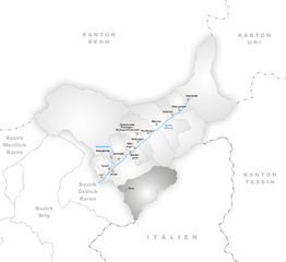
Goms District (Bezirk Goms)

- district of the canton of Valais, Switzerland
 Hiking in Goms District
Goms District, located in the Valais region of Switzerland, is a stunning destination for hiking enthusiasts. Known for its picturesque landscapes, charming villages, and rich cultural heritage, Goms offers a variety of hiking trails suited for different skill levels.
Highlights of Hiking in Goms District:
-
Scenic Trails: The region features a diverse range of trails, from easy walks along the Rhone River to challenging mountain hikes. Popular routes include the historical "Hiking Trail of the Old Path" that takes you through traditional villages and offers breathtaking views of the surrounding mountains.
-
Aletsch Glacier: A UNESCO World Heritage Site, the Aletsch Glacier is the largest glacier in the Alps. Trails leading to viewpoints of this majestic glacier provide some of the most spectacular panoramas in the region.
-
Cultural Experiences: Hiking in Goms also allows you to experience the local culture. Many trails pass through traditional Swiss villages where you can sample local cuisine and interact with the friendly residents.
-
Wildlife Watching: The Goms District is home to diverse wildlife. Keep an eye out for ibex, chamois, and various bird species as you hike through the alpine meadows and forests.
-
Accessibility: The Goms region is accessible by public transport, which makes it easy for hikers to reach different trailheads. The scenic train ride along the Rhone adds to the overall experience.
-
Well-Marked Trails: The hiking trails in Goms are well-marked and maintained, making it easy for hikers to navigate. Additionally, you can find maps and information at local tourist offices.
-
Seasonal Activities: Each season offers a different hiking experience—from colorful wildflowers in the summer to stunning autumn foliage. Winter hiking and snowshoeing are also popular activities in the colder months.
Tips for Hiking in Goms:
- Gear Up: Wear sturdy hiking boots and dress in layers to adapt to the changing weather conditions.
- Stay Hydrated: Carry enough water and snacks, especially on longer hikes.
- Respect Nature: Follow the Leave No Trace principles to preserve the beauty of the landscape.
- Check Conditions: Always check trail and weather conditions before heading out for a hike.
Goms District provides a unique combination of natural beauty and Swiss charm, making it a fantastic destination for hikers of all levels. Whether you're seeking tranquility in nature or adventure on rugged trails, Goms has something to offer.
- Country:

- Capital: Münster-Geschinen
- Licence Plate Code: VS
- Coordinates: 46° 27' 0" N, 8° 18' 0" E


- GPS tracks (wikiloc): [Link]
- AboveSeaLevel: 1407 м m
- Area: 588.3 sq km
- Wikipedia en: wiki(en)
- Wikipedia: wiki(de)
- Wikidata storage: Wikidata: Q660663
- Wikipedia Commons Category: [Link]
- Freebase ID: [/m/0286qq8]
- GeoNames ID: Alt: [6458766]
- GND ID: Alt: [4021592-1]
- archINFORM location ID: [45089]
- HDS ID: [12443]
- BabelNet ID: [03833706n]
Includes regions:


Reckingen-Gluringen
- municipality in Switzerland
Hiking in Reckingen-Gluringen
Reckingen-Gluringen is a charming village located in the Upper Valais region of Switzerland, nestled in the beautiful landscapes of the Swiss Alps. Hiking opportunities in this area are abundant, offering a variety of trails that cater to different skill levels and interests....
- Country:
- Postal Code: 3998
- Local Dialing Code: 027
- Licence Plate Code: VS
- Coordinates: 46° 28' 0" N, 8° 14' 0" E
- GPS tracks (wikiloc): [Link]
- AboveSeaLevel: 1326 м m
- Area: 41.2 sq km
- Web site: [Link]


Fiesch
- municipality in Switzerland
Hiking in Fiesch
Fiesch is a beautiful village located in the Aletsch region of the Swiss Alps, known for its stunning landscapes, access to the Aletsch Glacier, and a variety of hiking trails suited for different skill levels. Here are some highlights and tips for hiking in Fiesch:...
- Country:
- Postal Code: 3984
- Local Dialing Code: 027
- Licence Plate Code: VS
- Coordinates: 46° 24' 0" N, 8° 8' 0" E
- GPS tracks (wikiloc): [Link]
- AboveSeaLevel: 1049 м m
- Area: 11.26 sq km
- Population: 918
- Web site: [Link]


Bellwald
- municipality in Switzerland
Hiking in Bellwald
Bellwald is a picturesque village located in the Swiss Alps, offering stunning landscapes and a range of hiking opportunities. Here are some highlights and tips for hiking in and around Bellwald:...
- Country:
- Postal Code: 3997
- Local Dialing Code: 027
- Licence Plate Code: VS
- Coordinates: 46° 26' 0" N, 8° 9' 0" E
- GPS tracks (wikiloc): [Link]
- AboveSeaLevel: 1564 м m
- Area: 13.7 sq km
- Population: 389
- Web site: [Link]

Binn
- municipality in Switzerland
Hiking in Binn
Binn is a small village located in the picturesque Val Binn in the Swiss Alps, specifically in the Canton of Valais. It’s known for its stunning natural beauty and is a great spot for hiking enthusiasts. Here’s what you should know about hiking in Binn:...
- Country:
- Postal Code: 3996
- Local Dialing Code: 027
- Licence Plate Code: VS
- Coordinates: 46° 22' 0" N, 8° 11' 0" E
- GPS tracks (wikiloc): [Link]
- AboveSeaLevel: 1400 м m
- Area: 65.0 sq km
- Population: 140
- Web site: [Link]


Grafschaft
- municipality in Switzerland
Hiking in Grafschaft
Grafschaft is a captivating area in the Swiss region of Cantonal Valais, known for its stunning landscapes, serene valleys, and picturesque mountain views. Hiking in Grafschaft offers a range of trails that cater to different skill levels, so it's an excellent destination for both beginners and experienced hikers....
- Country:
- Postal Code: 3989
- Local Dialing Code: 027
- Licence Plate Code: VS
- Coordinates: 46° 27' 0" N, 8° 13' 0" E
- GPS tracks (wikiloc): [Link]
- AboveSeaLevel: 1312 м m
- Area: 22.6 sq km
- Web site: [Link]


Münster-Geschinen
- municipality in Switzerland
Hiking in Münster-Geschinen
Münster-Geschinen is a beautiful area located in the Swiss Alps, specifically in the Valais region, renowned for its stunning landscapes and excellent hiking opportunities. Here are some key points to consider when planning a hiking trip in this region:...
- Country:
- Postal Code: 3985
- Local Dialing Code: 027
- Licence Plate Code: VS
- Coordinates: 46° 29' 0" N, 8° 15' 0" E
- GPS tracks (wikiloc): [Link]
- AboveSeaLevel: 1370 м m
- Area: 48.7 sq km
- Web site: [Link]


Blitzingen
- municipality in Switzerland
Hiking in Blitzingen
Blitzingen is a charming village located in the Swiss Alps, specifically in the canton of Valais, and it’s surrounded by stunning landscapes, making it a great destination for hiking enthusiasts. Here are some highlights and tips for hiking in and around Blitzingen:...
- Country:
- Postal Code: 3989
- Local Dialing Code: 027
- Licence Plate Code: VS
- Coordinates: 46° 26' 0" N, 8° 12' 0" E
- GPS tracks (wikiloc): [Link]
- AboveSeaLevel: 1290 м m
- Area: 11.8 sq km
- Web site: [Link]
Ernen
- municipality in Switzerland
Hiking in Ernen
Ernen is a picturesque village located in the Valais region of Switzerland, surrounded by stunning alpine landscapes. It is known for its beautiful hiking trails that cater to all skill levels, offering hikers a chance to immerse themselves in nature and enjoy breathtaking views of the Swiss Alps....
- Country:
- Postal Code: 3995
- Local Dialing Code: 027
- Licence Plate Code: VS
- Coordinates: 46° 24' 0" N, 8° 9' 0" E
- GPS tracks (wikiloc): [Link]
- AboveSeaLevel: 1200 м m
- Area: 35.4 sq km
- Population: 501
- Web site: [Link]


Niederwald
- municipality in Switzerland
Hiking in Niederwald
Niederwald is a picturesque area located in the Swiss Alps, known for its stunning landscapes, lush greenery, and breathtaking mountain views. Hiking in Niederwald offers a fantastic experience for both beginners and experienced trekkers due to its diverse trails and scenic routes....
- Country:
- Postal Code: 3989
- Local Dialing Code: 027
- Licence Plate Code: VS
- Coordinates: 46° 26' 0" N, 8° 11' 0" E
- GPS tracks (wikiloc): [Link]
- AboveSeaLevel: 1682 м m
- Area: 4.7 sq km


Lax
- municipality in Switzerland
Hiking in Lax
Lax, Switzerland, is a beautiful village located in the Valais region, renowned for its stunning alpine scenery and numerous hiking opportunities. Here are some key points about hiking in and around Lax:...
- Country:
- Postal Code: 3994
- Local Dialing Code: 027
- Licence Plate Code: VS
- Coordinates: 46° 23' 0" N, 8° 7' 0" E
- GPS tracks (wikiloc): [Link]
- AboveSeaLevel: 1045 м m
- Area: 5.02 sq km
- Population: 308
- Web site: [Link]

Obergoms
- municipality in Switzerland
Hiking in Obergoms
Obergoms is a beautiful region located in the Valais (Wallis) canton of Switzerland, known for its stunning landscapes, alpine scenery, and extensive hiking trails. The area offers a variety of hiking opportunities suitable for all skill levels, from leisurely walks to more challenging treks....
- Country:
- Postal Code: 3988, 3999
- Local Dialing Code: 027
- Licence Plate Code: VS
- Coordinates: 46° 32' 0" N, 8° 21' 0" E
- GPS tracks (wikiloc): [Link]
- AboveSeaLevel: 1377 м m
- Area: 155.60 sq km
- Population: 662
- Web site: [Link]


Fieschertal
- municipality in Switzerland
Hiking in Fieschertal
Fieschertal, located in the Swiss Alps in the municipality of Fiesch, is a picturesque destination for hiking enthusiasts. The region is renowned for its stunning landscapes, lush valleys, and breathtaking mountain views, making it an excellent choice for hikers of all levels....
- Country:
- Postal Code: 3984
- Local Dialing Code: 027
- Licence Plate Code: VS
- Coordinates: 46° 30' 0" N, 8° 8' 0" E
- GPS tracks (wikiloc): [Link]
- AboveSeaLevel: 1108 м m
- Area: 172.96 sq km
- Population: 334
- Web site: [Link]
Shares border with regions:


Östlich Raron District
- district of the canton of Valais, Switzerland
Hiking in Östlich Raron District
Östlich Raron, located in the Valais region of Switzerland, offers a unique and beautiful hiking experience characterized by stunning alpine scenery, diverse landscapes, and a variety of trails suitable for different skill levels. Here are some highlights and tips for hiking in this area:...
- Country:
- Capital: Mörel-Filet
- Licence Plate Code: VS
- Coordinates: 46° 20' 0" N, 8° 3' 1" E
- GPS tracks (wikiloc): [Link]
- Area: 127.2 sq km


Brig District
- district of the canton of Valais, Switzerland
Hiking in Brig District
The Brig District, located in the Valais canton of Switzerland, is a picturesque region known for its stunning landscapes, rich history, and a variety of hiking opportunities. Here’s what you need to know about hiking in this beautiful area:...
- Country:
- Capital: Brig-Glis
- Coordinates: 46° 18' 42" N, 7° 59' 6" E
- GPS tracks (wikiloc): [Link]
- AboveSeaLevel: 1478 м m
- Area: 434.5 sq km

Westlich Raron District
- district of the canton of Valais, Switzerland
Hiking in Westlich Raron District
Westlich Raron is a beautiful area located in the Swiss Alps, specifically in the Valais region of Switzerland. It's known for its stunning landscapes, diverse trails, and the picturesque views of the surrounding mountains. Here are some key points to consider if you're planning to hike in this region:...
- Country:
- Capital: Raron
- Licence Plate Code: VS
- Coordinates: 46° 18' 0" N, 8° 48' 0" E
- GPS tracks (wikiloc): [Link]
- Area: 270.87 sq km