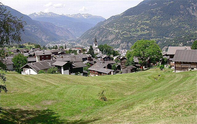
Brig District (Bezirk Brig)

- district of the canton of Valais, Switzerland
 Hiking in Brig District
The Brig District, located in the Valais canton of Switzerland, is a picturesque region known for its stunning landscapes, rich history, and a variety of hiking opportunities. Here’s what you need to know about hiking in this beautiful area:
Trails and Routes
-
Varied Terrain: The Brig District offers a range of hiking trails suitable for all skill levels. From gentle walks to challenging alpine routes, hikers can enjoy everything from serene pastures to rugged mountain paths.
-
Popular Treks:
- Aletsch Glacier: One of the most spectacular hikes in the area includes routes around the Aletsch Glacier, a UNESCO World Heritage Site. The trails give you panoramic views of the glacier and surrounding peaks.
- Simplon Pass: This historic mountain pass offers various trails with breathtaking views. The Simplon area has both easy hikes and more strenuous routes for experienced hikers.
- Brigerbad: Enjoy trails that take you to Brigerbad, where you can relax in thermal baths after a day of hiking.
-
Flora and Fauna: The region is rich in biodiversity. You might come across alpine flowers, diverse plant life, and even encounters with local wildlife like ibexes or marmots.
Seasonal Considerations
- Summer: The best time for hiking in Brig District is typically from late June to early October when the trails are clear of snow.
- Winter: For winter sports enthusiasts, the area also offers snowshoeing and winter hiking trails, adding a different dimension to the hiking experience.
Essential Tips
- Local Guidance: Consider hiring a local guide if you're unfamiliar with the area. They can provide insights into the best trails and local history.
- Preparation: Always check the weather forecast before heading out. Trails can vary in difficulty and conditions can change rapidly.
- Equipment: Wear appropriate hiking gear, including sturdy footwear, and carry essentials like water, snacks, a first aid kit, and a map or GPS device.
Additional Activities
In addition to hiking, the Brig District is perfect for other outdoor activities like mountain biking, paragliding, and visiting local attractions such as the Stockalper Palace or the charming town of Brig itself.
Overall, hiking in the Brig District can be a memorable experience characterized by breathtaking views, diverse trails, and the stunning natural beauty of the Swiss Alps. Always plan accordingly, and enjoy your adventure!
- Country:

- Capital: Brig-Glis
- Coordinates: 46° 18' 42" N, 7° 59' 6" E


- GPS tracks (wikiloc): [Link]
- AboveSeaLevel: 1478 м m
- Area: 434.5 sq km
- Wikipedia en: wiki(en)
- Wikipedia: wiki(de)
- Wikidata storage: Wikidata: Q659687
- Wikipedia Commons Category: [Link]
- Freebase ID: [/m/0dzxdx]
- GeoNames ID: Alt: [6458821]
- archINFORM location ID: [45091]
- HDS ID: [8400]
Includes regions:

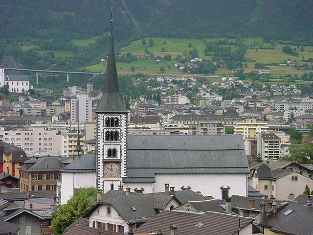
Brig-Glis
- municipality in the district of Brig, Canton of Valais, Switzerland
Hiking in Brig-Glis
Brig-Glis, located in the Valais region of Switzerland, is a fantastic area for hiking enthusiasts. The region offers a mix of stunning landscapes, including mountains, valleys, and lush forests, making it ideal for both novice and experienced hikers....
- Country:
- Postal Code: 3900
- Local Dialing Code: 027
- Licence Plate Code: VS
- Coordinates: 46° 18' 57" N, 7° 59' 15" E
- GPS tracks (wikiloc): [Link]
- AboveSeaLevel: 691 м m
- Area: 38 sq km
- Population: 13109
- Web site: [Link]

Naters
- municipality in the canton of Valais, Switzerland
Hiking in Naters
Naters is a picturesque municipality in the Valais region of Switzerland, located near the popular tourist destination of Brig. The area offers a variety of hiking opportunities, suitable for different skill levels and preferences. Here are some highlights and tips for hiking in Naters:...
- Country:
- Postal Code: 3904
- Local Dialing Code: 027
- Licence Plate Code: VS
- Coordinates: 46° 19' 25" N, 7° 59' 19" E
- GPS tracks (wikiloc): [Link]
- AboveSeaLevel: 2774 м m
- Area: 101.26 sq km
- Population: 9983
- Web site: [Link]
Termen
- municipality in Switzerland
Hiking in Termen
Termen is a small municipality located in the southern region of Switzerland, known for its beautiful alpine landscapes. While it's not one of the most widely recognized hiking destinations compared to its neighbors, it does offer some excellent opportunities for hikers seeking tranquility and stunning views....
- Country:
- Postal Code: 3912
- Local Dialing Code: 027
- Licence Plate Code: VS
- Coordinates: 46° 19' 0" N, 8° 1' 0" E
- GPS tracks (wikiloc): [Link]
- AboveSeaLevel: 925 м m
- Area: 18.8 sq km
- Population: 913
- Web site: [Link]

Ried-Brig
- municipality in Switzerland
Hiking in Ried-Brig
Ried-Brig is a charming village located in the Valais region of Switzerland, surrounded by stunning natural landscapes and offering excellent hiking opportunities. Here are some highlights for hiking in the area:...
- Country:
- Postal Code: 3911
- Local Dialing Code: 027
- Licence Plate Code: VS
- Coordinates: 46° 19' 0" N, 8° 1' 0" E
- GPS tracks (wikiloc): [Link]
- AboveSeaLevel: 918 м m
- Area: 47.53 sq km
- Population: 2092
- Web site: [Link]

Eggerberg
- municipality in Switzerland
Hiking in Eggerberg
Eggerberg, located in the Swiss canton of Valais, offers a variety of hiking opportunities for both beginners and experienced hikers. The region is known for its stunning alpine scenery, with picturesque views of the surrounding mountains and valleys....
- Country:
- Postal Code: 3939
- Local Dialing Code: 027
- Licence Plate Code: VS
- Coordinates: 46° 18' 57" N, 7° 53' 20" E
- GPS tracks (wikiloc): [Link]
- AboveSeaLevel: 1262 м m
- Area: 6.0 sq km
- Population: 340
- Web site: [Link]


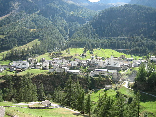
Zwischbergen
- municipality in Switzerland
Hiking in Zwischbergen
Zwischbergen, located in the Swiss Alps near the village of Simplon in the Valais region, is known for its stunning landscapes and excellent hiking opportunities. Here are some key highlights about hiking in Zwischbergen:...
- Country:
- Postal Code: 3901
- Licence Plate Code: VS
- Coordinates: 46° 10' 0" N, 8° 7' 0" E
- GPS tracks (wikiloc): [Link]
- AboveSeaLevel: 1322 м m
- Area: 86.1 sq km
- Population: 77
- Web site: [Link]
Simplon
- municipality in Switzerland
Hiking in Simplon
The Simplon region in Valais, Switzerland, is a stunning hiking destination known for its impressive mountainous landscapes, diverse flora and fauna, and rich cultural history. Here are some key highlights and considerations for hiking in this area:...
- Country:
- Postal Code: 3907
- Local Dialing Code: 027
- Licence Plate Code: VS
- Coordinates: 46° 12' 0" N, 8° 3' 0" E
- GPS tracks (wikiloc): [Link]
- AboveSeaLevel: 1476 м m
- Area: 90.9 sq km
- Population: 304
- Web site: [Link]
Shares border with regions:


Östlich Raron District
- district of the canton of Valais, Switzerland
Hiking in Östlich Raron District
Östlich Raron, located in the Valais region of Switzerland, offers a unique and beautiful hiking experience characterized by stunning alpine scenery, diverse landscapes, and a variety of trails suitable for different skill levels. Here are some highlights and tips for hiking in this area:...
- Country:
- Capital: Mörel-Filet
- Licence Plate Code: VS
- Coordinates: 46° 20' 0" N, 8° 3' 1" E
- GPS tracks (wikiloc): [Link]
- Area: 127.2 sq km


Visp District
- district of the canton of Valais, Switzerland
Hiking in Visp District
The Visp District, located in the Valais canton of Switzerland, is an excellent destination for hiking enthusiasts. Surrounded by stunning Alpine scenery, it offers a variety of trails suitable for different skill levels, from beginners to experienced hikers. Here are some highlights and key points regarding hiking in the Visp District:...
- Country:
- Capital: Visp
- Licence Plate Code: VS
- Coordinates: 46° 17' 0" N, 7° 52' 0" E
- GPS tracks (wikiloc): [Link]
- AboveSeaLevel: 2758 м m
- Area: 863.8 sq km

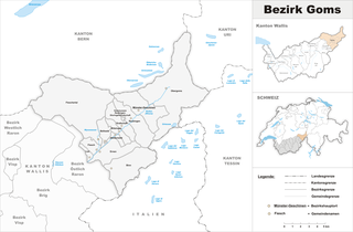
Goms District
- district of the canton of Valais, Switzerland
Hiking in Goms District
Goms District, located in the Valais region of Switzerland, is a stunning destination for hiking enthusiasts. Known for its picturesque landscapes, charming villages, and rich cultural heritage, Goms offers a variety of hiking trails suited for different skill levels....
- Country:
- Capital: Münster-Geschinen
- Licence Plate Code: VS
- Coordinates: 46° 27' 0" N, 8° 18' 0" E
- GPS tracks (wikiloc): [Link]
- AboveSeaLevel: 1407 м m
- Area: 588.3 sq km

Westlich Raron District
- district of the canton of Valais, Switzerland
Hiking in Westlich Raron District
Westlich Raron is a beautiful area located in the Swiss Alps, specifically in the Valais region of Switzerland. It's known for its stunning landscapes, diverse trails, and the picturesque views of the surrounding mountains. Here are some key points to consider if you're planning to hike in this region:...
- Country:
- Capital: Raron
- Licence Plate Code: VS
- Coordinates: 46° 18' 0" N, 8° 48' 0" E
- GPS tracks (wikiloc): [Link]
- Area: 270.87 sq km