Goujounac (Goujounac)

- commune in Lot, France
- Country:

- Postal Code: 46250
- Coordinates: 44° 34' 35" N, 1° 11' 48" E


- GPS tracks (wikiloc): [Link]
- Area: 10.38 sq km
- Population: 225
- Wikipedia en: wiki(en)
- Wikipedia: wiki(fr)
- Wikidata storage: Wikidata: Q971313
- Wikipedia Commons Category: [Link]
- Freebase ID: [/m/02pl75b]
- GeoNames ID: Alt: [6434787]
- SIREN number: [214601262]
- BnF ID: [15260867x]
- INSEE municipality code: 46126
Shares border with regions:
Pomarède
- commune in Lot, France
- Country:
- Postal Code: 46250
- Coordinates: 44° 33' 53" N, 1° 10' 15" E
- GPS tracks (wikiloc): [Link]
- Area: 7.04 sq km
- Population: 171

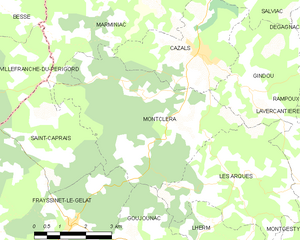
Montcléra
- commune in Lot, France
- Country:
- Postal Code: 46250
- Coordinates: 44° 37' 12" N, 1° 12' 37" E
- GPS tracks (wikiloc): [Link]
- Area: 20.91 sq km
- Population: 281
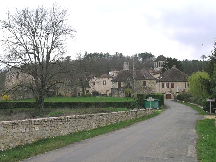

Lherm
- commune in Lot, France
- Country:
- Postal Code: 46150
- Coordinates: 44° 34' 3" N, 1° 14' 44" E
- GPS tracks (wikiloc): [Link]
- Area: 13.47 sq km
- Population: 231

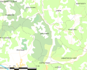
Les Junies
- commune in Lot, France
- Country:
- Postal Code: 46150
- Coordinates: 44° 32' 18" N, 1° 14' 7" E
- GPS tracks (wikiloc): [Link]
- Area: 13.06 sq km
- Population: 261
- Web site: [Link]


Frayssinet-le-Gélat
- commune in Lot, France
- Country:
- Postal Code: 46250
- Coordinates: 44° 34' 57" N, 1° 9' 50" E
- GPS tracks (wikiloc): [Link]
- Area: 23.14 sq km
- Population: 354


Les Arques
- commune in Lot, France
- Country:
- Postal Code: 46250
- Coordinates: 44° 36' 9" N, 1° 15' 3" E
- GPS tracks (wikiloc): [Link]
- Area: 15.05 sq km
- Population: 198