Gouvets (Gouvets)

- commune in Manche, France
- Country:

- Postal Code: 50420
- Coordinates: 48° 55' 57" N, 1° 5' 47" E


- GPS tracks (wikiloc): [Link]
- Area: 11.01 sq km
- Population: 268
- Wikipedia en: wiki(en)
- Wikipedia: wiki(fr)
- Wikidata storage: Wikidata: Q1071641
- Wikipedia Commons Category: [Link]
- Freebase ID: [/m/0h311b]
- Freebase ID: [/m/0h311b]
- GeoNames ID: Alt: [6435426]
- GeoNames ID: Alt: [6435426]
- SIREN number: [215002148]
- SIREN number: [215002148]
- BnF ID: [15262191b]
- BnF ID: [15262191b]
- PACTOLS thesaurus ID: [pcrt3forf5LslS]
- PACTOLS thesaurus ID: [pcrt3forf5LslS]
- INSEE municipality code: 50214
- INSEE municipality code: 50214
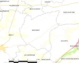
Shares border with regions:


Margueray
- commune in Manche, France
- Country:
- Postal Code: 50410
- Coordinates: 48° 53' 47" N, 1° 8' 34" E
- GPS tracks (wikiloc): [Link]
- Area: 4.64 sq km
- Population: 132

Montabot
- commune in Manche, France
- Country:
- Postal Code: 50410
- Coordinates: 48° 56' 5" N, 1° 7' 31" E
- GPS tracks (wikiloc): [Link]
- Area: 11.56 sq km
- Population: 274


Pont-Farcy
- former commune in Manche, France
- Country:
- Postal Code: 14380
- Coordinates: 48° 56' 10" N, 1° 2' 10" E
- GPS tracks (wikiloc): [Link]
- AboveSeaLevel: 86 м m
- Area: 13.45 sq km
- Population: 537
- Web site: [Link]


Saint-Vigor-des-Monts
- commune in Manche, France
- Country:
- Postal Code: 50420
- Coordinates: 48° 54' 38" N, 1° 5' 12" E
- GPS tracks (wikiloc): [Link]
- Area: 15.74 sq km
- Population: 287