Gramat (Gramat)

- commune in Lot, France
- Country:

- Postal Code: 46500
- Coordinates: 44° 46' 44" N, 1° 43' 30" E


- GPS tracks (wikiloc): [Link]
- Area: 57.07 sq km
- Population: 3649
- Web site: http://www.gramat.fr
- Wikipedia en: wiki(en)
- Wikipedia: wiki(fr)
- Wikidata storage: Wikidata: Q430834
- Wikipedia Commons Category: [Link]
- Freebase ID: [/m/07y159]
- GeoNames ID: Alt: [3015386]
- SIREN number: [214601288]
- BnF ID: [15260869m]
- VIAF ID: Alt: [139522715]
- MusicBrainz area ID: [cb8d9d28-37e0-4be9-84d5-54dda4e65aa3]
- WOEID: [593374]
- INSEE municipality code: 46128
Shares border with regions:


Issendolus
- commune in Lot, France
- Country:
- Postal Code: 46500
- Coordinates: 44° 44' 33" N, 1° 47' 16" E
- GPS tracks (wikiloc): [Link]
- Area: 18.91 sq km
- Population: 512


Rignac
- commune in Lot, France
- Country:
- Postal Code: 46500
- Coordinates: 44° 48' 23" N, 1° 41' 44" E
- GPS tracks (wikiloc): [Link]
- AboveSeaLevel: 210 м m
- Area: 9.64 sq km
- Population: 267
- Web site: [Link]


Thégra
- commune in Lot, France
- Country:
- Postal Code: 46500
- Coordinates: 44° 49' 16" N, 1° 45' 23" E
- GPS tracks (wikiloc): [Link]
- Area: 12.82 sq km
- Population: 473
- Web site: [Link]

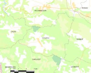
Couzou
- commune in Lot, France
- Country:
- Postal Code: 46500
- Coordinates: 44° 45' 57" N, 1° 36' 59" E
- GPS tracks (wikiloc): [Link]
- Area: 21.72 sq km
- Population: 97


Bio
- commune in Lot, France
- Country:
- Postal Code: 46500
- Coordinates: 44° 46' 58" N, 1° 47' 5" E
- GPS tracks (wikiloc): [Link]
- Area: 10.79 sq km
- Population: 357


Reilhac
- commune in Lot, France
- Country:
- Postal Code: 46500
- Coordinates: 44° 42' 1" N, 1° 43' 9" E
- GPS tracks (wikiloc): [Link]
- Area: 12.98 sq km
- Population: 180


Lavergne
- commune in Lot, France
- Country:
- Postal Code: 46500
- Coordinates: 44° 47' 54" N, 1° 45' 37" E
- GPS tracks (wikiloc): [Link]
- Area: 8.82 sq km
- Population: 449


Rocamadour
- commune in Lot, France
- Country:
- Postal Code: 46500
- Coordinates: 44° 47' 58" N, 1° 37' 4" E
- GPS tracks (wikiloc): [Link]
- AboveSeaLevel: 279 м m
- Area: 49.42 sq km
- Population: 628
- Web site: [Link]
Le Bastit
- commune in Lot, France
- Country:
- Postal Code: 46500
- Coordinates: 44° 43' 22" N, 1° 39' 55" E
- GPS tracks (wikiloc): [Link]
- Area: 28.25 sq km
- Population: 166