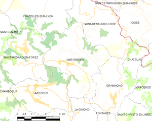
Grammond (Grammond)

- commune in Loire, France
- Country:

- Postal Code: 42140
- Coordinates: 45° 33' 55" N, 4° 26' 29" E


- GPS tracks (wikiloc): [Link]
- Area: 8.13 sq km
- Population: 893
- Wikipedia en: wiki(en)
- Wikipedia: wiki(fr)
- Wikidata storage: Wikidata: Q509208
- Wikipedia Commons Category: [Link]
- Freebase ID: [/m/03nw8vg]
- Freebase ID: [/m/03nw8vg]
- GeoNames ID: Alt: [6434176]
- GeoNames ID: Alt: [6434176]
- SIREN number: [214201022]
- SIREN number: [214201022]
- BnF ID: [15259671k]
- BnF ID: [15259671k]
- INSEE municipality code: 42102
- INSEE municipality code: 42102
Shares border with regions:


Fontanès
- commune in Loire, France
- Country:
- Postal Code: 42140
- Coordinates: 45° 32' 48" N, 4° 26' 14" E
- GPS tracks (wikiloc): [Link]
- Area: 6.63 sq km
- Population: 673


Saint-Christo-en-Jarez
- commune in Loire, France
- Country:
- Postal Code: 42320
- Coordinates: 45° 32' 41" N, 4° 29' 12" E
- GPS tracks (wikiloc): [Link]
- Area: 21.77 sq km
- Population: 1828
- Web site: [Link]

Saint-Denis-sur-Coise
- commune in Loire, France
- Country:
- Postal Code: 42140
- Coordinates: 45° 37' 1" N, 4° 25' 24" E
- GPS tracks (wikiloc): [Link]
- Area: 10.79 sq km
- Population: 659
Châtelus
- commune in Loire, France
- Country:
- Postal Code: 42140
- Coordinates: 45° 35' 45" N, 4° 27' 56" E
- GPS tracks (wikiloc): [Link]
- Area: 2.53 sq km
- Population: 135

Chevrières
- commune in Loire, France
- Country:
- Postal Code: 42140
- Coordinates: 45° 35' 18" N, 4° 24' 3" E
- GPS tracks (wikiloc): [Link]
- AboveSeaLevel: 634 м m
- Area: 14.54 sq km
- Population: 1067
Marcenod
- commune in Loire, France
- Country:
- Postal Code: 42140
- Coordinates: 45° 34' 19" N, 4° 28' 55" E
- GPS tracks (wikiloc): [Link]
- Area: 9 sq km
- Population: 708