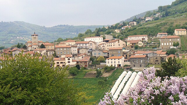
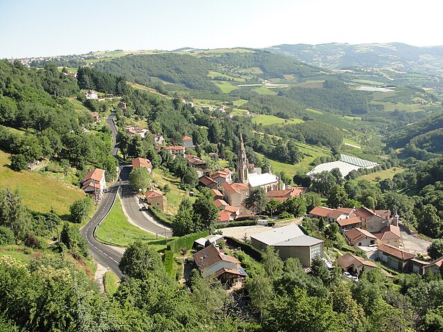
Saint-Christo-en-Jarez (Saint-Christo-en-Jarez)

- commune in Loire, France
- Country:

- Postal Code: 42320
- Coordinates: 45° 32' 41" N, 4° 29' 12" E


- GPS tracks (wikiloc): [Link]
- Area: 21.77 sq km
- Population: 1828
- Web site: http://www.st-christo.fr
- Wikipedia en: wiki(en)
- Wikipedia: wiki(fr)
- Wikidata storage: Wikidata: Q1107492
- Wikipedia Commons Category: [Link]
- Freebase ID: [/m/03nwb0c]
- Freebase ID: [/m/03nwb0c]
- GeoNames ID: Alt: [6434250]
- GeoNames ID: Alt: [6434250]
- SIREN number: [214202087]
- SIREN number: [214202087]
- BnF ID: [15259776k]
- BnF ID: [15259776k]
- INSEE municipality code: 42208
- INSEE municipality code: 42208
Shares border with regions:


Fontanès
- commune in Loire, France
- Country:
- Postal Code: 42140
- Coordinates: 45° 32' 48" N, 4° 26' 14" E
- GPS tracks (wikiloc): [Link]
- Area: 6.63 sq km
- Population: 673


Sorbiers
- commune in Loire, France
- Country:
- Postal Code: 42290
- Coordinates: 45° 29' 16" N, 4° 27' 1" E
- GPS tracks (wikiloc): [Link]
- Area: 12.19 sq km
- Population: 8083
- Web site: [Link]

Saint-Romain-en-Jarez
- commune in Loire, France
- Country:
- Postal Code: 42800
- Coordinates: 45° 33' 22" N, 4° 32' 4" E
- GPS tracks (wikiloc): [Link]
- Area: 16.96 sq km
- Population: 1222

Valfleury
- commune in Loire, France
- Country:
- Postal Code: 42320
- Coordinates: 45° 31' 21" N, 4° 29' 33" E
- GPS tracks (wikiloc): [Link]
- Area: 8.77 sq km
- Population: 706

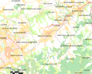
Saint-Chamond
- commune in Loire, France
- Country:
- Postal Code: 42400
- Coordinates: 45° 28' 35" N, 4° 30' 53" E
- GPS tracks (wikiloc): [Link]
- AboveSeaLevel: 375 м m
- Area: 54.88 sq km
- Population: 34870
- Web site: [Link]
Grammond
- commune in Loire, France
- Country:
- Postal Code: 42140
- Coordinates: 45° 33' 55" N, 4° 26' 29" E
- GPS tracks (wikiloc): [Link]
- Area: 8.13 sq km
- Population: 893
Marcenod
- commune in Loire, France
- Country:
- Postal Code: 42140
- Coordinates: 45° 34' 19" N, 4° 28' 55" E
- GPS tracks (wikiloc): [Link]
- Area: 9 sq km
- Population: 708