Grez-sur-Loing (Grez-sur-Loing)

- commune in Seine-et-Marne, France
- Country:

- Postal Code: 77880
- Coordinates: 48° 18' 55" N, 2° 41' 20" E


- GPS tracks (wikiloc): [Link]
- Area: 12.97 sq km
- Population: 1406
- Web site: http://www.grezsurloing.fr
- Wikipedia en: wiki(en)
- Wikipedia: wiki(fr)
- Wikidata storage: Wikidata: Q251748
- Wikipedia Commons Gallery: [Link]
- Wikipedia Commons Category: [Link]
- Freebase ID: [/m/0598nl]
- Freebase ID: [/m/0598nl]
- GeoNames ID: Alt: [3014671]
- GeoNames ID: Alt: [3014671]
- SIREN number: [217702166]
- SIREN number: [217702166]
- BnF ID: [15275556v]
- BnF ID: [15275556v]
- VIAF ID: Alt: [148102575]
- VIAF ID: Alt: [148102575]
- Library of Congress authority ID: Alt: [n87153359]
- Library of Congress authority ID: Alt: [n87153359]
- PACTOLS thesaurus ID: [pcrtwTWBxTyf6g]
- PACTOLS thesaurus ID: [pcrtwTWBxTyf6g]
- MusicBrainz area ID: [8fcf7eb7-04b0-4eb5-b0bf-292ecb262920]
- MusicBrainz area ID: [8fcf7eb7-04b0-4eb5-b0bf-292ecb262920]
- YSO ID: [113005]
- YSO ID: [113005]
- INSEE municipality code: 77216
- INSEE municipality code: 77216
Shares border with regions:

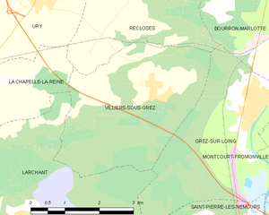
Villiers-sous-Grez
- commune in Seine-et-Marne, France
- Country:
- Postal Code: 77760
- Coordinates: 48° 19' 10" N, 2° 38' 53" E
- GPS tracks (wikiloc): [Link]
- Area: 12.25 sq km
- Population: 740
- Web site: [Link]


Recloses
- commune in Seine-et-Marne, France
- Country:
- Postal Code: 77760
- Coordinates: 48° 20' 52" N, 2° 38' 30" E
- GPS tracks (wikiloc): [Link]
- Area: 9.35 sq km
- Population: 685
- Web site: [Link]


La Genevraye
- commune in Seine-et-Marne, France
- Country:
- Postal Code: 77690
- Coordinates: 48° 19' 14" N, 2° 44' 47" E
- GPS tracks (wikiloc): [Link]
- Area: 13.16 sq km
- Population: 764


Bourron-Marlotte
- commune in Seine-et-Marne, France
- Country:
- Postal Code: 77780
- Coordinates: 48° 20' 28" N, 2° 42' 28" E
- GPS tracks (wikiloc): [Link]
- Area: 11.26 sq km
- Population: 2767
- Web site: [Link]

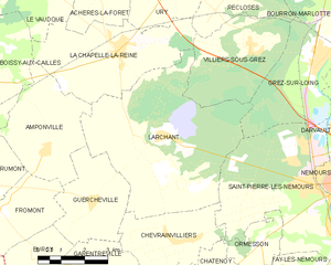
Larchant
- commune in Seine-et-Marne, France
- Country:
- Postal Code: 77760
- Coordinates: 48° 17' 5" N, 2° 35' 48" E
- GPS tracks (wikiloc): [Link]
- Area: 29.24 sq km
- Population: 723
- Web site: [Link]


Saint-Pierre-lès-Nemours
- commune in Seine-et-Marne, France
- Country:
- Postal Code: 77140
- Coordinates: 48° 15' 55" N, 2° 40' 47" E
- GPS tracks (wikiloc): [Link]
- Area: 21.62 sq km
- Population: 5490
- Web site: [Link]


Montcourt-Fromonville
- commune in Seine-et-Marne, France
- Country:
- Postal Code: 77140
- Coordinates: 48° 18' 20" N, 2° 42' 13" E
- GPS tracks (wikiloc): [Link]
- Area: 8.17 sq km
- Population: 2007
- Web site: [Link]