Larchant (Larchant)

- commune in Seine-et-Marne, France
- Country:

- Postal Code: 77760
- Coordinates: 48° 17' 5" N, 2° 35' 48" E


- GPS tracks (wikiloc): [Link]
- Area: 29.24 sq km
- Population: 723
- Web site: http://www.larchant.fr
- Wikipedia en: wiki(en)
- Wikipedia: wiki(fr)
- Wikidata storage: Wikidata: Q274968
- Wikipedia Commons Category: [Link]
- Freebase ID: [/m/02qwgg3]
- Freebase ID: [/m/02qwgg3]
- GeoNames ID: Alt: [3007041]
- GeoNames ID: Alt: [3007041]
- SIREN number: [217702448]
- SIREN number: [217702448]
- BnF ID: [152755843]
- BnF ID: [152755843]
- VIAF ID: Alt: [129257528]
- VIAF ID: Alt: [129257528]
- Library of Congress authority ID: Alt: [nr92025702]
- Library of Congress authority ID: Alt: [nr92025702]
- INSEE municipality code: 77244
- INSEE municipality code: 77244
Shares border with regions:

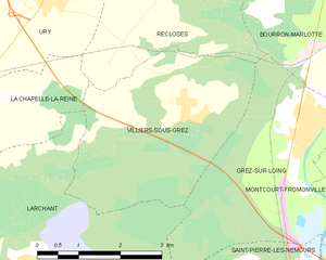
Villiers-sous-Grez
- commune in Seine-et-Marne, France
- Country:
- Postal Code: 77760
- Coordinates: 48° 19' 10" N, 2° 38' 53" E
- GPS tracks (wikiloc): [Link]
- Area: 12.25 sq km
- Population: 740
- Web site: [Link]


La Chapelle-la-Reine
- commune in Seine-et-Marne, France
- Country:
- Postal Code: 77760
- Coordinates: 48° 19' 6" N, 2° 34' 18" E
- GPS tracks (wikiloc): [Link]
- Area: 15.91 sq km
- Population: 2475
- Web site: [Link]


Chevrainvilliers
- commune in Seine-et-Marne, France
- Country:
- Postal Code: 77760
- Coordinates: 48° 14' 42" N, 2° 36' 54" E
- GPS tracks (wikiloc): [Link]
- Area: 8.95 sq km
- Population: 225
- Web site: [Link]


Grez-sur-Loing
- commune in Seine-et-Marne, France
- Country:
- Postal Code: 77880
- Coordinates: 48° 18' 55" N, 2° 41' 20" E
- GPS tracks (wikiloc): [Link]
- Area: 12.97 sq km
- Population: 1406
- Web site: [Link]


Amponville
- commune in Seine-et-Marne, France
- Country:
- Postal Code: 77760
- Coordinates: 48° 16' 44" N, 2° 31' 47" E
- GPS tracks (wikiloc): [Link]
- Area: 12.3 sq km
- Population: 363


Guercheville
- commune in Seine-et-Marne, France
- Country:
- Postal Code: 77760
- Coordinates: 48° 15' 34" N, 2° 33' 28" E
- GPS tracks (wikiloc): [Link]
- Area: 9.21 sq km
- Population: 277


Saint-Pierre-lès-Nemours
- commune in Seine-et-Marne, France
- Country:
- Postal Code: 77140
- Coordinates: 48° 15' 55" N, 2° 40' 47" E
- GPS tracks (wikiloc): [Link]
- Area: 21.62 sq km
- Population: 5490
- Web site: [Link]