Grisignano di Zocco (Grisignano di Zocco)
.svg)
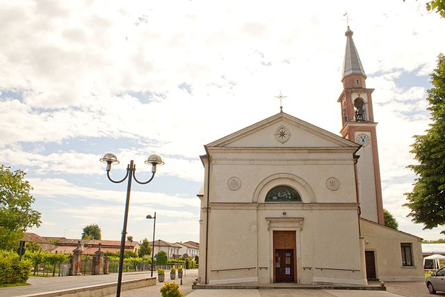
- Italian comune
 Hiking in Grisignano di Zocco
Grisignano di Zocco is located in the province of Vicenza, in the Veneto region of Italy. While it might not be the most renowned hiking destination, it offers a charming setting with picturesque landscapes typical of the Italian countryside.
Hiking Opportunities
-
Local Trails: The area around Grisignano di Zocco features several local trails that wind through the scenic countryside. These trails often pass through fields, vineyards, and small woodlands, providing a peaceful hiking experience.
-
Nearby Natural Parks: Consider exploring nearby natural parks or regional reserves. The Colli Euganei Regional Park and the Berici Hills are not far away and offer a range of well-marked hiking trails with varying difficulties.
-
Cultural Walks: In addition to the natural beauty, hiking in this region allows you to experience local culture. You may encounter traditional farms, charming villages, and historical landmarks along the trails.
Tips for Hiking in the Area
- Navigation: Carry a map or use GPS, as some smaller trails might not be well-marked. Mobile apps can also assist in trailfinding.
- Seasons: The best times for hiking in this region are spring and autumn. The weather is typically mild and the landscapes are vibrant with colors during these seasons.
- Local Cuisine: Plan to enjoy some local cuisine at an osteria or trattoria post-hike. Italian food is a highlight of any visit!
Get Prepared
- Gear: Ensure you have appropriate hiking gear. Even for easier trails, sturdy footwear and comfortable clothing are essential.
- Hydration and Nutrition: Bring plenty of water and snacks, especially if you plan on hiking for several hours.
While Grisignano di Zocco may not be a hiking hotspot, its surrounding areas offer lovely opportunities to explore the natural beauty and rich culture of the Veneto region. Happy hiking!
- Country:

- Postal Code: 36040
- Local Dialing Code: 0444
- Licence Plate Code: VI
- Coordinates: 45° 29' 0" N, 11° 42' 0" E


- GPS tracks (wikiloc): [Link]
- AboveSeaLevel: 23 м m
- Area: 17.02 sq km
- Population: 4293
- Web site: http://www.comune.grisignano.vi.it/
- Wikipedia en: wiki(en)
- Wikipedia: wiki(it)
- Wikidata storage: Wikidata: Q46215
- Wikipedia Commons Category: [Link]
- Freebase ID: [/m/0g8pqm]
- GeoNames ID: Alt: [6538263]
- VIAF ID: Alt: [241251053]
- OSM relation ID: [45067]
- MusicBrainz area ID: [74d935ec-7cf6-45fd-be4f-32d74cf12cc9]
- UN/LOCODE: [ITGZC]
- ISTAT ID: 024046
- Italian cadastre code: E184
Shares border with regions:
Campodoro
- Italian comune
Hiking in Campodoro
Campodoro is a lesser-known region situated in Italy, particularly in the Province of Padova in the Veneto region. When planning a hiking trip in this area, there are a few important points to keep in mind:...
- Country:
- Postal Code: 35010
- Local Dialing Code: 049
- Licence Plate Code: PD
- Coordinates: 45° 29' 0" N, 11° 45' 0" E
- GPS tracks (wikiloc): [Link]
- AboveSeaLevel: 23 м m
- Area: 11.22 sq km
- Population: 2652
- Web site: [Link]
Mestrino
- Italian comune
Hiking in Mestrino
Mestrino, a charming town located in the Veneto region of Italy, offers several opportunities for hiking enthusiasts to explore the picturesque landscapes of the area. While Mestrino itself might not be known for extensive hiking trails, its proximity to various natural parks and the beautiful countryside makes it an excellent base for outdoor activities....
- Country:
- Postal Code: 35035
- Local Dialing Code: 049
- Licence Plate Code: PD
- Coordinates: 45° 27' 0" N, 11° 46' 0" E
- GPS tracks (wikiloc): [Link]
- AboveSeaLevel: 20 м m
- Area: 19.22 sq km
- Population: 11502
- Web site: [Link]
Veggiano
- Italian comune
Hiking in Veggiano
Veggiano is a small town located in the Veneto region of Italy, not far from the city of Padua. While it may not be a famous hiking destination, the surrounding area offers several opportunities for outdoor activities, including hiking....
- Country:
- Postal Code: 35030
- Local Dialing Code: 049
- Licence Plate Code: PD
- Coordinates: 45° 27' 0" N, 11° 43' 0" E
- GPS tracks (wikiloc): [Link]
- AboveSeaLevel: 21 м m
- Area: 16.41 sq km
- Population: 4765
- Web site: [Link]
Montegalda
- Italian comune
Hiking in Montegalda
Montegalda is a picturesque area located in the province of Vicenza, Italy. It's known for its beautiful landscapes, rolling hills, and a mix of natural and cultural attractions. While it's not as widely known as some other hiking destinations in the region, it offers some lovely trails and outdoor experiences for nature lovers....
- Country:
- Postal Code: 36047
- Local Dialing Code: 0444
- Licence Plate Code: VI
- Coordinates: 45° 27' 0" N, 11° 41' 0" E
- GPS tracks (wikiloc): [Link]
- AboveSeaLevel: 28 м m
- Area: 17.41 sq km
- Population: 3431
- Web site: [Link]


Camisano Vicentino
- Italian comune
Hiking in Camisano Vicentino
Camisano Vicentino, located in the Veneto region of Italy, is a charming area that offers a variety of hiking opportunities. While it may not be as widely known for hiking as other mountainous regions of Italy, there are still enjoyable trails and natural landscapes to explore....
- Country:
- Postal Code: 36043
- Local Dialing Code: 0444
- Licence Plate Code: VI
- Coordinates: 45° 31' 0" N, 11° 43' 0" E
- GPS tracks (wikiloc): [Link]
- AboveSeaLevel: 27 м m
- Area: 30.02 sq km
- Population: 11248
- Web site: [Link]


Grumolo delle Abbadesse
- Italian comune
Hiking in Grumolo delle Abbadesse
Grumolo delle Abbadesse is a charming village located in the province of Vicenza, in the Veneto region of northern Italy. While it may not be as commonly known as some of the larger hiking destinations in Italy, the surrounding area offers lovely landscapes and opportunities for outdoor activities including hiking....
- Country:
- Postal Code: 36040
- Local Dialing Code: 0444
- Licence Plate Code: VI
- Coordinates: 45° 31' 0" N, 11° 40' 0" E
- GPS tracks (wikiloc): [Link]
- AboveSeaLevel: 30 м m
- Area: 15.01 sq km
- Population: 3748
- Web site: [Link]