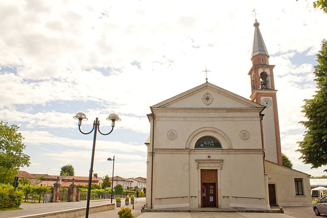
Montegalda (Montegalda)
.svg)
- Italian comune
 Hiking in Montegalda
Montegalda is a picturesque area located in the province of Vicenza, Italy. It's known for its beautiful landscapes, rolling hills, and a mix of natural and cultural attractions. While it's not as widely known as some other hiking destinations in the region, it offers some lovely trails and outdoor experiences for nature lovers.
Hiking Trails
-
Local Trails: Montegalda has various local trails that wind through the countryside, offering views of vineyards, olive groves, and charming rural landscapes. These trails can vary in difficulty, making them suitable for different hiking abilities.
-
Colli Berici: The nearby Colli Berici (Berici Hills) is a popular hiking destination with well-marked trails. The hills offer a range of hiking experiences, from easy walks to more challenging routes, all with stunning views of the surrounding area.
-
Nature Reserves: Explore local nature reserves that support diverse flora and fauna, perfect for those interested in both hiking and wildlife watching.
Hiking Tips
- Best Time to Visit: Spring (April to June) and fall (September to October) are ideal times for hiking in Montegalda, as the weather is usually mild and the landscapes are vibrant.
- Equipment: Wear sturdy hiking boots, and consider bringing trekking poles for support, especially on steep or uneven terrain. A good backpack with water and snacks is essential.
- Navigation: While many trails are marked, it's a good idea to carry a map or have a GPS device to stay on track, especially if you venture into less-known areas.
Cultural Aspects
Montegalda is not just about hiking; it also has cultural and historical sites worth exploring. After a hike, you can enjoy local cuisine in nearby restaurants or visit historical landmarks.
Safety
- Wildlife: Be cautious of wildlife and always stay on designated trails.
- Weather: Check the weather forecast before heading out, as conditions can change rapidly in the hills.
- Inform Someone: Always inform someone about your plans before you go hiking, especially if you’re venturing out alone.
Overall, Montegalda offers a charming hiking experience in the heart of Italy, blending natural beauty with cultural richness. Enjoy your trip and happy hiking!
- Country:

- Postal Code: 36047
- Local Dialing Code: 0444
- Licence Plate Code: VI
- Coordinates: 45° 27' 0" N, 11° 41' 0" E


- GPS tracks (wikiloc): [Link]
- AboveSeaLevel: 28 м m
- Area: 17.41 sq km
- Population: 3431
- Web site: http://www.comune.montegalda.vi.it/
- Wikipedia en: wiki(en)
- Wikipedia: wiki(it)
- Wikidata storage: Wikidata: Q46168
- Wikipedia Commons Category: [Link]
- Freebase ID: [/m/0g8vx7]
- GeoNames ID: Alt: [6542996]
- VIAF ID: Alt: [241868617]
- OSM relation ID: [44994]
- UN/LOCODE: [ITMT7]
- ISTAT ID: 024064
- Italian cadastre code: F514
Shares border with regions:
Cervarese Santa Croce
- Italian comune
Hiking in Cervarese Santa Croce
Cervarese Santa Croce is a charming municipality in the province of Padua, Italy, nestled at the foot of the Euganean Hills. This area offers a variety of hiking opportunities, set against a backdrop of beautiful landscapes, rolling hills, and lush greenery....
- Country:
- Postal Code: 35030
- Local Dialing Code: 049
- Licence Plate Code: PD
- Coordinates: 45° 24' 11" N, 11° 41' 32" E
- GPS tracks (wikiloc): [Link]
- AboveSeaLevel: 30 м m
- Area: 17.71 sq km
- Population: 5779
- Web site: [Link]
Veggiano
- Italian comune
Hiking in Veggiano
Veggiano is a small town located in the Veneto region of Italy, not far from the city of Padua. While it may not be a famous hiking destination, the surrounding area offers several opportunities for outdoor activities, including hiking....
- Country:
- Postal Code: 35030
- Local Dialing Code: 049
- Licence Plate Code: PD
- Coordinates: 45° 27' 0" N, 11° 43' 0" E
- GPS tracks (wikiloc): [Link]
- AboveSeaLevel: 21 м m
- Area: 16.41 sq km
- Population: 4765
- Web site: [Link]


Montegaldella
- Italian comune
Hiking in Montegaldella
Montegaldella is a charming area located in the Veneto region of Italy, known for its beautiful natural landscapes and hiking opportunities. The region offers a range of trails that cater to various skill levels, making it a great destination for both beginners and experienced hikers....
- Country:
- Postal Code: 36047
- Local Dialing Code: 0444
- Licence Plate Code: VI
- Coordinates: 45° 26' 0" N, 11° 40' 0" E
- GPS tracks (wikiloc): [Link]
- AboveSeaLevel: 23 м m
- Area: 13.57 sq km
- Population: 1774
- Web site: [Link]
Grisignano di Zocco
- Italian comune
Hiking in Grisignano di Zocco
Grisignano di Zocco is located in the province of Vicenza, in the Veneto region of Italy. While it might not be the most renowned hiking destination, it offers a charming setting with picturesque landscapes typical of the Italian countryside....
- Country:
- Postal Code: 36040
- Local Dialing Code: 0444
- Licence Plate Code: VI
- Coordinates: 45° 29' 0" N, 11° 42' 0" E
- GPS tracks (wikiloc): [Link]
- AboveSeaLevel: 23 м m
- Area: 17.02 sq km
- Population: 4293
- Web site: [Link]


Grumolo delle Abbadesse
- Italian comune
Hiking in Grumolo delle Abbadesse
Grumolo delle Abbadesse is a charming village located in the province of Vicenza, in the Veneto region of northern Italy. While it may not be as commonly known as some of the larger hiking destinations in Italy, the surrounding area offers lovely landscapes and opportunities for outdoor activities including hiking....
- Country:
- Postal Code: 36040
- Local Dialing Code: 0444
- Licence Plate Code: VI
- Coordinates: 45° 31' 0" N, 11° 40' 0" E
- GPS tracks (wikiloc): [Link]
- AboveSeaLevel: 30 м m
- Area: 15.01 sq km
- Population: 3748
- Web site: [Link]
Longare
- Italian comune
Hiking in Longare
Longare is a picturesque area located in the province of Vicenza, Italy, surrounded by beautiful landscapes and rolling hills of the Veneto region. While it may not be as well-known as other hiking destinations, it offers several opportunities for outdoor enthusiasts who want to explore nature and enjoy the scenic views....
- Country:
- Postal Code: 36023
- Local Dialing Code: 0444
- Licence Plate Code: VI
- Coordinates: 45° 29' 0" N, 11° 37' 0" E
- GPS tracks (wikiloc): [Link]
- AboveSeaLevel: 29 м m
- Area: 22.77 sq km
- Population: 5684
- Web site: [Link]