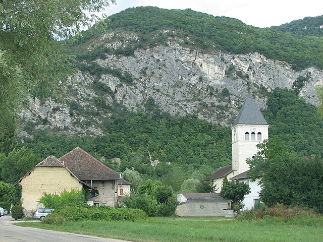
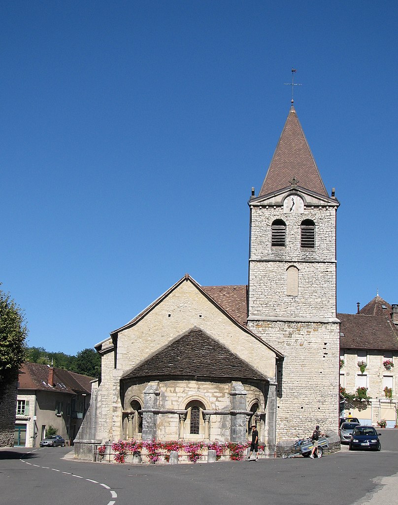
Groslée (Groslée)
- former commune in Ain, France
Groslée is a charming municipality located in the Auvergne-Rhône-Alpes region of France, nestled within the breathtaking landscapes of the French Alps. Hiking in this area offers a wonderful opportunity to explore scenic vistas, lush forests, and a variety of terrains.
Popular Hiking Trails
-
Sentier du Mont Chini: This trail provides a moderate hike with stunning views of the surrounding mountains. The route takes you through beautiful forests and offers a challenging ascent that rewards hikers with panoramic views.
-
Les Crêts: A family-friendly trail that is suitable for all ages. This pathway winds through gentle hills and provides a relaxed hiking experience with views of the nearby Rhône valley.
-
Circuit des Bouverans: A longer trek ideal for experienced hikers, this circular route takes you through various ecosystems and gives you a chance to see local wildlife and flora.
Tips for Hiking in Groslée
- Weather Preparedness: Always check the local weather forecast before heading out. Conditions in the mountains can change rapidly.
- Trail Maps: Ensure you have a detailed map of the hiking trails or download a hiking app for navigation, as some paths might not be well-marked.
- Respect Nature: Follow Leave No Trace principles to keep the environment pristine. Stay on marked trails and take your trash with you.
- Hydration and Snacks: Carry enough water and snacks, especially on longer hikes, to maintain energy levels.
- Local Regulations: Be aware of any specific regulations or guidelines set by local authorities, particularly regarding wildlife and conservation areas.
Nearby Attractions
While in Groslée, you might also want to explore nearby attractions:
- The Rhône River: Offers various water activities if you're looking for a break from hiking.
- Historical Sites: Check out local churches or historic buildings in Groslée for a cultural experience.
Best Time to Hike
The prime hiking season in Groslée typically runs from late spring to early autumn (May to September), when the weather is most favorable, and trails are generally accessible. However, for those who enjoy winter hiking or snowshoeing, the surrounding areas can also offer unique experiences in the colder months.
With its stunning natural beauty, diverse trails, and peaceful atmosphere, hiking in Groslée is sure to provide a memorable outdoor adventure.
- Country:

- Postal Code: 01680
- Coordinates: 45° 42' 46" N, 5° 34' 0" E


- GPS tracks (wikiloc): [Link]
- Area: 7.27 sq km
- Population: 360
- Wikipedia en: wiki(en)
- Wikipedia: wiki(fr)
- Wikidata storage: Wikidata: Q840075
- Wikipedia Commons Category: [Link]
- Wikipedia Commons Maps Category: [Link]
- Freebase ID: [/m/0815r4]
- Freebase ID: [/m/0815r4]
- Freebase ID: [/m/0815r4]
- GeoNames ID: Alt: [6424543]
- GeoNames ID: Alt: [6424543]
- GeoNames ID: Alt: [6424543]
- INSEE municipality code: 01182
- INSEE municipality code: 01182
- INSEE municipality code: 01182
Shares border with regions:


Brangues
- commune in Isère, France
Brangues is a charming village located in the Isère department of the Auvergne-Rhône-Alpes region in southeastern France. It's situated near the stunning Vercors Regional Natural Park, which offers a variety of hiking trails that cater to different skill levels....
- Country:

- Postal Code: 38510
- Coordinates: 45° 41' 35" N, 5° 31' 52" E


- GPS tracks (wikiloc): [Link]
- Area: 11.67 sq km
- Population: 616
- Web site: [Link]

Conzieu
- commune in Ain, France
Conzieu is a small village located in the Ain department of the Auvergne-Rhône-Alpes region in France. While it may not be as widely known as some other hiking destinations in the Alps, it offers various opportunities for nature lovers and hikers to explore its beautiful landscapes....
- Country:

- Postal Code: 01300
- Coordinates: 45° 43' 34" N, 5° 36' 26" E


- GPS tracks (wikiloc): [Link]
- Area: 7.2 sq km
- Population: 146

Groslée-Saint-Benoit
- commune in Ain, France
 Hiking in Groslée-Saint-Benoit
Groslée-Saint-Benoît is a picturesque commune located in the Auvergne-Rhône-Alpes region of France. Known for its stunning natural landscapes, it offers a variety of hiking opportunities that attract outdoor enthusiasts....
- Country:

- Postal Code: 01680; 01300
- Coordinates: 45° 41' 42" N, 5° 35' 14" E


- GPS tracks (wikiloc): [Link]
- Area: 28.92 sq km

Saint-Benoît
- former commune in Ain, France
Saint-Benoît, located in the Ain department of France, offers a picturesque setting for hiking enthusiasts. Nestled in the foothills of the Jura Mountains, the area features a mix of lush forests, rolling hills, and stunning views of the surrounding landscape, making it an ideal location for both casual walkers and experienced hikers....
- Country:

- Postal Code: 01300
- Coordinates: 45° 41' 40" N, 5° 35' 19" E


- GPS tracks (wikiloc): [Link]
- Area: 21.65 sq km
- Population: 833

Lhuis
- commune in Ain, France
Lhuis is a charming commune located in the Ain department of the Auvergne-Rhône-Alpes region of France. Nestled near the foothills of the Alps, it provides a beautiful backdrop for outdoor activities, including hiking. While Lhuis itself might be more quiet and less well-known than larger hiking destinations, it offers access to a range of trails that cater to different skill levels and preferences....
- Country:

- Postal Code: 01680
- Coordinates: 45° 44' 48" N, 5° 32' 0" E


- GPS tracks (wikiloc): [Link]
- Area: 24.43 sq km
- Population: 887
- Web site: [Link]