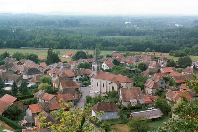
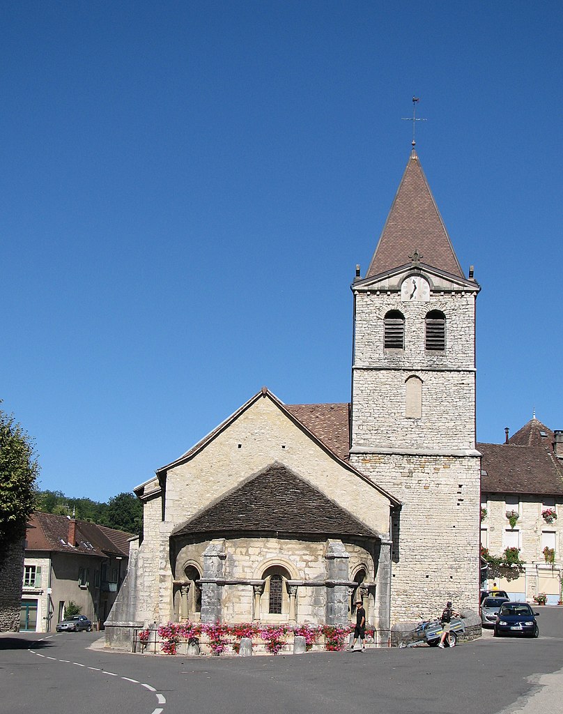
Groslée-Saint-Benoit (Groslée-Saint-Benoit)
- commune in Ain, France
 Hiking in Groslée-Saint-Benoit
Groslée-Saint-Benoît is a picturesque commune located in the Auvergne-Rhône-Alpes region of France. Known for its stunning natural landscapes, it offers a variety of hiking opportunities that attract outdoor enthusiasts.
Hiking Highlights in Groslée-Saint-Benoît:
-
Scenic Trails: The area boasts several scenic trails that wind through lush forests, meadows, and along rivers, providing hikers with fantastic views of the surrounding mountains and valleys.
-
Variety of Difficulty Levels: Whether you're a beginner or an experienced hiker, you'll find trails suitable for all skill levels. Short, family-friendly trails are available alongside more challenging routes for seasoned hikers.
-
Fauna and Flora: Hikers can enjoy diverse flora and fauna throughout the terrain. Keep an eye out for local wildlife, as well as various plant species unique to the region.
-
Cultural Features: Some trails may lead you to historical sites, such as old farms or church ruins, adding a cultural aspect to your hike.
-
Local Amenities: Groslée-Saint-Benoît has local accommodations and restaurants that can enhance your hiking experience. It’s a good idea to stop by local shops or markets to stock up on snacks and hydration before hitting the trails.
Tips for Hiking in Groslée-Saint-Benoît:
-
Check Trail Maps: Before heading out, review the available trail maps and choose your route based on your skill level and the time you have available.
-
Weather Awareness: Always check the weather forecast before your hike and dress accordingly. The weather can change quickly in mountainous areas.
-
Safety First: Let someone know your hiking plan, carry a first-aid kit, and bring plenty of water and snacks to stay energized.
-
Leave No Trace: Practice environmental stewardship by respecting nature and leaving the trails as you found them.
-
Guided Tours: If you're unfamiliar with the area or prefer a more structured hike, consider joining a guided hiking tour, which can provide valuable insights into the local ecosystem and history.
Groslée-Saint-Benoît serves as an excellent gateway to explore the natural beauty of the French Alps and enjoy the tranquility of the outdoors. Enjoy your hiking adventure!
- Country:

- Postal Code: 01680; 01300
- Coordinates: 45° 41' 42" N, 5° 35' 14" E


- GPS tracks (wikiloc): [Link]
- Area: 28.92 sq km
- Wikipedia en: wiki(en)
- Wikipedia: wiki(fr)
- Wikidata storage: Wikidata: Q21944483
- Wikipedia Commons Category: [Link]
- SIREN number: [200060143]
- OpenCorporates ID: [fr/200060143]
- INSEE municipality code: 01338
Shares border with regions:


Brangues
- commune in Isère, France
Brangues is a charming village located in the Isère department of the Auvergne-Rhône-Alpes region in southeastern France. It's situated near the stunning Vercors Regional Natural Park, which offers a variety of hiking trails that cater to different skill levels....
- Country:

- Postal Code: 38510
- Coordinates: 45° 41' 35" N, 5° 31' 52" E


- GPS tracks (wikiloc): [Link]
- Area: 11.67 sq km
- Population: 616
- Web site: [Link]


Le Bouchage
- village in Isère, France
Le Bouchage is a small commune located in the Isère department of the Auvergne-Rhône-Alpes region in southeastern France. While it might not be as well-known as some of the larger towns and national parks in the area, it offers a charming landscape that can appeal to hikers looking for quieter trails and scenic views....
- Country:

- Postal Code: 38510
- Coordinates: 45° 40' 13" N, 5° 31' 33" E


- GPS tracks (wikiloc): [Link]
- Area: 11.2 sq km
- Population: 625
- Web site: [Link]

Brégnier-Cordon
- commune in Ain, France
Brégnier-Cordon is a charming village located in the Auvergne-Rhône-Alpes region of France, surrounded by stunning natural landscapes, making it an excellent destination for hiking enthusiasts. Here are some key points to consider when hiking in and around Brégnier-Cordon:...
- Country:

- Postal Code: 01300
- Coordinates: 45° 38' 56" N, 5° 37' 11" E


- GPS tracks (wikiloc): [Link]
- Area: 11 sq km
- Population: 856
- Web site: [Link]

Conzieu
- commune in Ain, France
Conzieu is a small village located in the Ain department of the Auvergne-Rhône-Alpes region in France. While it may not be as widely known as some other hiking destinations in the Alps, it offers various opportunities for nature lovers and hikers to explore its beautiful landscapes....
- Country:

- Postal Code: 01300
- Coordinates: 45° 43' 34" N, 5° 36' 26" E


- GPS tracks (wikiloc): [Link]
- Area: 7.2 sq km
- Population: 146

Saint-Bois
- former commune in Ain, France
Saint-Bois is a small village located in the Vosges department in northeastern France. While it may not be as widely known as some other hiking destinations, the surrounding areas offer beautiful landscapes and a variety of trails that cater to hikers of all skill levels....
- Country:

- Postal Code: 01300
- Coordinates: 45° 41' 58" N, 5° 38' 7" E


- GPS tracks (wikiloc): [Link]
- Area: 9.42 sq km
- Population: 146

Lhuis
- commune in Ain, France
Lhuis is a charming commune located in the Ain department of the Auvergne-Rhône-Alpes region of France. Nestled near the foothills of the Alps, it provides a beautiful backdrop for outdoor activities, including hiking. While Lhuis itself might be more quiet and less well-known than larger hiking destinations, it offers access to a range of trails that cater to different skill levels and preferences....
- Country:

- Postal Code: 01680
- Coordinates: 45° 44' 48" N, 5° 32' 0" E


- GPS tracks (wikiloc): [Link]
- Area: 24.43 sq km
- Population: 887
- Web site: [Link]

Groslée
- former commune in Ain, France
Groslée is a charming municipality located in the Auvergne-Rhône-Alpes region of France, nestled within the breathtaking landscapes of the French Alps. Hiking in this area offers a wonderful opportunity to explore scenic vistas, lush forests, and a variety of terrains....
- Country:

- Postal Code: 01680
- Coordinates: 45° 42' 46" N, 5° 34' 0" E


- GPS tracks (wikiloc): [Link]
- Area: 7.27 sq km
- Population: 360

Prémeyzel
- commune in Ain, France
Prémeyzel is a charming Alpine village located in the Canton of Vaud, Switzerland. It's positioned at an altitude of approximately 1,300 meters (4,265 feet), nestled in the Jura Mountains, which makes it a great spot for hiking enthusiasts. Here are some key aspects to consider when hiking in and around Prémeyzel:...
- Country:

- Postal Code: 01300
- Coordinates: 45° 41' 2" N, 5° 38' 53" E


- GPS tracks (wikiloc): [Link]
- Area: 7.63 sq km
- Population: 238
- Web site: [Link]