Guizerix (Guizerix)

- commune in Hautes-Pyrénées, France
- Country:

- Postal Code: 65230
- Coordinates: 43° 19' 25" N, 0° 26' 48" E


- GPS tracks (wikiloc): [Link]
- Area: 7.2 sq km
- Population: 126
- Wikipedia en: wiki(en)
- Wikipedia: wiki(fr)
- Wikidata storage: Wikidata: Q579084
- Wikipedia Commons Category: [Link]
- Freebase ID: [/m/03nv5fj]
- Freebase ID: [/m/03nv5fj]
- GeoNames ID: Alt: [6440753]
- GeoNames ID: Alt: [6440753]
- SIREN number: [216502138]
- SIREN number: [216502138]
- BnF ID: [15270593v]
- BnF ID: [15270593v]
- INSEE municipality code: 65213
- INSEE municipality code: 65213
Shares border with regions:
Duffort
- commune in Gers, France
- Country:
- Postal Code: 32170
- Coordinates: 43° 20' 38" N, 0° 24' 48" E
- GPS tracks (wikiloc): [Link]
- Area: 9.84 sq km
- Population: 139


Larroque
- commune in Hautes-Pyrénées, France
- Country:
- Postal Code: 65230
- Coordinates: 43° 18' 39" N, 0° 29' 27" E
- GPS tracks (wikiloc): [Link]
- AboveSeaLevel: 354 м m
- Area: 6.89 sq km
- Population: 106


Sadournin
- commune in Hautes-Pyrénées, France
- Country:
- Postal Code: 65220
- Coordinates: 43° 18' 56" N, 0° 24' 3" E
- GPS tracks (wikiloc): [Link]
- Area: 12.41 sq km
- Population: 177


Puntous
- commune in Hautes-Pyrénées, France
- Country:
- Postal Code: 65230
- Coordinates: 43° 18' 13" N, 0° 28' 13" E
- GPS tracks (wikiloc): [Link]
- Area: 8.85 sq km
- Population: 190

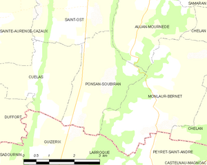
Ponsan-Soubiran
- commune in Gers, France
- Country:
- Postal Code: 32300
- Coordinates: 43° 21' 5" N, 0° 29' 3" E
- GPS tracks (wikiloc): [Link]
- Area: 6.87 sq km
- Population: 99


Cuélas
- commune in Gers, France
- Country:
- Postal Code: 32300
- Coordinates: 43° 21' 6" N, 0° 27' 14" E
- GPS tracks (wikiloc): [Link]
- Area: 6.55 sq km
- Population: 120