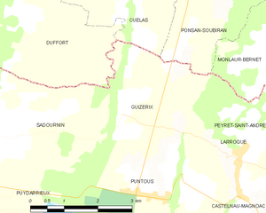
Duffort (Duffort)

- commune in Gers, France
- Country:

- Postal Code: 32170
- Coordinates: 43° 20' 38" N, 0° 24' 48" E


- GPS tracks (wikiloc): [Link]
- Area: 9.84 sq km
- Population: 139
- Wikipedia en: wiki(en)
- Wikipedia: wiki(fr)
- Wikidata storage: Wikidata: Q1006866
- Wikipedia Commons Category: [Link]
- Freebase ID: [/m/03nrply]
- GeoNames ID: Alt: [6431901]
- SIREN number: [213201163]
- BnF ID: [15255703d]
- INSEE municipality code: 32116
Shares border with regions:


Sainte-Aurence-Cazaux
- commune in Gers, France
- Country:
- Postal Code: 32300
- Coordinates: 43° 22' 30" N, 0° 25' 20" E
- GPS tracks (wikiloc): [Link]
- Area: 9.54 sq km
- Population: 107


Sadournin
- commune in Hautes-Pyrénées, France
- Country:
- Postal Code: 65220
- Coordinates: 43° 18' 56" N, 0° 24' 3" E
- GPS tracks (wikiloc): [Link]
- Area: 12.41 sq km
- Population: 177


Fontrailles
- commune in Hautes-Pyrénées, France
- Country:
- Postal Code: 65220
- Coordinates: 43° 20' 38" N, 0° 21' 19" E
- GPS tracks (wikiloc): [Link]
- Area: 8.99 sq km
- Population: 139
Guizerix
- commune in Hautes-Pyrénées, France
- Country:
- Postal Code: 65230
- Coordinates: 43° 19' 25" N, 0° 26' 48" E
- GPS tracks (wikiloc): [Link]
- Area: 7.2 sq km
- Population: 126


Cuélas
- commune in Gers, France
- Country:
- Postal Code: 32300
- Coordinates: 43° 21' 6" N, 0° 27' 14" E
- GPS tracks (wikiloc): [Link]
- Area: 6.55 sq km
- Population: 120
Barcugnan
- commune in Gers, France
- Country:
- Postal Code: 32170
- Coordinates: 43° 22' 43" N, 0° 24' 22" E
- GPS tracks (wikiloc): [Link]
- Area: 9.11 sq km
- Population: 109