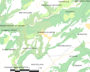
Guyans-Vennes (Guyans-Vennes)

- commune in Doubs, France
 Hiking in Guyans-Vennes
Guyans-Vennes is a quaint municipality located in the Jura region of France, known for its beautiful natural landscapes and opportunities for hiking enthusiasts. Here are some key points to consider when hiking in and around Guyans-Vennes:
Scenic Trails
- Varied Terrain: The region offers a mix of terrains, including forested paths, rolling hills, and stunning viewpoints over the Jura mountains and valleys.
- Marked Trails: Many hiking trails are well-marked, making it easier for hikers to navigate. Look for blue and yellow markers, which indicate different trail systems.
Notable Hikes
- Les Sentiers du Jura: There are several trails belonging to the Jura Trail Network that pass through or near Guyans-Vennes, allowing you to explore picturesque landscapes.
- Routes with Views: Some trails lead to panoramic viewpoints where you can take in the beauty of the surrounding forests and mountains.
Flora and Fauna
- Biodiversity: As you hike, keep an eye out for diverse wildlife and plant species unique to this region, including various birds and wildflowers.
Hiking Season
- Best Times to Hike: Spring (April to June) and fall (September to November) are ideal for hiking, offering mild temperatures and beautiful scenery. Summer months can get warm and are popular among tourists.
Preparation and Safety
- Footwear and Gear: Wear sturdy, comfortable hiking boots suitable for uneven terrain. Bring layers, as the weather can change quickly in the mountains.
- Hydration and Snacks: Carry sufficient water and nutritious snacks to keep your energy up during your hikes.
Local Regulations and Guidelines
- Leave No Trace: Always follow the principles of Leave No Trace to minimize your impact on the environment.
Additional Activities
- In addition to hiking, consider exploring local cultural attractions, visiting small villages, or partaking in local cuisine in nearby towns for a full experience.
Guyans-Vennes offers a serene environment for hikers who appreciate nature and tranquility. Be sure to check local maps and resources for the latest trail information before setting out. Enjoy your hiking adventure!
- Country:

- Postal Code: 25390
- Coordinates: 47° 9' 23" N, 6° 34' 15" E


- GPS tracks (wikiloc): [Link]
- Area: 19.67 sq km
- Population: 816
- Wikipedia en: wiki(en)
- Wikipedia: wiki(fr)
- Wikidata storage: Wikidata: Q907345
- Wikipedia Commons Category: [Link]
- Freebase ID: [/m/03mh9_4]
- Freebase ID: [/m/03mh9_4]
- GeoNames ID: Alt: [6429821]
- GeoNames ID: Alt: [6429821]
- SIREN number: [212503015]
- SIREN number: [212503015]
- BnF ID: [152525274]
- BnF ID: [152525274]
- PACTOLS thesaurus ID: [pcrtDARupNNKh8]
- PACTOLS thesaurus ID: [pcrtDARupNNKh8]
- INSEE municipality code: 25301
- INSEE municipality code: 25301
Shares border with regions:


Vennes
- commune in Doubs, France
Hiking in Vennes
Vennes, located in Norway, is known for its stunning natural beauty and diverse hiking opportunities. With breathtaking landscapes, including fjords, mountains, and forests, it offers a variety of trails suitable for all experience levels. Here are some highlights to consider when hiking in Vennes:...
- Country:
- Postal Code: 25390
- Coordinates: 47° 9' 10" N, 6° 32' 50" E
- GPS tracks (wikiloc): [Link]
- AboveSeaLevel: 850 м m
- Area: 7.31 sq km
- Population: 155

Plaimbois-du-Miroir
- commune in Doubs, France
Hiking in Plaimbois-du-Miroir
Plaimbois-du-Miroir is a charming village located in the Jura region of France, known for its picturesque landscapes and outdoor activities, including hiking. The Jura Mountains offer a variety of trails that cater to hikers of different skill levels. Here are some highlights:...
- Country:
- Postal Code: 25210
- Coordinates: 47° 11' 29" N, 6° 38' 43" E
- GPS tracks (wikiloc): [Link]
- Area: 11.71 sq km
- Population: 238


Plaimbois-Vennes
- commune in Doubs, France
Hiking in Plaimbois-Vennes
Plaimbois-Vennes is a charming commune located in the Doubs department in the Bourgogne-Franche-Comté region of eastern France. Nestled in the picturesque landscapes of the Jura Mountains, this area is known for its natural beauty, making it an excellent destination for hiking enthusiasts....
- Country:
- Postal Code: 25390
- Coordinates: 47° 11' 2" N, 6° 32' 26" E
- GPS tracks (wikiloc): [Link]
- Area: 10.8 sq km
- Population: 102


Mont-de-Laval
- commune in Doubs, France
Hiking in Mont-de-Laval
Mont-de-Laval is situated in the beautiful region of the French Alps, and offers a variety of hiking opportunities that cater to different skill levels. Here are some highlights regarding hiking in the area:...
- Country:
- Postal Code: 25210
- Coordinates: 47° 10' 10" N, 6° 37' 41" E
- GPS tracks (wikiloc): [Link]
- Area: 8.44 sq km
- Population: 173