Guzargues (Guzargues)

- commune in Hérault, France
- Country:

- Postal Code: 34820
- Coordinates: 43° 43' 21" N, 3° 55' 30" E


- GPS tracks (wikiloc): [Link]
- Area: 11.73 sq km
- Population: 521
- Wikipedia en: wiki(en)
- Wikipedia: wiki(fr)
- Wikidata storage: Wikidata: Q204558
- Wikipedia Commons Category: [Link]
- Freebase ID: [/m/03mfqm_]
- Freebase ID: [/m/03mfqm_]
- GeoNames ID: Alt: [6432520]
- GeoNames ID: Alt: [6432520]
- SIREN number: [213401185]
- SIREN number: [213401185]
- BnF ID: [152567191]
- BnF ID: [152567191]
- PACTOLS thesaurus ID: [pcrteGT9Mo6z0o]
- PACTOLS thesaurus ID: [pcrteGT9Mo6z0o]
- INSEE municipality code: 34118
- INSEE municipality code: 34118
Shares border with regions:

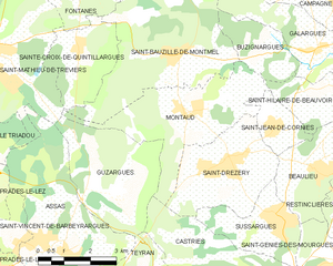
Montaud
- commune in Hérault, France
- Country:
- Postal Code: 34160
- Coordinates: 43° 45' 4" N, 3° 57' 20" E
- GPS tracks (wikiloc): [Link]
- Area: 12.92 sq km
- Population: 983

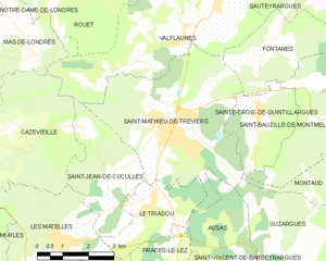
Saint-Mathieu-de-Tréviers
- commune in Hérault, France
- Country:
- Postal Code: 34270
- Coordinates: 43° 46' 11" N, 3° 52' 7" E
- GPS tracks (wikiloc): [Link]
- Area: 21.92 sq km
- Population: 4688
- Web site: [Link]


Castries
- commune in Hérault, France
- Country:
- Postal Code: 34160
- Coordinates: 43° 40' 44" N, 3° 58' 53" E
- GPS tracks (wikiloc): [Link]
- Area: 24.05 sq km
- Population: 6041
- Web site: [Link]


Assas
- commune in Hérault, France
- Country:
- Postal Code: 34820
- Coordinates: 43° 42' 7" N, 3° 53' 57" E
- GPS tracks (wikiloc): [Link]
- Area: 19.11 sq km
- Population: 1499
- Web site: [Link]


Teyran
- commune in Hérault, France
- Country:
- Postal Code: 34820
- Coordinates: 43° 41' 3" N, 3° 55' 41" E
- GPS tracks (wikiloc): [Link]
- Area: 10.04 sq km
- Population: 4607