Hérens District (Bezirk Hérens)

- district of the canton of Valais, Switzerland
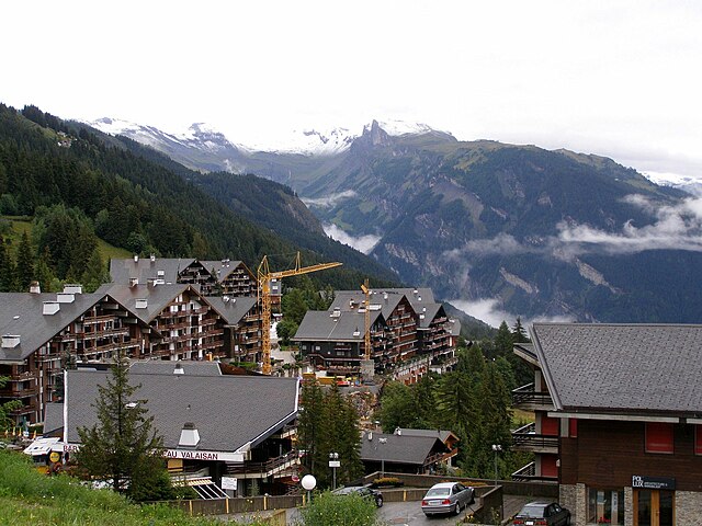
 Hiking in Hérens District
The Hérens District, located in the Valais Canton of Switzerland, is known for its stunning landscapes, diverse terrain, and rich cultural heritage, making it a fantastic destination for hiking enthusiasts. Here are some key points to consider when hiking in the Hérens District:
Natural Landscapes:
- Alpine Scenery: The district features breathtaking views of the Alps, with impressive peaks like the Dent Blanche and the Matterhorn nearby.
- Diverse Flora and Fauna: As you hike, you may encounter diverse wildlife and various alpine plant species, particularly in protected areas.
Hiking Trails:
- Variety of Trails: There are numerous trails ranging from easy strolls suitable for families to challenging routes for experienced hikers.
- Anytime Accessibility: Most trails are accessible from late spring to early autumn, but be sure to check local conditions, especially for snow.
Noteworthy Hikes:
- Stavons to Arolla: This is a beautiful route that offers views of glaciers and is a great opportunity to experience the tranquility of the mountains.
- Hiking to Moiry Glacier: A more challenging hike leading to stunning glacier views, with varying trails depending on your starting point.
- Tour des Combins: A longer multi-day trek that takes you through spectacular scenery and picturesque villages.
Cultural Experience:
- Alpine Villages: The villages in the Hérens District, such as Les Haudères and Evolène, provide a glimpse into the local culture, with traditional architecture and customs.
- Local Cuisine: Take the opportunity to taste local Swiss dishes in mountain huts or village restaurants.
Safety and Preparation:
- Weather Conditions: Always check the weather forecast before heading out and be prepared for rapid changes in mountain weather.
- Equipment: Wear appropriate hiking gear, including sturdy boots and layered clothing. A map or GPS device is recommended for navigation.
- Water and Supplies: Carry enough water and snacks, as some trails might not have facilities along the way.
Guidance and Regulations:
- Guided Tours: Consider joining guided tours, especially if you are unfamiliar with the area or if you want to explore more challenging routes.
- Respect Nature: Follow local guidelines regarding wildlife, trail preservation, and mountain etiquette to keep the environment pristine.
Overall, hiking in the Hérens District offers a memorable experience for adventurers looking to explore the beauty of the Swiss Alps while enjoying a taste of local culture and natural history. Whether you are looking for a leisurely hike or a strenuous adventure, this region has something to suit every level of experience.
- Country:

- Capital: Vex
- Licence Plate Code: VS
- Coordinates: 46° 11' 38" N, 7° 25' 26" E


- GPS tracks (wikiloc): [Link]
- AboveSeaLevel: 1098 м m
- Area: 443.5 sq km
- Wikipedia en: wiki(en)
- Wikipedia: wiki(de)
- Wikidata storage: Wikidata: Q633980
- Wikipedia Commons Category: [Link]
- Freebase ID: [/m/0286pq_]
- GeoNames ID: Alt: [6458872]
- archINFORM location ID: [45097]
- HDS ID: [34133]
Includes regions:


Vex
- municipality in Switzerland
Hiking in Vex
Vex, located in the Val d'Hérens region of Switzerland, offers a wonderful variety of hiking opportunities amidst stunning alpine scenery. Here are some key points to consider when hiking in Vex:...
- Country:
- Postal Code: 1981
- Local Dialing Code: 027
- Licence Plate Code: VS
- Coordinates: 46° 13' 0" N, 7° 24' 0" E
- GPS tracks (wikiloc): [Link]
- AboveSeaLevel: 929 м m
- Area: 13.0 sq km
- Population: 1820
- Web site: [Link]


Evolène
- municipality in Switzerland
Hiking in Evolène
Evolène is a picturesque village located in the Val d'Hérens region of the Swiss Alps, known for its stunning natural landscapes, traditional architecture, and rich cultural heritage. This area offers a variety of hiking trails that cater to different experience levels and preferences....
- Country:
- Postal Code: 1983
- Local Dialing Code: 027
- Licence Plate Code: VS
- Coordinates: 46° 6' 46" N, 7° 29' 46" E
- GPS tracks (wikiloc): [Link]
- AboveSeaLevel: 2602 м m
- Area: 209.94 sq km
- Population: 1701
- Web site: [Link]


Hérémence
- municipality in Switzerland
Hiking in Hérémence
Hérémence is a picturesque municipality located in the Valais region of Switzerland, known for its stunning alpine landscapes and numerous hiking opportunities. Here are some key points about hiking in and around Hérémence:...
- Country:
- Postal Code: 1987
- Local Dialing Code: 027
- Licence Plate Code: VS
- Coordinates: 46° 11' 0" N, 7° 24' 0" E
- GPS tracks (wikiloc): [Link]
- AboveSeaLevel: 2125 м m
- Area: 107.6 sq km
- Population: 1391
- Web site: [Link]

Ayent
- municipality in Switzerland
Hiking in Ayent
Ayent is a picturesque municipality located in the Valais region of Switzerland, known for its stunning landscapes, hiking trails, and beautiful views of the surrounding mountains. Here are some highlights for hiking in Ayent:...
- Country:
- Local Dialing Code: 027
- Licence Plate Code: VS
- Coordinates: 46° 19' 41" N, 7° 24' 37" E
- GPS tracks (wikiloc): [Link]
- AboveSeaLevel: 2235 м m
- Area: 55.0 sq km
- Population: 3975
- Web site: [Link]


Les Agettes
- municipality in Switzerland
Hiking in Les Agettes
Les Agettes, located in Switzerland, is an excellent destination for hiking enthusiasts. Nestled in the Valais region, this area boasts stunning natural landscapes, rolling hills, and panoramic views of the surrounding Alps....
- Country:
- Postal Code: 1992
- Local Dialing Code: 027
- Licence Plate Code: VS
- Coordinates: 46° 13' 0" N, 7° 23' 0" E
- GPS tracks (wikiloc): [Link]
- AboveSeaLevel: 1002 м m
- Area: 5.1 sq km
- Web site: [Link]


Saint-Martin
- municipality in Switzerland
Hiking in Saint-Martin
Hiking in Saint-Martin, a charming village in the Valais region of Switzerland, offers a wonderful mix of natural beauty, traditional Swiss culture, and a range of trails suitable for hikers of all levels. Here’s an overview of what you can expect when hiking in this area:...
- Country:
- Postal Code: 1969
- Local Dialing Code: 027
- Licence Plate Code: VS
- Coordinates: 46° 10' 0" N, 7° 26' 0" E
- GPS tracks (wikiloc): [Link]
- AboveSeaLevel: 1411 м m
- Area: 9.8 sq km
- Population: 829
- Web site: [Link]


Mont-Noble
- municipality in Switzerland
Hiking in Mont-Noble
Mont-Noble, located in the Valais region of Switzerland, is a wonderful destination for hiking enthusiasts. The area is known for its breathtaking scenery, including panoramic views of the Alps, lush valleys, and picturesque mountain landscapes....
- Country:
- Postal Code: 1961, 1966, 1973
- Local Dialing Code: 027
- Licence Plate Code: VS
- Coordinates: 46° 13' 48" N, 7° 25' 44" E
- GPS tracks (wikiloc): [Link]
- AboveSeaLevel: 1286 м m
- Area: 43 sq km
- Population: 1068
- Web site: [Link]
Shares border with regions:

Sion District
- district of the canton of Valais, Switzerland
Hiking in Sion District
The Sion District, located in the heart of Switzerland's Valais canton, is a wonderful destination for hiking enthusiasts. Known for its stunning alpine landscapes, charming villages, and rich cultural heritage, the Sion District offers a variety of hiking trails suitable for different skill levels....
- Country:
- Capital: Sion
- Licence Plate Code: VS
- Coordinates: 46° 14' 0" N, 7° 20' 58" E
- GPS tracks (wikiloc): [Link]
- AboveSeaLevel: 548 м m
- Area: 125.6 sq km


Sierre District
- district of the canton of Valais, Switzerland
Hiking in Sierre District
The Sierre District is located in the Valais (Wallis) region of Switzerland, and it's known for its stunning landscapes, diverse terrain, and a variety of hiking trails suitable for all levels of hikers. Here are some key highlights about hiking in the Sierre District:...
- Country:
- Capital: Sierre
- Licence Plate Code: VS
- Coordinates: 46° 16' 14" N, 7° 30' 57" E
- GPS tracks (wikiloc): [Link]
- AboveSeaLevel: 515 м m
- Area: 397.0 sq km


Visp District
- district of the canton of Valais, Switzerland
Hiking in Visp District
The Visp District, located in the Valais canton of Switzerland, is an excellent destination for hiking enthusiasts. Surrounded by stunning Alpine scenery, it offers a variety of trails suitable for different skill levels, from beginners to experienced hikers. Here are some highlights and key points regarding hiking in the Visp District:...
- Country:
- Capital: Visp
- Licence Plate Code: VS
- Coordinates: 46° 17' 0" N, 7° 52' 0" E
- GPS tracks (wikiloc): [Link]
- AboveSeaLevel: 2758 м m
- Area: 863.8 sq km


Entremont District
- district of the canton of Valais, Switzerland
Hiking in Entremont District
The Entremont District, located in the French Alps, is a fantastic destination for hiking enthusiasts, offering stunning landscapes and a variety of trails for all levels of hikers. The region is characterized by its alpine scenery, including majestic mountains, lush valleys, and picturesque villages, making it a great place to explore the natural beauty of the French Alps....
- Country:
- Capital: Sembrancher
- Licence Plate Code: VS
- Coordinates: 46° 3' 42" N, 7° 16' 23" E
- GPS tracks (wikiloc): [Link]
- AboveSeaLevel: 2229 м m
- Area: 633.2 sq km

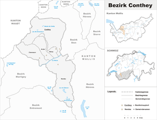
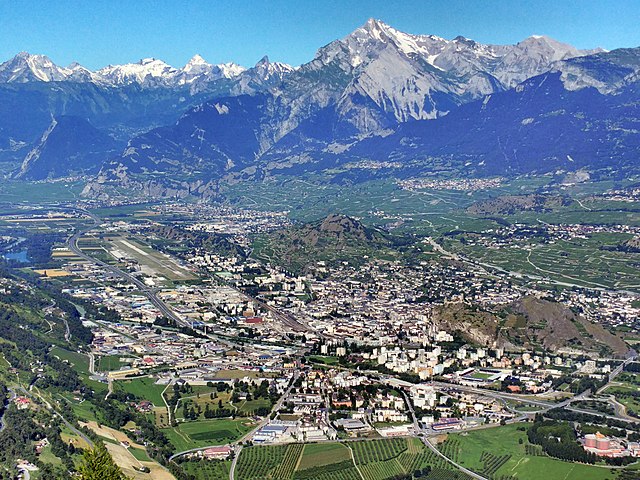
Conthey District
- district of the canton of Valais, Switzerland
Hiking in Conthey District
Conthey District, located in the Canton of Valais in Switzerland, is known for its stunning landscapes, abundant natural beauty, and diverse hiking opportunities. Here are some highlights of hiking in this area:...
- Country:
- Capital: Conthey
- Licence Plate Code: VS
- Coordinates: 46° 12' 17" N, 7° 16' 42" E
- GPS tracks (wikiloc): [Link]
- AboveSeaLevel: 487 м m
- Area: 234.2 sq km