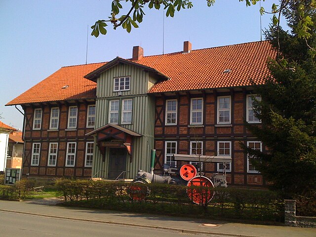
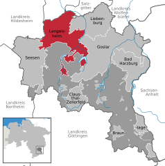
Hahausen (Hahausen)
- municipality of Germany
Hahausen, a small village in Germany, is located in the scenic Harz Mountains, which offer a variety of hiking opportunities. The area is known for its beautiful landscapes, dense forests, and rich biodiversity, making it a great destination for outdoor enthusiasts.
Hiking Trails
Here are some popular hiking trails and features in and around Hahausen:
-
The Harz National Park: This park offers numerous well-marked trails that cater to different skill levels. You can explore its stunning forests, unique rock formations, and diverse wildlife.
-
The Brocken: One of the most famous peaks in the Harz region, the Brocken is accessible from various trails originating from Hahausen. The hike offers spectacular views from the summit, which can also be reached via the historical Brocken Railway.
-
The Goetheweg Trail: This scenic route connects several points of interest in the region and is perfect for those looking to enjoy a longer hike while taking in the beauty of the Harz landscape.
-
Local Trails: There are many smaller trails surrounding Hahausen that lead through picturesque villages, fields, and woodlands, providing a more intimate hiking experience.
Tips for Hiking in Hahausen
- Weather: The weather can change quickly in the Harz Mountains, so be prepared with appropriate clothing and gear.
- Footwear: Sturdy, waterproof hiking boots are recommended due to potential muddy or uneven terrain.
- Navigation: While trails are usually well-marked, having a map or a GPS device can be helpful, especially for longer hikes.
- Wildlife: Be respectful of the local wildlife and follow any guidelines related to conservation in the national park or surrounding areas.
Conclusion
Hahausen is a great starting point for exploring the stunning hiking possibilities in the Harz Mountains. Whether you're looking for a gentle walk or a challenging hike, you’ll find a trail that suits your preferences while enjoying the natural beauty of this region. Don't forget to carry enough water and snacks, and enjoy your hike!
- Country:

- Postal Code: 38729
- Local Dialing Code: 05383
- Licence Plate Code: GS
- Coordinates: 51° 57' 0" N, 10° 13' 0" E


- GPS tracks (wikiloc): [Link]
- AboveSeaLevel: 207 м m
- Area: 9.65 sq km
- Population: 754
- Web site: http://www.hahausen.de
- Wikipedia en: wiki(en)
- Wikipedia: wiki(de)
- Wikidata storage: Wikidata: Q646286
- Wikipedia Commons Category: [Link]
- Freebase ID: [/m/02q95yw]
- Freebase ID: [/m/02q95yw]
- GeoNames ID: Alt: [2912392]
- GeoNames ID: Alt: [2912392]
- VIAF ID: Alt: [240836805]
- VIAF ID: Alt: [240836805]
- OSM relation ID: [1421433]
- OSM relation ID: [1421433]
- GND ID: Alt: [4104368-6]
- GND ID: Alt: [4104368-6]
- Historical Gazetteer (GOV) ID: [HAHSEN_W3372]
- Historical Gazetteer (GOV) ID: [HAHSEN_W3372]
- German municipality key: 03153006
- German municipality key: 03153006
Includes regions:
Neuekrug
- human settlement in Germany
Hiking in Neuekrug (Hahausen) offers a unique experience in the heart of Lower Saxony, Germany. This quaint village, surrounded by picturesque landscapes, provides several opportunities for outdoor enthusiasts to explore the natural beauty of the region. Here are some highlights and tips for hiking in this area:...
- Country:

- Postal Code: 38729
- Local Dialing Code: 05383
- Coordinates: 51° 56' 30" N, 10° 13' 40" E


- GPS tracks (wikiloc): [Link]
- AboveSeaLevel: 214 м m
Ödishausen
- human settlement in Germany
Ödishausen, a picturesque location, is a wonderful spot for hiking enthusiasts. While it might not be as widely known as larger national parks or hiking areas, the region offers a variety of trails that cater to different skill levels and preferences....
- Country:

- Postal Code: 38723
- Local Dialing Code: 05384
- Coordinates: 51° 56' 48" N, 10° 10' 35" E


- GPS tracks (wikiloc): [Link]
- AboveSeaLevel: 198 м m
Shares border with regions:


Bockenem
- municipality of Germany
Bockenem, located in Lower Saxony, Germany, is a charming small town surrounded by beautiful natural landscapes, making it a great destination for hiking enthusiasts. Here are some highlights and tips for hiking in and around Bockenem:...
- Country:

- Postal Code: 31167
- Local Dialing Code: 05067
- Licence Plate Code: HI
- Coordinates: 52° 0' 36" N, 10° 7' 55" E


- GPS tracks (wikiloc): [Link]
- AboveSeaLevel: 122 м m
- Area: 109.04 sq km
- Population: 9827
- Web site: [Link]


Lutter am Barenberge
- municipality of Germany
 Hiking in Lutter am Barenberge
Lutter am Barenberge, located in Lower Saxony, Germany, offers some charming hiking opportunities for outdoor enthusiasts. The area is surrounded by picturesque landscapes, including forests, hills, and quaint villages, and provides a pleasant hiking experience for both beginners and experienced hikers....
- Country:

- Postal Code: 38729
- Local Dialing Code: 05383
- Licence Plate Code: GS
- Coordinates: 51° 59' 24" N, 10° 16' 16" E


- GPS tracks (wikiloc): [Link]
- AboveSeaLevel: 165 м m
- Area: 33.29 sq km
- Population: 2362
- Web site: [Link]


Langelsheim
- municipality of Germany
Langelsheim is a quaint town located in the Harz region of Germany, surrounded by scenic landscapes and natural beauty, making it an ideal spot for hiking enthusiasts. The area features a mix of dense forests, rolling hills, and rocky outcrops, offering a variety of trails suitable for different skill levels....
- Country:

- Postal Code: 38685
- Local Dialing Code: 05326
- Licence Plate Code: GS
- Coordinates: 51° 56' 17" N, 10° 20' 6" E


- GPS tracks (wikiloc): [Link]
- AboveSeaLevel: 204 м m
- Area: 48.72 sq km
- Population: 11536
- Web site: [Link]
