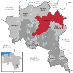
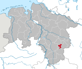
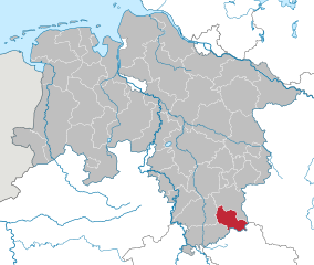
Goslar (Landkreis Goslar)

- district in Lower Saxony, Germany
 Hiking in Goslar
Goslar, located in Lower Saxony, Germany, is a beautiful area that offers a variety of hiking opportunities, particularly due to its proximity to the Harz Mountains. The district is known for its picturesque landscapes, medieval architecture, and rich history. Here are some highlights and suggestions for hiking in the Goslar district:
1.
- Description: The park is a major attraction for hikers and nature lovers. It features dense forests, high peaks, and unique geological formations.
- Trails: The park has numerous well-marked trails that vary in difficulty. Popular routes include the Brocken, the highest peak in Northern Germany, which offers panoramic views and is accessible by foot or by the Brocken Railway.
2.
- Description: This scenic trail near the city of Goslar leads to some of the most stunning viewpoints in the region.
- Highlights: It passes through forests, past streams, and provides opportunities to see local flora and fauna, as well as historical sites.
3.
- Description: A circular hiking route that takes you through the charming towns of Zellerfeld and Clausthal-Zellerfeld.
- Details: The trail is about 12 km long and suitable for families, as it offers easy terrain and lovely views of the surrounding countryside.
4.
- Description: Known for its stunning cliffs and rock formations, the Okertal Valley offers a variety of shorter trails for day hikes.
- Experience: The area is ideal for both hiking and rock climbing, making it a perfect spot for outdoor enthusiasts.
5.
- Hiking and Culture: Many trails in the area pass by historical landmarks, including the medieval town of Goslar itself, which is a UNESCO World Heritage site. Be sure to explore the old town, with its charming half-timbered houses and the impressive Goslar Imperial Palace.
6.
- Best Time to Hike: Spring and fall offer the best weather conditions and beautiful scenery with blooming flowers or colorful foliage.
- What to Bring: Be sure to wear sturdy hiking boots, carry water, snacks, a map or GPS device, and dress in layers, as weather in the mountains can change quickly.
- Safety: Always stick to marked trails, let someone know your hiking plans, and check the weather conditions before heading out.
Conclusion
Hiking in Goslar offers a combination of breathtaking natural beauty and rich history. Whether you're looking for leisurely walks or challenging hikes, you'll find trails that suit your preferences. Enjoy the stunning views and the unique cultural aspects of this remarkable region!
- Country:

- Capital: Goslar
- Licence Plate Code: GS; CLZ; BRL
- Coordinates: 51° 54' 38" N, 10° 25' 16" E


- GPS tracks (wikiloc): [Link]
- AboveSeaLevel: 263 м m
- Area: 965.07 sq km
- Population: 137979
- Web site: http://www.landkreis-goslar.de/
- Wikipedia en: wiki(en)
- Wikipedia: wiki(de)
- Wikidata storage: Wikidata: Q6040
- Wikipedia Commons Gallery: [Link]
- Wikipedia Commons Category: [Link]
- Wikipedia Commons Maps Category: [Link]
- Freebase ID: [/m/014qy_]
- Freebase ID: [/m/014qy_]
- GeoNames ID: Alt: [3221012]
- GeoNames ID: Alt: [3221012]
- VIAF ID: Alt: [131999781]
- VIAF ID: Alt: [131999781]
- OSM relation ID: [62669]
- OSM relation ID: [62669]
- GND ID: Alt: [4021644-5]
- GND ID: Alt: [4021644-5]
- archINFORM location ID: [7768]
- archINFORM location ID: [7768]
- TGN ID: [7077049]
- TGN ID: [7077049]
- NUTS code: [DE916]
- NUTS code: [DE916]
- BabelNet ID: [00803291n]
- BabelNet ID: [00803291n]
- German district key: 03153
- German district key: 03153
Includes regions:

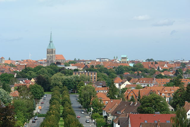
Goslar
- historic town in Lower Saxony, Germany
Hiking in Goslar
Goslar, located in the Harz Mountains of Germany, is a fantastic destination for hiking enthusiasts. The area is renowned for its breathtaking landscapes, rich history, and diverse range of trails suitable for all levels of hikers. Here’s a comprehensive overview of hiking in Goslar:...
- Country:
- Postal Code: 38644; 38642; 38640
- Local Dialing Code: 05325; 05321
- Licence Plate Code: CLZ; BRL; GS
- Coordinates: 51° 54' 22" N, 10° 25' 45" E
- GPS tracks (wikiloc): [Link]
- AboveSeaLevel: 255 м m
- Area: 163.71 sq km
- Population: 50782
- Web site: [Link]

Lutter am Barenberge
- Samtgemeinde in Lower Saxony
Hiking in Lutter am Barenberge
Lutter am Barenberge is a small town located in the Samtgemeinde of Lutter am Barenberge in Lower Saxony, Germany. While it may not be as widely known as some larger hiking destinations, the area offers beautiful landscapes and a variety of trails suitable for various skill levels....
- Country:
- Coordinates: 51° 59' 21" N, 10° 15' 47" E
- GPS tracks (wikiloc): [Link]
- Area: 59.76 sq km
- Population: 4025
- Web site: [Link]

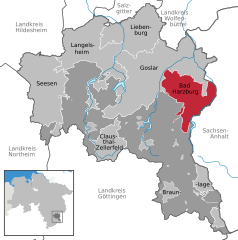
Bad Harzburg
- city in Lower Saxony, Germany
Hiking in Bad Harzburg
Bad Harzburg is a beautiful spa town in the Harz Mountains of Germany, known for its stunning landscapes, rich history, and well-maintained hiking trails. Here’s an overview of what you can expect when hiking in the area:...
- Country:
- Postal Code: 38667
- Local Dialing Code: 05322
- Licence Plate Code: CLZ; BRL; GS
- Coordinates: 51° 52' 52" N, 10° 33' 44" E
- GPS tracks (wikiloc): [Link]
- AboveSeaLevel: 261 м m
- Area: 65.42 sq km
- Population: 21735
- Web site: [Link]


Braunlage
- city in Lower Saxony, Germany
Hiking in Braunlage
Braunlage is a charming town located in the Harz mountains of Germany, surrounded by stunning nature and numerous hiking trails. The Harz region is known for its beautiful landscapes, dense forests, rocky peaks, and diverse wildlife, making it a great destination for outdoor enthusiasts....
- Country:
- Postal Code: 38700
- Local Dialing Code: 05520
- Licence Plate Code: CLZ; BRL; GS
- Coordinates: 51° 44' 0" N, 10° 37' 0" E
- GPS tracks (wikiloc): [Link]
- AboveSeaLevel: 601 м m
- Area: 21.7 sq km
- Population: 6049
- Web site: [Link]

Seesen
- municipality of Germany
Hiking in Seesen
Seesen, located in the Harz mountain range of Germany, offers a variety of hiking opportunities for both beginners and experienced trekkers. The region is renowned for its stunning landscapes, rich biodiversity, and numerous trails that cater to different skill levels....
- Country:
- Postal Code: 38723
- Local Dialing Code: 05384; 05381
- Licence Plate Code: GS
- Coordinates: 51° 53' 35" N, 10° 10' 42" E
- GPS tracks (wikiloc): [Link]
- AboveSeaLevel: 205 м m
- Area: 102.13 sq km
- Population: 19314
- Web site: [Link]

Oberharz
- former Samtgemeinde in Lower Saxony, Germany
Hiking in Oberharz
The Oberharz region, located in the Samtgemeinde area of Lower Saxony, Germany, is a beautiful destination for hiking enthusiasts. Known for its stunning natural landscapes, the region features a mix of dense forests, serene lakes, and rolling hills, making it a great place for outdoor activities....
- Country:
- Coordinates: 51° 48' 11" N, 10° 19' 58" E
- GPS tracks (wikiloc): [Link]
- Area: 43.63 sq km
- Web site: [Link]
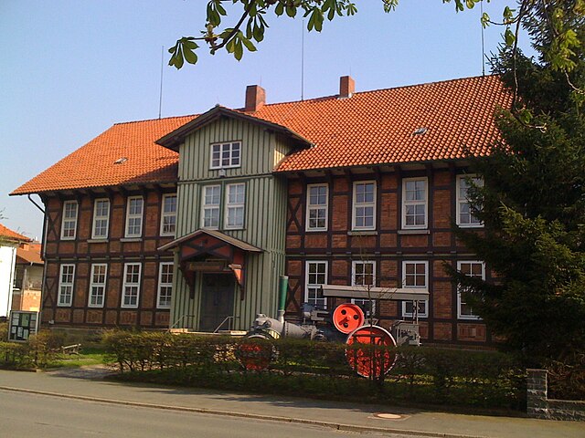
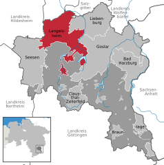
Langelsheim
- municipality of Germany
Hiking in Langelsheim
Langelsheim is a quaint town located in the Harz region of Germany, surrounded by scenic landscapes and natural beauty, making it an ideal spot for hiking enthusiasts. The area features a mix of dense forests, rolling hills, and rocky outcrops, offering a variety of trails suitable for different skill levels....
- Country:
- Postal Code: 38685
- Local Dialing Code: 05326
- Licence Plate Code: GS
- Coordinates: 51° 56' 17" N, 10° 20' 6" E
- GPS tracks (wikiloc): [Link]
- AboveSeaLevel: 204 м m
- Area: 48.72 sq km
- Population: 11536
- Web site: [Link]

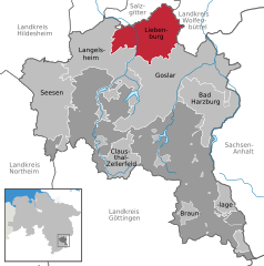
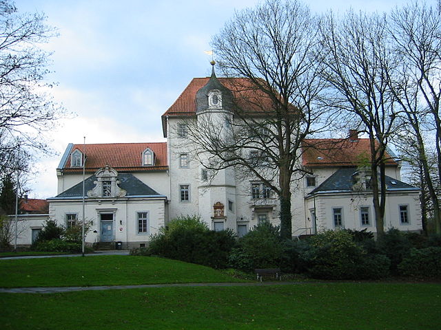
Liebenburg
- municipality of Germany
Hiking in Liebenburg
Liebenburg, located in Lower Saxony, Germany, is a charming town surrounded by picturesque landscapes that are perfect for hiking enthusiasts. The area features a variety of hiking trails suitable for different skill levels, allowing you to explore the natural beauty of the region....
- Country:
- Postal Code: 38704
- Local Dialing Code: 05346
- Licence Plate Code: GS
- Coordinates: 52° 1' 27" N, 10° 26' 2" E
- GPS tracks (wikiloc): [Link]
- AboveSeaLevel: 128 м m
- Area: 78.73 sq km
- Population: 8620
- Web site: [Link]
Shares border with regions:

Salzgitter
- independent city in southeast Lower Saxony, Germany
Hiking in Salzgitter
Salzgitter, located in Lower Saxony, Germany, offers a variety of hiking opportunities amidst its scenic landscapes. This region is characterized by rolling hills, forests, and lakes, making it a great destination for nature lovers and hikers of all skill levels. Here are some highlights for hiking in Salzgitter:...
- Country:
- Postal Code: 38239; 38229; 38228; 38259; 38226
- Local Dialing Code: 05339; 05300; 05341
- Licence Plate Code: SZ
- Coordinates: 52° 9' 13" N, 10° 24' 21" E
- GPS tracks (wikiloc): [Link]
- AboveSeaLevel: 90 м m
- Area: 224.49 sq km
- Population: 104614
- Web site: [Link]

Hildesheim
- district in Lower Saxony, Germany
Hiking in Hildesheim
Hildesheim is a beautiful district in Lower Saxony, Germany, known for its rich cultural heritage and scenic landscapes. While it may not be as famous for hiking as some other regions in Germany, there are still several great options for hikers of various skill levels....
- Country:
- Capital: Hildesheim
- Licence Plate Code: HI; ALF
- Coordinates: 52° 4' 48" N, 9° 55' 12" E
- GPS tracks (wikiloc): [Link]
- AboveSeaLevel: 80 м m
- Area: 1206.00 sq km
- Population: 277300
- Web site: [Link]


Northeim
- district in Lower Saxony, Germany
Hiking in Northeim
Northeim is a lovely district located in Lower Saxony, Germany, known for its scenic landscapes and variety of hiking opportunities. The region is characterized by a mix of forests, hills, and rivers, making it a great destination for outdoor enthusiasts....
- Country:
- Licence Plate Code: NOM; GAN; EIN
- Coordinates: 51° 45' 0" N, 9° 49' 48" E
- GPS tracks (wikiloc): [Link]
- AboveSeaLevel: 149 м m
- Area: 1267.00 sq km
- Population: 133610
- Web site: [Link]

Osterode
- former district in Lower Saxony, Germany
Hiking in Osterode
Osterode, located in the Lower Saxony region of Germany, offers a variety of hiking opportunities, particularly given its picturesque landscapes and proximity to the Harz Mountains. Here are some key points to consider for hiking in the Osterode district:...
- Country:
- Licence Plate Code: OHA
- Coordinates: 51° 40' 12" N, 10° 19' 48" E
- GPS tracks (wikiloc): [Link]
- AboveSeaLevel: 505 м m
- Area: 636.00 sq km
- Population: 75245
- Web site: [Link]
Wolfenbüttel
- district in southeastern Lower Saxony, Germany
Hiking in Wolfenbüttel
Wolfenbüttel is a beautiful district located in Lower Saxony, Germany, known for its picturesque landscapes, historic towns, and a variety of outdoor activities, including hiking. Here are some key points about hiking in the Wolfenbüttel district:...
- Country:
- Licence Plate Code: WF
- Coordinates: 52° 10' 0" N, 10° 35' 0" E
- GPS tracks (wikiloc): [Link]
- AboveSeaLevel: 87 м m
- Area: 722.33 sq km
- Population: 120904
- Web site: [Link]
Harz District
- German district in Saxony-Anhalt
Hiking in Harz District
The Harz district, located in central Germany, is a popular destination for hiking enthusiasts due to its stunning landscapes, rich history, and diverse range of trails. Here are some key points about hiking in the Harz region:...
- Country:
- Licence Plate Code: WR; QLB; HZ; HBS
- Coordinates: 51° 49' 12" N, 10° 57' 36" E
- GPS tracks (wikiloc): [Link]
- AboveSeaLevel: 243 м m
- Area: 2.10 sq km
- Population: 223094
- Web site: [Link]