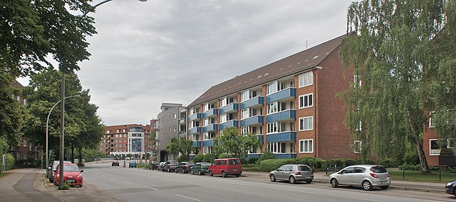
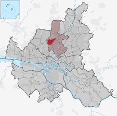
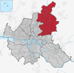
Hamburg-Nord (Bezirk Hamburg-Nord)

- borough of Hamburg, Germany
 Hiking in Hamburg-Nord
Hamburg-Nord, a district of Hamburg, Germany, offers several outdoor activities and green spaces suitable for hiking. While it might not have the extensive mountain trails found in more rural areas, there are still numerous paths and parks to explore, making it a pleasant area for walks and light hiking.
Key Areas for Hiking in Hamburg-Nord:
-
Outer Alster Lake (Außenalster):
- The area around the Outer Alster Lake is perfect for a leisurely hike. It features scenic paths along the water, providing lovely views of the lake and surrounding parks. The trail is approximately 7 kilometers around the lake.
-
Hamburg Stadtpark:
- This large public park is a great option for hiking and offers various paths, gardens, and open spaces. You can enjoy the peaceful atmosphere, beautiful landscaping, and even a small lake. It's also a good spot for a picnic after your hike.
-
Boberger Niederung Nature Reserve:
- A bit further afield, this nature reserve offers a unique landscape with wetlands, meadows, and woods. There are multiple trails to explore, making it a great spot for nature lovers and those looking for a more natural hiking experience.
-
Lakes and Parks:
- In addition to the Outer Alster, you can explore several smaller lakes and parks throughout the district, such as the Eppendorfer Moor which has some nice walking trails surrounded by nature.
-
Ohlsdorf Cemetery:
- While it may be an unconventional choice, Ohlsdorf Cemetery features expansive grounds that can be explored, with beautiful paths, gardens, and historical monuments. It’s a peaceful place to walk and reflect.
Tips for Hiking in Hamburg-Nord:
- Weather: Be sure to check the weather before heading out, as it can be quite variable.
- Footwear: Wear comfortable shoes suitable for walking, as some paths may be uneven.
- Hydration: Bring water, especially if you plan to hike for an extended period.
- Wildlife: Keep an eye out for local wildlife, especially in natural areas like Boberger Niederung.
- Public Transport: Hamburg has an excellent public transport system, making it easy to reach many of these hiking spots.
Overall, Hamburg-Nord may not offer strenuous hiking opportunities, but its parks and lakes provide a lovely environment for casual hikes and walks, perfect for enjoying nature within the city.
- Country:

- Coordinates: 53° 37' 0" N, 10° 0' 0" E


- GPS tracks (wikiloc): [Link]
- AboveSeaLevel: 11 м m
- Area: 57.5 sq km
- Web site: http://www.hamburg.de/hamburg-nord/
- Wikipedia en: wiki(en)
- Wikipedia: wiki(de)
- Wikidata storage: Wikidata: Q1627
- Wikipedia Commons Category: [Link]
- Freebase ID: [/m/043mg55]
- GeoNames ID: Alt: [8354626]
- VIAF ID: Alt: [247394726]
- OSM relation ID: [30352]
- archINFORM location ID: [7751]
- TGN ID: [7179574]
Includes regions:


Barmbek-Nord
- district of Northern Hamburg, Hamburg, Germany
Hiking in Barmbek-Nord
Barmbek-Nord is a neighborhood in Hamburg, Germany, that primarily features urban landscapes rather than traditional hiking trails. However, it does offer opportunities for walking and exploring green spaces....
- Country:
- Coordinates: 53° 36' 19" N, 10° 2' 24" E
- GPS tracks (wikiloc): [Link]
- AboveSeaLevel: 20 м m
- Area: 3.9 sq km
- Population: 40261

Barmbek-Süd
- district of the German city of Hamburg
Hiking in Barmbek-Süd
Barmbek-Süd is a district in Hamburg, Germany, known predominantly as a residential area rather than a hiking destination. However, it does offer some opportunities for enjoyable walks and nature exploration. While it may not have extensive hiking trails like those found in national parks or wilderness areas, you can still find pleasant green spaces and parks for leisurely walks....
- Country:
- Coordinates: 53° 34' 48" N, 10° 2' 26" E
- GPS tracks (wikiloc): [Link]
- AboveSeaLevel: 8 м m
- Area: 3.1 sq km


Dulsberg
- quarter of the Germany city of Hamburg
Hiking in Dulsberg
Dulsberg is a district in Hamburg, Germany, primarily known for its residential neighborhoods rather than traditional hiking areas. However, if you're interested in exploring nature and enjoying outdoor activities, there are several ways you can incorporate hiking into your experience in and around Dulsberg....
- Country:
- Coordinates: 53° 34' 54" N, 10° 3' 48" E
- GPS tracks (wikiloc): [Link]
- Area: 1.2 sq km


Uhlenhorst
- quarter of the German city of Hamburg
Hiking in Uhlenhorst
Uhlenhorst is a neighborhood in Hamburg, Germany, known primarily for its residential areas and tranquil lakeside parks rather than traditional hiking trails. However, you can still enjoy walking and exploring the scenic beauty of this waterfront area....
- Country:
- Local Dialing Code: 040
- Coordinates: 53° 34' 21" N, 10° 1' 7" E
- GPS tracks (wikiloc): [Link]
- AboveSeaLevel: 14 м m
- Area: 2.2 sq km


Hohenfelde
- quarter of the German city of Hamburg
Hiking in Hohenfelde
Hohenfelde is a district in Hamburg, Germany, known for its charming residential areas and proximity to some parks and green spaces, making it a lovely spot for those seeking urban hiking experiences. While Hohenfelde itself may not have extensive hiking trails typical of rural areas, there are several nearby options that provide great opportunities for outdoor activities....
- Country:
- Coordinates: 53° 33' 42" N, 10° 1' 15" E
- GPS tracks (wikiloc): [Link]
- AboveSeaLevel: 83 м m
- Area: 1.1 sq km
- Web site: [Link]


Winterhude
- quarter of the German city of Hamburg
Hiking in Winterhude
Winterhude is a well-known district in Hamburg, Germany, and while it may not be famous for traditional hiking trails like some national parks or mountains, it offers some beautiful outdoor spaces that are perfect for walking, jogging, and light hiking....
- Country:
- Coordinates: 53° 36' 0" N, 10° 0' 0" E
- GPS tracks (wikiloc): [Link]
- AboveSeaLevel: 16 м m
- Area: 7.6 sq km


Eppendorf
- quarter of the German city of Hamburg
Hiking in Eppendorf
Eppendorf is a charming neighborhood in Hamburg known for its picturesque streets, historic buildings, and proximity to the Alster River. While Eppendorf is not traditionally thought of as a hiking destination like the surrounding nature areas, it does offer some pleasant walking and hiking opportunities suitable for leisurely explorations....
- Country:
- Coordinates: 53° 35' 44" N, 9° 59' 2" E
- GPS tracks (wikiloc): [Link]
- AboveSeaLevel: 11 м m
- Area: 2.7 sq km


Ohlsdorf
- quarter of the German city of Hamburg
Hiking in Ohlsdorf
Ohlsdorf, located in the northern part of Hamburg, is primarily known for its large cemetery, the Ohlsdorf Cemetery (Friedhof Ohlsdorf), which is one of the largest park cemeteries in the world. While Ohlsdorf might not be a traditional hiking destination, it does offer some pleasant walking opportunities, particularly for those who enjoy serene environments....
- Country:
- Coordinates: 53° 37' 33" N, 10° 1' 53" E
- GPS tracks (wikiloc): [Link]
- AboveSeaLevel: 14 м m
- Area: 7.2 sq km


Fuhlsbüttel
- quarter of the city of Hamburg, Germany
Hiking in Fuhlsbüttel
Fuhlsbüttel is a district in Hamburg, Germany, primarily known for its residential areas and proximity to the Hamburg Airport. While it might not be a classic hiking destination, there are still outdoor activities and green spaces nearby that can provide for enjoyable walks and light hikes....
- Country:
- Coordinates: 53° 38' 6" N, 10° 0' 58" E
- GPS tracks (wikiloc): [Link]
- AboveSeaLevel: 17 м m
- Area: 6.6 sq km


Alsterdorf
- quarter of the German city of Hamburg
Hiking in Alsterdorf
Alsterdorf is a neighborhood located in Hamburg, Germany, and while it may not be widely known for traditional hiking like you would find in mountainous regions, there are still some lovely walking paths and green spaces that can be enjoyed by those looking to hike in an urban setting....
- Country:
- Coordinates: 53° 36' 0" N, 10° 0' 0" E
- GPS tracks (wikiloc): [Link]
- AboveSeaLevel: 13 м m
- Area: 3.1 sq km
- Population: 13271

Groß Borstel
- quarter of the German city of Hamburg
Hiking in Groß Borstel
Groß Borstel, located in the Hamburg district of Hamburg-Nord, is not primarily known as a hiking destination. However, it does have some lovely green areas and parks that can offer pleasant walks and outdoor experiences right within the urban environment....
- Country:
- Coordinates: 53° 36' 49" N, 9° 58' 57" E
- GPS tracks (wikiloc): [Link]
- AboveSeaLevel: 17 м m
- Area: 4.5 sq km


Langenhorn
- quarter of the German city of Hamburg
Hiking in Langenhorn
Langenhorn is a pleasant area in the northern part of Hamburg, Germany. While it's not a traditional hiking destination like mountainous regions, there are still opportunities for enjoyable walks and nature exploration in and around Langenhorn. Here are a few activities and suggestions for hiking or walking in the area:...
- Country:
- Postal Code: 22419; 22417; 22415
- Local Dialing Code: 040
- Coordinates: 53° 39' 0" N, 10° 0' 0" E
- GPS tracks (wikiloc): [Link]
- AboveSeaLevel: 27 м m
- Area: 13.8 sq km
- Population: 41560
Hoheluft
- quarter of the German city of Hamburg
Hiking in Hoheluft
Hoheluft is a district in Hamburg, Germany, which is primarily urban and doesn’t have the same type of hiking opportunities as rural areas or national parks. However, you can enjoy some scenic walks and green spaces within the city....
- Country:
- Coordinates: 53° 34' 58" N, 9° 58' 33" E
- GPS tracks (wikiloc): [Link]
- AboveSeaLevel: 83 м m
- Area: 1.3 sq km
- Web site: [Link]
Shares border with regions:

Hamburg-Mitte
- district of Hamburg, Germany
Hiking in Hamburg-Mitte
Hiking in Hamburg-Mitte offers a unique blend of urban exploration, historical sites, and beautiful green spaces. While the area is predominantly urban, there are several parks and nature areas where you can enjoy some fresh air and scenic views. Here are a few highlights and suggestions for hiking and outdoor activities in Hamburg-Mitte:...
- Country:
- Coordinates: 53° 33' 1" N, 9° 59' 39" E
- GPS tracks (wikiloc): [Link]
- AboveSeaLevel: 11 м m
- Area: 142.2 sq km
- Population: 301550


Eimsbüttel
- borough of Hamburg, Germany
Hiking in Eimsbüttel
Eimsbüttel is a vibrant district in Hamburg, Germany, known more for its urban scenery than traditional hiking. However, while it may not offer expansive wilderness trails, there are plenty of opportunities for urban hiking and enjoying nature within the city environment....
- Country:
- Coordinates: 53° 34' 28" N, 9° 57' 34" E
- GPS tracks (wikiloc): [Link]
- AboveSeaLevel: 15 м m
- Area: 50.1 sq km
- Population: 258865
Wandsbek
- borough of Hamburg, Germany
Hiking in Wandsbek
Wandsbek is a district in Hamburg, Germany, known more for its urban landscape than traditional hiking trails. However, there are several parks, nature reserves, and green spaces where you can enjoy walking and light hiking activities. Here are some highlights for hiking and outdoor exploration in the Wandsbek area:...
- Country:
- Local Dialing Code: 040
- Coordinates: 53° 35' 0" N, 10° 5' 0" E
- GPS tracks (wikiloc): [Link]
- Area: 147.5 sq km
- Population: 435235
- Web site: [Link]
Segeberg
- district in Germany
Hiking in Segeberg
Segeberg, located in Schleswig-Holstein, Germany, offers a variety of hiking opportunities amidst its beautiful natural landscapes. The area is renowned for its rolling hills, dense forests, and picturesque lakes, making it a great destination for outdoor enthusiasts....
- Country:
- Licence Plate Code: SE
- Coordinates: 53° 55' 12" N, 10° 10' 12" E
- GPS tracks (wikiloc): [Link]
- AboveSeaLevel: 37 м m
- Area: 1344.39 sq km
- Population: 272235
- Web site: [Link]