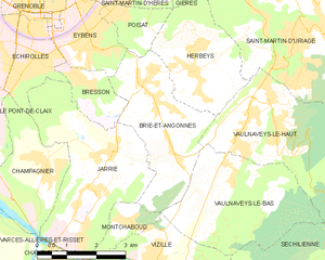
Herbeys (Herbeys)

- commune in Isère, France
 Hiking in Herbeys
Herbeys is a charming village located near the French Alps, offering a range of hiking opportunities for outdoor enthusiasts. Here are some highlights and tips for hiking in Herbeys:
Trails and Scenery
-
Diverse Terrain: The area around Herbeys features a variety of landscapes, including forests, meadows, and rocky paths. This diverse terrain offers hikers stunning views of the surrounding mountains and valleys.
-
Accessible Trails: There are numerous hiking trails suitable for different skill levels. Whether you are a beginner or an experienced hiker, you can find a trail that matches your abilities.
-
Nearby Mountain Peaks: Many trails lead to panoramic viewpoints and mountain peaks, allowing for breathtaking vistas. Some popular nearby peaks include the Chartreuse Mountains and the Vercors.
-
Flora and Fauna: Hikers can enjoy the rich biodiversity of the region, with opportunities to spot various wildlife and unique Alpine plants.
Hiking Tips
-
Preparation: Always check weather conditions before heading out, as mountain weather can change rapidly. Bring adequate clothing, water, and snacks.
-
Trail Maps: Familiarize yourself with trail maps and markers. Local tourist offices often provide maps and information about trail conditions.
-
Safety: Hiking alone can be risky, especially on less-trafficked trails. Consider going with a buddy or informing someone of your plans if hiking solo.
-
Respect Nature: Stay on marked trails, pack out all trash, and respect wildlife and plant life to preserve the natural beauty of the area.
Facilities
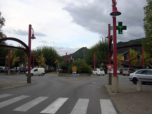
- Local Amenities: Herbeys has local amenities like restaurants and accommodations that can enhance your hiking experience. It's a good idea to enjoy some local cuisine after a day out on the trails.
Seasonal Considerations
-
Spring and Summer: These are the most popular hiking seasons, with blooming wildflowers and pleasant temperatures.
-
Autumn: The fall foliage can offer stunning scenery, but be cautious of wet or slippery trails.
-
Winter: Hiking can be more challenging in winter due to snow. Check for trails suitable for snowshoeing or winter hiking if you plan to hike during this season.
Hiking in Herbeys can be an enriching experience, combining physical activity with the beauty of nature and the charm of the French Alps. Happy hiking!
- Country:

- Postal Code: 38320
- Coordinates: 45° 8' 20" N, 5° 47' 36" E


- GPS tracks (wikiloc): [Link]
- Area: 7.73 sq km
- Population: 1364
- Web site: http://www.herbeys.fr
- Wikipedia en: wiki(en)
- Wikipedia: wiki(fr)
- Wikidata storage: Wikidata: Q1153199
- Wikipedia Commons Category: [Link]
- Freebase ID: [/m/03nvk42]
- GeoNames ID: Alt: [6433210]
- SIREN number: [213801889]
- BnF ID: [152580067]
- VIAF ID: Alt: [244233972]
- INSEE municipality code: 38188
Shares border with regions:

Vaulnaveys-le-Haut
- commune in Isère, France
Hiking in Vaulnaveys-le-Haut
Vaulnaveys-le-Haut is a charming village located in the French Alps, nestled just south of Grenoble. This picturesque area offers a variety of hiking opportunities for outdoor enthusiasts of all skill levels. The beautiful landscapes, stunning mountain views, and rich natural surroundings make it an ideal destination for hiking....
- Country:
- Postal Code: 38410
- Coordinates: 45° 7' 6" N, 5° 48' 37" E
- GPS tracks (wikiloc): [Link]
- Area: 19.86 sq km
- Population: 3707
- Web site: [Link]

Brié-et-Angonnes
- commune in Isère, France
Hiking in Brié-et-Angonnes
Brié-et-Angonnes is a charming commune located in the Auvergne-Rhône-Alpes region of France, situated near the city of Grenoble. The area offers a variety of hiking opportunities that cater to different skill levels, making it a great destination for both beginners and experienced hikers....
- Country:
- Postal Code: 38320
- Coordinates: 45° 6' 41" N, 5° 47' 12" E
- GPS tracks (wikiloc): [Link]
- Area: 9.7 sq km
- Population: 2531
- Web site: [Link]

Poisat
- commune in Isère, France
Hiking in Poisat
Poisat, located near Grenoble in the French Alps, offers beautiful hiking options with stunning views of the surrounding mountains and valleys. Here are some key points about hiking in the Poisat area:...
- Country:
- Postal Code: 38320
- Coordinates: 45° 9' 29" N, 5° 45' 43" E
- GPS tracks (wikiloc): [Link]
- Area: 2.56 sq km
- Population: 2165
- Web site: [Link]


Saint-Martin-d'Uriage
- commune in Isère, France
Hiking in Saint-Martin-d'Uriage
Saint-Martin-d'Uriage is a charming commune located in the Isère department of southeastern France. Nestled at the foothills of the Belledonne mountain range, it offers a variety of hiking opportunities that cater to different skill levels and preferences....
- Country:
- Postal Code: 38410
- Coordinates: 45° 9' 8" N, 5° 50' 21" E
- GPS tracks (wikiloc): [Link]
- Area: 29.69 sq km
- Population: 5408
- Web site: [Link]

Gières
- commune in Isère, France
Hiking in Gières
Gières is a charming village located in the Auvergne-Rhône-Alpes region of France, near the city of Grenoble. It boasts a scenic backdrop of the surrounding mountains, making it a wonderful place for hiking enthusiasts. Here are some key points to consider if you're planning to hike in or around Gières:...
- Country:
- Postal Code: 38610
- Coordinates: 45° 10' 55" N, 5° 47' 31" E
- GPS tracks (wikiloc): [Link]
- Area: 6.93 sq km
- Population: 6483
- Web site: [Link]