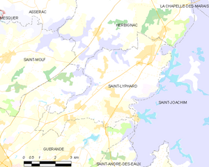
Herbignac (Herbignac)

- commune in Loire-Atlantique, France
- Country:

- Postal Code: 44410
- Coordinates: 47° 26' 56" N, 2° 19' 3" E


- GPS tracks (wikiloc): [Link]
- Area: 71.43 sq km
- Population: 6582
- Web site: http://www.herbignac.com
- Wikipedia en: wiki(en)
- Wikipedia: wiki(fr)
- Wikidata storage: Wikidata: Q752379
- Wikipedia Commons Category: [Link]
- Freebase ID: [/m/03nwcvg]
- Freebase ID: [/m/03nwcvg]
- GeoNames ID: Alt: [3013484]
- GeoNames ID: Alt: [3013484]
- SIREN number: [214400723]
- SIREN number: [214400723]
- BnF ID: [15260241k]
- BnF ID: [15260241k]
- VIAF ID: Alt: [167441532]
- VIAF ID: Alt: [167441532]
- GND ID: Alt: [4367005-2]
- GND ID: Alt: [4367005-2]
- Library of Congress authority ID: Alt: [nr96008360]
- Library of Congress authority ID: Alt: [nr96008360]
- INSEE municipality code: 44072
- INSEE municipality code: 44072
Shares border with regions:

Saint-Lyphard
- commune in Loire-Atlantique, France
- Country:
- Postal Code: 44410
- Coordinates: 47° 23' 52" N, 2° 18' 28" E
- GPS tracks (wikiloc): [Link]
- Area: 24.63 sq km
- Population: 4627
- Web site: [Link]


La Roche-Bernard
- commune in Morbihan, France
- Country:
- Postal Code: 56130
- Coordinates: 47° 31' 6" N, 2° 17' 57" E
- GPS tracks (wikiloc): [Link]
- Area: 0.43 sq km
- Population: 666
- Web site: [Link]


Saint-Joachim
- commune in Loire-Atlantique, France
- Country:
- Postal Code: 44720
- Coordinates: 47° 22' 56" N, 2° 12' 3" E
- GPS tracks (wikiloc): [Link]
- Area: 86.22 sq km
- Population: 3934
- Web site: [Link]

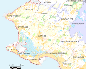
Guérande
- commune in Loire-Atlantique, Brittany, France
- Country:
- Postal Code: 44350
- Coordinates: 47° 19' 41" N, 2° 25' 45" E
- GPS tracks (wikiloc): [Link]
- Area: 81.44 sq km
- Population: 16294
- Web site: [Link]


Missillac
- commune in Loire-Atlantique, France
- Country:
- Postal Code: 44780
- Coordinates: 47° 28' 56" N, 2° 9' 32" E
- GPS tracks (wikiloc): [Link]
- Area: 59.55 sq km
- Population: 5199
- Web site: [Link]


Saint-Molf
- commune in Loire-Atlantique, France
- Country:
- Postal Code: 44350
- Coordinates: 47° 23' 29" N, 2° 25' 30" E
- GPS tracks (wikiloc): [Link]
- Area: 22.82 sq km
- Population: 2499
- Web site: [Link]
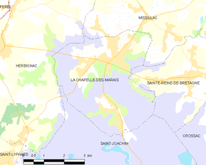
La Chapelle-des-Marais
- commune in Loire-Atlantique, France
- Country:
- Postal Code: 44410
- Coordinates: 47° 26' 50" N, 2° 14' 30" E
- GPS tracks (wikiloc): [Link]
- Area: 18.05 sq km
- Population: 4069
- Web site: [Link]

Férel
- commune in Morbihan, France
- Country:
- Postal Code: 56130
- Coordinates: 47° 28' 56" N, 2° 20' 37" E
- GPS tracks (wikiloc): [Link]
- Area: 28.9 sq km
- Population: 3151
- Web site: [Link]


Camoël
- commune in Morbihan, France
- Country:
- Postal Code: 56130
- Coordinates: 47° 28' 55" N, 2° 23' 42" E
- GPS tracks (wikiloc): [Link]
- Area: 14.33 sq km
- Population: 988


Nivillac
- commune in Morbihan, France
- Country:
- Postal Code: 56130
- Coordinates: 47° 32' 2" N, 2° 16' 57" E
- GPS tracks (wikiloc): [Link]
- Area: 55.48 sq km
- Population: 4490
- Web site: [Link]


Assérac
- commune in Loire-Atlantique, France
- Country:
- Postal Code: 44410
- Coordinates: 47° 25' 45" N, 2° 23' 26" E
- GPS tracks (wikiloc): [Link]
- Area: 32.91 sq km
- Population: 1801
- Web site: [Link]