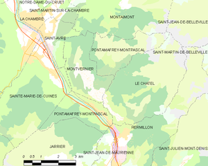
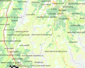
Hermillon (Hermillon)
- commune in Savoie, France
Hermillon, located in the Savoie region of the French Alps, offers a range of beautiful hiking opportunities amidst stunning mountain scenery. The area is characterized by its picturesque landscapes, charming villages, and a variety of trails that cater to different skill levels.
Key Highlights for Hiking in Hermillon
-
Scenic Routes: The trails around Hermillon provide breathtaking views of the surrounding peaks, valleys, and forests. Lookout points along the paths often reveal panoramic vistas, especially of Mont Blanc on clear days.
-
Trail Variety: There are both easy and challenging trails suitable for families, casual hikers, and experienced trekkers. The area features well-marked paths that are accessible during the warmer months, typically from late spring to early autumn.
-
Flora and Fauna: As you hike, you'll likely encounter a diverse array of wildlife and flora. Keep an eye out for native species, and enjoy the beautiful wildflowers that bloom during the summer months.
-
Cultural Sites: Some trails may lead you through traditional alpine villages where you can experience local culture and cuisine. Stopping for a meal or a snack at a mountain refuge can enhance your hiking experience.
-
Guided Tours: For those unfamiliar with the area, consider joining a guided hiking tour. Local guides can offer insights into the landscape, history, and best practices for hiking in the region.
-
Preparation: It's important to prepare adequately for hiking in Hermillon. Bring proper hiking gear, plenty of water, and snacks. Be mindful of the weather, as conditions can change rapidly in the mountains.
-
Safety: Always let someone know your hiking plans, and try to stay on marked trails. Carry a map or GPS device in case you need to navigate your way back.
If you’re planning a hiking trip to Hermillon, be sure to check local conditions and trail status before heading out, and enjoy the stunning natural beauty of the Alps!
- Country:

- Postal Code: 73300
- Coordinates: 45° 17' 54" N, 6° 21' 44" E


- GPS tracks (wikiloc): [Link]
- Area: 14.06 sq km
- Population: 572
- Wikipedia en: wiki(en)
- Wikipedia: wiki(fr)
- Wikidata storage: Wikidata: Q1231270
- Wikipedia Commons Category: [Link]
- Freebase ID: [/m/02q1ptd]
- GeoNames ID: Alt: [6442807]
- SIREN number: [217301357]
- BnF ID: [152740687]
- WOEID: [594731]
- INSEE municipality code: 73135
Shares border with regions:


Pontamafrey-Montpascal
- commune in Savoie, France
 Hiking in Pontamafrey-Montpascal
Pontamafrey-Montpascal is a scenic area in the Savoie region of France, known for its beautiful landscapes, diverse trails, and rich natural flora and fauna. While specific trails can vary, here are some general guidelines and tips for hiking in this region:...
- Country:

- Postal Code: 73300
- Coordinates: 45° 18' 45" N, 6° 20' 29" E


- GPS tracks (wikiloc): [Link]
- Area: 11.59 sq km
- Population: 312
- Web site: [Link]


Le Châtel
- commune in Savoie, France
Le Châtel, a picturesque area located in the French Alps, offers a variety of hiking opportunities suited for different skill levels. It's a less crowded destination compared to some of the more famous Alpine regions, making it a great choice for those seeking tranquility and natural beauty....
- Country:

- Postal Code: 73300
- Coordinates: 45° 18' 25" N, 6° 21' 32" E


- GPS tracks (wikiloc): [Link]
- Area: 15.31 sq km
- Population: 195
- Web site: [Link]


Saint-Jean-de-Maurienne
- commune in Savoie, France
 Hiking in Saint-Jean-de-Maurienne
Saint-Jean-de-Maurienne, located in the Savoie region of the French Alps, is a fantastic destination for hiking enthusiasts, offering a mix of stunning natural landscapes, rich cultural heritage, and a variety of trails suitable for different skill levels....
- Country:

- Postal Code: 73300
- Coordinates: 45° 16' 36" N, 6° 20' 42" E


- GPS tracks (wikiloc): [Link]
- Area: 11.51 sq km
- Population: 7809
- Web site: [Link]


Saint-Julien-Mont-Denis
- commune in Savoie, France
 Hiking in Saint-Julien-Mont-Denis
Saint-Julien-Mont-Denis is a picturesque village located in the Savoie region of the French Alps, offering a variety of hiking opportunities for all skill levels. Nestled against a backdrop of stunning mountains, the area is popular among outdoor enthusiasts, particularly during the warmer months....
- Country:

- Postal Code: 73870
- Coordinates: 45° 15' 23" N, 6° 24' 16" E


- GPS tracks (wikiloc): [Link]
- Area: 33.04 sq km
- Population: 1629
- Web site: [Link]


Saint-Jean-de-Belleville
- commune in Savoie, France
 Hiking in Saint-Jean-de-Belleville
Saint-Jean-de-Belleville is a charming alpine village located in the Savoie region of the French Alps, offering beautiful landscapes and a variety of hiking opportunities. Situated near the Trois Vallées ski area, it serves as a fantastic base for exploring the surrounding mountains, particularly in the warmer months when the snow melts and trails become accessible....
- Country:

- Postal Code: 73440
- Coordinates: 45° 25' 37" N, 6° 29' 6" E


- GPS tracks (wikiloc): [Link]
- Area: 59.6 sq km
- Population: 535
- Web site: [Link]
