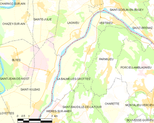
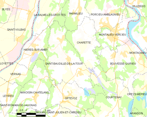
Hières-sur-Amby (Hières-sur-Amby)
- commune in Isère, France
Hières-sur-Amby is a charming commune located in the Isère department in the Auvergne-Rhône-Alpes region of France. It’s surrounded by natural beauty and offers various hiking opportunities, making it a great destination for outdoor enthusiasts.
Hiking Highlights in Hières-sur-Amby
-
Scenic Trails: The area around Hières-sur-Amby features several trails that cater to different skill levels. These trails often offer beautiful views of the surrounding mountains, valleys, and the picturesque landscape typical of this region.
-
Nature and Wildlife: While hiking, you may encounter diverse flora and fauna. The area is rich in natural habitats supported by the varied terrain.
-
Nearby Natural Parks: The proximity to larger natural parks, such as Chartreuse and Vercors, allows for extended hiking trips into more rugged wilderness if you're looking for a challenge or to explore more remote areas.
-
Cultural Experiences: Besides the natural scenery, the region has historical sites and local culture that you can explore, adding a rich context to your hiking experience.
-
Accessibility: Many trails in and around Hières-sur-Amby are accessible for families and beginners, making it an excellent spot for those new to hiking or looking for leisurely walks.
Tips for Hiking in Hières-sur-Amby
-
Prepare Accordingly: Depending on the season, weather conditions can vary, so be sure to check the forecast and dress appropriately.
-
Footwear: Wear sturdy hiking boots for comfort and support, especially if you plan on tackling uneven terrain.
-
Essentials: Carry water, snacks, and a map or GPS device for navigation.
-
Local Advice: Consider stopping by local tourist information centers for updated trail maps and recommendations tailored to your hiking preferences.
-
Leave No Trace: Always practice Leave No Trace principles to preserve the natural beauty for future hikers.
Overall, hiking in Hières-sur-Amby allows you to immerse yourself in beautiful natural surroundings while offering experiences that cater to hikers, from tranquil walks to more adventurous treks. Enjoy your time exploring the great outdoors!
- Country:

- Postal Code: 38118
- Coordinates: 45° 47' 51" N, 5° 17' 38" E


- GPS tracks (wikiloc): [Link]
- AboveSeaLevel: 429 м m
- Area: 8.73 sq km
- Population: 1245
- Web site: http://www.hieressuramby.fr
- Wikipedia en: wiki(en)
- Wikipedia: wiki(fr)
- Wikidata storage: Wikidata: Q624444
- Wikipedia Commons Category: [Link]
- Freebase ID: [/m/03nvjcp]
- GeoNames ID: Alt: [6433212]
- SIREN number: [213801905]
- BnF ID: [15258008x]
- VIAF ID: Alt: [143215075]
- Library of Congress authority ID: Alt: [n93020719]
- PACTOLS thesaurus ID: [pcrtRRbSYevGp5]
- Digital Atlas of the Roman Empire ID: [17326]
- INSEE municipality code: 38190
Shares border with regions:


Annoisin-Chatelans
- commune in Isère, France
Annoisin-Chatelans, located in the Isère department of the Auvergne-Rhône-Alpes region in southeastern France, offers a variety of hiking opportunities for all skill levels. Nestled near the foothills of the French Alps, this area features beautiful landscapes, lush greenery, and scenic views....
- Country:

- Postal Code: 38460
- Coordinates: 45° 45' 25" N, 5° 17' 36" E


- GPS tracks (wikiloc): [Link]
- Area: 13.27 sq km
- Population: 666


La Balme-les-Grottes
- commune in Isère, France
 Hiking in La Balme-les-Grottes
La Balme-les-Grottes is a charming village in the Auvergne-Rhône-Alpes region of France, known for its stunning natural surroundings and the remarkable geological formations that attract hikers and outdoor enthusiasts. Here are some highlights regarding hiking in this area:...
- Country:

- Postal Code: 38390
- Coordinates: 45° 51' 9" N, 5° 20' 12" E


- GPS tracks (wikiloc): [Link]
- Area: 14.61 sq km
- Population: 1011
- Web site: [Link]


Vernas
- commune in Isère, France
Hiking in Vernas, a picturesque area in the French Alps, offers a variety of trails suited for all skill levels, from gentle walks to challenging mountain ascents. Here are a few key highlights to consider when hiking in this beautiful region:...
- Country:

- Postal Code: 38460
- Coordinates: 45° 46' 39" N, 5° 16' 54" E


- GPS tracks (wikiloc): [Link]
- Area: 5.87 sq km
- Population: 257


Saint-Baudille-de-la-Tour
- commune in Isère, France
 Hiking in Saint-Baudille-de-la-Tour
Saint-Baudille-de-la-Tour is a charming commune located in the Isère department in the Auvergne-Rhône-Alpes region of southeastern France. It serves as an excellent starting point for outdoor activities, including hiking, thanks to its scenic landscapes and proximity to the Alps....
- Country:

- Postal Code: 38118
- Coordinates: 45° 47' 23" N, 5° 20' 18" E


- GPS tracks (wikiloc): [Link]
- Area: 21.76 sq km
- Population: 797
- Web site: [Link]

Saint-Vulbas
- commune in Ain, France
Saint-Vulbas is a charming commune located in the Ain department of the Auvergne-Rhône-Alpes region in France. It’s a great spot for hiking enthusiasts due to its picturesque landscapes, relatively accessible trail systems, and proximity to natural features....
- Country:

- Postal Code: 01150
- Coordinates: 45° 50' 2" N, 5° 17' 27" E


- GPS tracks (wikiloc): [Link]
- Area: 21.44 sq km
- Population: 1194
- Web site: [Link]
