Annoisin-Chatelans (Annoisin-Chatelans)
- commune in Isère, France
Annoisin-Chatelans, located in the Isère department of the Auvergne-Rhône-Alpes region in southeastern France, offers a variety of hiking opportunities for all skill levels. Nestled near the foothills of the French Alps, this area features beautiful landscapes, lush greenery, and scenic views.
Hiking Highlights in Annoisin-Chatelans:
-
Diverse Trails: The region boasts numerous hiking trails that vary in difficulty, from easy walks suitable for families to more challenging routes for experienced hikers. Many trails allow you to explore the natural beauty of the surrounding countryside.
-
Natural Beauty: While hiking, you can enjoy picturesque views of the Alps, rolling hills, and charming villages. The area is rich in flora and fauna, making it a great spot for nature lovers.
-
Cultural Sightseeing: Along the trails, you might encounter historical sites and local architecture, providing a chance to immerse yourself in the region's culture. Don’t miss the local churches and traditional farmhouses.
-
Accessibility: Annoisin-Chatelans is relatively close to larger cities like Grenoble and Lyon, making it a convenient location for day hikes or longer excursions from urban areas.
Tips for Hiking in the Area:
-
Prepare Adequately: Check the weather forecast before heading out, as conditions can change rapidly in mountainous regions. Dress in layers and wear appropriate hiking boots.
-
Map and Navigation: Familiarize yourself with trail maps and use a GPS device or a hiking app, as some trails may not be well-marked.
-
Stay Hydrated and Snack Smart: Bring enough water and food to keep your energy up during the hikes. There are often limited facilities on the trails.
-
Respect Nature: Follow Leave No Trace principles by staying on marked trails, respecting wildlife, and carrying your trash out with you.
Conclusion:
Hiking in Annoisin-Chatelans can be a rewarding experience for both novices and seasoned hikers. With beautiful landscapes and a blend of nature and culture, it offers a perfect getaway for outdoor enthusiasts. Always remember to prioritize safety and be well-prepared for your hiking adventure!
- Country:

- Postal Code: 38460
- Coordinates: 45° 45' 25" N, 5° 17' 36" E


- GPS tracks (wikiloc): [Link]
- Area: 13.27 sq km
- Population: 666
- Wikipedia en: wiki(en)
- Wikipedia: wiki(fr)
- Wikidata storage: Wikidata: Q1008806
- Wikipedia Commons Category: [Link]
- Freebase ID: [/m/03g_7mf]
- GeoNames ID: Alt: [6448708]
- SIREN number: [213800105]
- BnF ID: [152578395]
- INSEE municipality code: 38010
Shares border with regions:


Vernas
- commune in Isère, France
Hiking in Vernas, a picturesque area in the French Alps, offers a variety of trails suited for all skill levels, from gentle walks to challenging mountain ascents. Here are a few key highlights to consider when hiking in this beautiful region:...
- Country:

- Postal Code: 38460
- Coordinates: 45° 46' 39" N, 5° 16' 54" E


- GPS tracks (wikiloc): [Link]
- Area: 5.87 sq km
- Population: 257

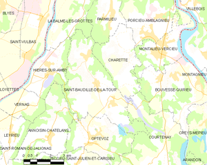
Saint-Baudille-de-la-Tour
- commune in Isère, France
 Hiking in Saint-Baudille-de-la-Tour
Saint-Baudille-de-la-Tour is a charming commune located in the Isère department in the Auvergne-Rhône-Alpes region of southeastern France. It serves as an excellent starting point for outdoor activities, including hiking, thanks to its scenic landscapes and proximity to the Alps....
- Country:

- Postal Code: 38118
- Coordinates: 45° 47' 23" N, 5° 20' 18" E


- GPS tracks (wikiloc): [Link]
- Area: 21.76 sq km
- Population: 797
- Web site: [Link]

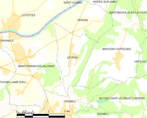
Leyrieu
- commune in Isère, France
Leyrieu is a charming village located in the Auvergne-Rhône-Alpes region of France. Surrounded by beautiful natural landscapes, it offers several opportunities for hiking and outdoor activities. Here are some key points to consider when hiking in Leyrieu:...
- Country:

- Postal Code: 38460
- Coordinates: 45° 45' 28" N, 5° 15' 18" E


- GPS tracks (wikiloc): [Link]
- Area: 6.39 sq km
- Population: 799


Crémieu
- commune in Isère, France
Crémieu is a charming medieval town located in the Auvergne-Rhône-Alpes region of France, just northwest of Lyon. It offers a wonderful setting for hikers, combining historical sights with beautiful natural landscapes. Here are some key points about hiking in and around Crémieu:...
- Country:

- Postal Code: 38460
- Coordinates: 45° 43' 29" N, 5° 15' 5" E


- GPS tracks (wikiloc): [Link]
- AboveSeaLevel: 415 м m
- Area: 6.14 sq km
- Population: 3312
- Web site: [Link]
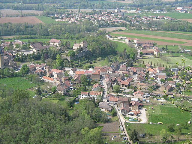

Hières-sur-Amby
- commune in Isère, France
Hières-sur-Amby is a charming commune located in the Isère department in the Auvergne-Rhône-Alpes region of France. It’s surrounded by natural beauty and offers various hiking opportunities, making it a great destination for outdoor enthusiasts....
- Country:

- Postal Code: 38118
- Coordinates: 45° 47' 51" N, 5° 17' 38" E


- GPS tracks (wikiloc): [Link]
- AboveSeaLevel: 429 м m
- Area: 8.73 sq km
- Population: 1245
- Web site: [Link]
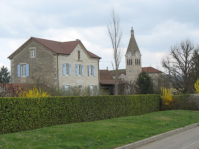
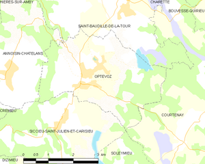
Optevoz
- commune in Isère, France
Optevoz is a charming commune in the Isère department of the Auvergne-Rhône-Alpes region in southeastern France. While it may not be one of the most famous hiking destinations, it offers a beautiful backdrop for outdoor activities, including hiking, especially if you enjoy picturesque views and a more tranquil setting away from larger tourist crowds....
- Country:

- Postal Code: 38460
- Coordinates: 45° 45' 9" N, 5° 19' 53" E


- GPS tracks (wikiloc): [Link]
- Area: 12 sq km
- Population: 829
- Web site: [Link]


Siccieu-Saint-Julien-et-Carisieu
- commune in Isère, France
 Hiking in Siccieu-Saint-Julien-et-Carisieu
Siccieu-Saint-Julien-et-Carisieu is a picturesque commune located in the Isère department of the Auvergne-Rhône-Alpes region in southeastern France. It is surrounded by beautiful landscapes that offer excellent hiking opportunities. Here are some insights into hiking in this region:...
- Country:

- Postal Code: 38460
- Coordinates: 45° 44' 6" N, 5° 18' 58" E


- GPS tracks (wikiloc): [Link]
- AboveSeaLevel: 335 м m
- Area: 14.22 sq km
- Population: 600
