Vernas (Vernas)
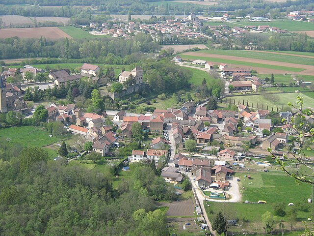
- commune in Isère, France
Hiking in Vernas, a picturesque area in the French Alps, offers a variety of trails suited for all skill levels, from gentle walks to challenging mountain ascents. Here are a few key highlights to consider when hiking in this beautiful region:
Scenic Trails
- GR5 Trail: This long-distance trail runs through the Alps and offers stunning views. Sections of it near Vernas provide breathtaking panoramas and varied terrain.
- Local Nature Walks: Shorter paths around Vernas allow hikers to immerse themselves in the local flora and fauna, with well-marked routes easily accessible from the village.
Natural Attractions
- Lakes: Nearby alpine lakes, such as Lac de Verney, provide scenic picnic spots and wonderful photo opportunities.
- Wildlife: Look out for local wildlife, including marmots and a variety of bird species, particularly in the summer months.
Hiking Seasons
- Summer (June to September): This is the most popular hiking season, with all trails accessible. The wildflowers are in bloom, and the weather is generally mild.
- Autumn (October): Enjoy stunning fall colors; however, check trail conditions as some may begin to close as snow levels rise.
- Winter: Some trails may be suitable for snowshoeing or winter hiking, depending on snow coverage.
Preparation and Safety
- Trail Maps: Always carry a detailed map or use a hiking app. The trails are often well-marked, but navigation aids are helpful.
- Gear: Wear appropriate hiking gear, including sturdy boots and weather-appropriate clothing. Layers are recommended due to changing weather conditions.
- Hydration and food: Carry enough water and snacks, especially on longer hikes.
Local Services
- Guided Tours: Consider joining a guided hike to learn more about the area's ecology and history.
- Accommodations: Vernas offers various lodgings, from campsites to charming chalets, making it convenient for overnight stays.
Make sure to check local resources or tourist information for up-to-date trail conditions, potential closures, and additional tips before you head out. Enjoy your hike in Vernas!
- Country:

- Postal Code: 38460
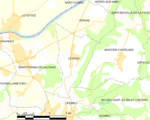
- Coordinates: 45° 46' 39" N, 5° 16' 54" E


- GPS tracks (wikiloc): [Link]
- Area: 5.87 sq km
- Population: 257
- Wikipedia en: wiki(en)
- Wikipedia: wiki(fr)
- Wikidata storage: Wikidata: Q1067344
- Wikipedia Commons Category: [Link]
- Freebase ID: [/m/03g_5pk]
- GeoNames ID: Alt: [6616683]
- SIREN number: [213805351]
- BnF ID: [15258335n]
- VIAF ID: Alt: [246303464]
- INSEE municipality code: 38535
Shares border with regions:


Annoisin-Chatelans
- commune in Isère, France
Annoisin-Chatelans, located in the Isère department of the Auvergne-Rhône-Alpes region in southeastern France, offers a variety of hiking opportunities for all skill levels. Nestled near the foothills of the French Alps, this area features beautiful landscapes, lush greenery, and scenic views....
- Country:

- Postal Code: 38460
- Coordinates: 45° 45' 25" N, 5° 17' 36" E


- GPS tracks (wikiloc): [Link]
- Area: 13.27 sq km
- Population: 666


Saint-Romain-de-Jalionas
- commune in Isère, France
 Hiking in Saint-Romain-de-Jalionas
Saint-Romain-de-Jalionas is a charming commune located in the Auvergne-Rhône-Alpes region of France, specifically within the Isère department. While it may not be as widely known as some other hiking destinations, it offers opportunities for those looking to explore the natural beauty of the area....
- Country:

- Postal Code: 38460
- Coordinates: 45° 45' 11" N, 5° 13' 12" E


- GPS tracks (wikiloc): [Link]
- Area: 13.65 sq km
- Population: 3216


Leyrieu
- commune in Isère, France
Leyrieu is a charming village located in the Auvergne-Rhône-Alpes region of France. Surrounded by beautiful natural landscapes, it offers several opportunities for hiking and outdoor activities. Here are some key points to consider when hiking in Leyrieu:...
- Country:

- Postal Code: 38460
- Coordinates: 45° 45' 28" N, 5° 15' 18" E


- GPS tracks (wikiloc): [Link]
- Area: 6.39 sq km
- Population: 799

Saint-Vulbas
- commune in Ain, France
Saint-Vulbas is a charming commune located in the Ain department of the Auvergne-Rhône-Alpes region in France. It’s a great spot for hiking enthusiasts due to its picturesque landscapes, relatively accessible trail systems, and proximity to natural features....
- Country:

- Postal Code: 01150
- Coordinates: 45° 50' 2" N, 5° 17' 27" E


- GPS tracks (wikiloc): [Link]
- Area: 21.44 sq km
- Population: 1194
- Web site: [Link]


Hières-sur-Amby
- commune in Isère, France
Hières-sur-Amby is a charming commune located in the Isère department in the Auvergne-Rhône-Alpes region of France. It’s surrounded by natural beauty and offers various hiking opportunities, making it a great destination for outdoor enthusiasts....
- Country:

- Postal Code: 38118
- Coordinates: 45° 47' 51" N, 5° 17' 38" E


- GPS tracks (wikiloc): [Link]
- AboveSeaLevel: 429 м m
- Area: 8.73 sq km
- Population: 1245
- Web site: [Link]

Loyettes
- commune in Ain, France
Loyettes is a small commune located in the Auvergne-Rhône-Alpes region of France. While it may not be as widely known for hiking as some other areas in the region, there are still opportunities for outdoor activities and enjoying nature nearby....
- Country:

- Postal Code: 01360
- Coordinates: 45° 46' 27" N, 5° 12' 11" E


- GPS tracks (wikiloc): [Link]
- Area: 21.28 sq km
- Population: 3145
- Web site: [Link]
