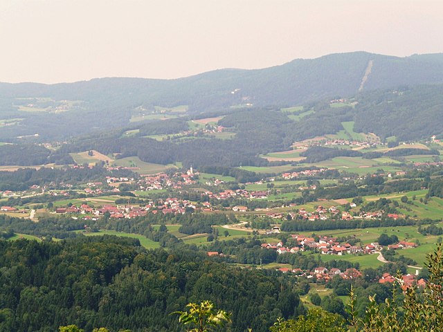
Hunding (Hunding)

- municipality of Germany
 Hiking in Hunding
It appears that "Hunding" may refer to a specific location that isn't widely recognized or perhaps has a different name more commonly used. However, if you meant to ask about hiking in a general area known for its outdoor activities, I can provide you with some tips and recommendations based on popular hiking destinations.
If you are indeed asking about a specific place, please provide additional context or correct any spelling, and I’ll do my best to assist you!
In general, here are some tips for a successful hiking trip:
-
Research the Area: Look for trail maps and reviews to find suitable trails based on your experience level and the kind of scenery you’re hoping to enjoy.
-
Pack Appropriately: Always carry the ten essentials: navigation tools, water, food, clothing layers, first aid kit, fire-starting equipment, a headlamp, a multi-tool, sunscreen, and insect repellent.
-
Consider Weather Conditions: Always check the weather forecast before heading out. Weather can change quickly in mountainous areas.
-
Know Your Limits: Choose trails that match your fitness level and experience. Don’t hesitate to turn around if conditions become unsafe.
-
Respect the Environment: Follow Leave No Trace principles to minimize your impact on nature.
-
Safety First: Let someone know your hiking plan and expected return time. Carry a whistle or other signaling device in case of emergencies.
If you're looking for specific trails, information on local flora and fauna, or tips on gear, feel free to ask!
- Country:

- Postal Code: 94551
- Local Dialing Code: 09904
- Licence Plate Code: DEG
- Coordinates: 48° 51' 0" N, 13° 11' 0" E


- GPS tracks (wikiloc): [Link]
- AboveSeaLevel: 468 м m
- Area: 14.67 sq km
- Population: 1171
- Web site: http://www.hunding.de
- Wikipedia en: wiki(en)
- Wikipedia: wiki(de)
- Wikidata storage: Wikidata: Q627437
- Wikipedia Commons Category: [Link]
- Freebase ID: [/m/02p6c68]
- GeoNames ID: Alt: [6556459]
- VIAF ID: Alt: [249071802]
- OSM relation ID: [959805]
- GND ID: Alt: [4257437-7]
- Bavarikon ID: [ODB_A00001441]
- German municipality key: 09271126
Shares border with regions:


Schöfweg
- municipality of Germany
Hiking in Schöfweg
Schöfweg, located in the Bavarian Forest in Germany, offers beautiful hiking opportunities for outdoor enthusiasts. The region is known for its stunning natural landscapes, dense forests, and diverse wildlife, making it a great destination for hikers of all skill levels....
- Country:
- Postal Code: 94572
- Local Dialing Code: 09908
- Licence Plate Code: FRG
- Coordinates: 48° 50' 20" N, 13° 13' 43" E
- GPS tracks (wikiloc): [Link]
- AboveSeaLevel: 772 м m
- Area: 19.02 sq km
- Population: 1174
- Web site: [Link]

Grattersdorf
- municipality of Germany
Hiking in Grattersdorf
Grattersdorf, a small village in Bavaria, Germany, is situated in a scenic area ideal for hiking enthusiasts. Here are some features to consider if you're planning a hike in this picturesque region:...
- Country:
- Postal Code: 94551; 94541
- Local Dialing Code: 09904
- Licence Plate Code: DEG
- Coordinates: 48° 48' 0" N, 13° 9' 0" E
- GPS tracks (wikiloc): [Link]
- AboveSeaLevel: 476 м m
- Area: 25.98 sq km
- Population: 1258
- Web site: [Link]
Lalling
- municipality of Germany
Hiking in Lalling
Lalling, located in Bavaria, Germany, offers a variety of beautiful hiking opportunities, characterized by its stunning landscapes, lush forests, and picturesque surroundings. Here are some highlights for hiking in Lalling:...
- Country:
- Postal Code: 94551
- Local Dialing Code: 09904
- Licence Plate Code: DEG
- Coordinates: 48° 51' 0" N, 13° 8' 0" E
- GPS tracks (wikiloc): [Link]
- AboveSeaLevel: 446 м m
- Area: 27.92 sq km
- Population: 1541
- Web site: [Link]