Lalling (Lalling)

- municipality of Germany
 Hiking in Lalling
Lalling, located in Bavaria, Germany, offers a variety of beautiful hiking opportunities, characterized by its stunning landscapes, lush forests, and picturesque surroundings. Here are some highlights for hiking in Lalling:
Scenic Trails
-
Donau-Ilz-Radweg: This trail runs through the heart of the Bavarian Forest, following the Danube River and the Ilz River. It offers beautiful views and is suitable for both hikers and cyclists.
-
Lalling Nature Trail: There are several nature trails in the area that showcase the local flora and fauna. These trails are well-marked and provide educational information about the region's biodiversity.
-
Bavarian Forest National Park: Just a short drive away, this national park features a variety of hiking trails, including ones that lead through pristine forests, past glacial lakes, and up to scenic viewpoints like the Grosser Arber.
Difficulty Levels
The hiking trails around Lalling range from easy strolls suitable for families to challenging hikes for seasoned outdoor enthusiasts. It's essential to choose a trail that matches your fitness level and experience.
Best Time to Hike
The best times for hiking in Lalling are typically late spring through early fall when the weather is more stable and the vegetation is lush. However, winter hiking is also possible in the area, providing a different but beautiful experience.
Preparation Tips
- Check Weather Conditions: Weather can change quickly in the mountains, so it's essential to check forecasts before heading out.
- Dress Appropriately: Wear sturdy hiking boots and appropriate clothing for the trail conditions. Layering is advisable as temperatures can vary.
- Bring Supplies: Carry enough water, snacks, and a map or GPS device. It's also advisable to have a fully charged phone for navigation and safety.
- Stay on Marked Trails: To protect the environment and ensure your safety, stick to marked hiking paths.
Local Amenities
Lalling and the surrounding areas have accommodations, restaurants, and shops to support your hiking adventure. It's a good idea to plan your stay ahead of time, especially during peak hiking seasons.
Conclusion
Hiking in Lalling is a rewarding experience that showcases the natural beauty of Bavaria. With careful planning and preparation, you can enjoy the diverse landscapes and tranquil settings that this region has to offer. Always remember to follow local guidelines and leave no trace to preserve the environment for future hikers. Happy hiking!
- Country:

- Postal Code: 94551
- Local Dialing Code: 09904
- Licence Plate Code: DEG
- Coordinates: 48° 51' 0" N, 13° 8' 0" E


- GPS tracks (wikiloc): [Link]
- AboveSeaLevel: 446 м m
- Area: 27.92 sq km
- Population: 1541
- Web site: https://www.lalling.de/
- Wikipedia en: wiki(en)
- Wikipedia: wiki(de)
- Wikidata storage: Wikidata: Q510035
- Wikipedia Commons Category: [Link]
- Freebase ID: [/m/02q0_z2]
- GeoNames ID: Alt: [2881787]
- VIAF ID: Alt: [246642069]
- OSM relation ID: [959807]
- GND ID: Alt: [4269989-7]
- TGN ID: [7149723]
- Bavarikon ID: [ODB_A00001444]
- German municipality key: 09271130
Shares border with regions:

Auerbach
- municipality of Germany
Hiking in Auerbach
Auerbach in Lower Bavaria is a picturesque area that offers a variety of hiking opportunities in the beautiful Bavarian countryside. Here are some highlights and tips for hiking in Auerbach and the surrounding region:...
- Country:
- Postal Code: 94530
- Local Dialing Code: 09901
- Licence Plate Code: DEG
- Coordinates: 48° 48' 0" N, 13° 6' 0" E
- GPS tracks (wikiloc): [Link]
- AboveSeaLevel: 396 м m
- Area: 24.06 sq km
- Population: 2088
- Web site: [Link]


Kirchberg im Wald
- municipality of Germany
Hiking in Kirchberg im Wald
Kirchberg im Wald, located in Bavaria, Germany, is a charming destination for outdoor enthusiasts, particularly those who enjoy hiking. The area is surrounded by beautiful natural landscapes, including rolling hills, dense forests, and picturesque meadows, making it an ideal spot for various hiking trails....
- Country:
- Postal Code: 94259
- Local Dialing Code: 09927
- Licence Plate Code: REG
- Coordinates: 48° 54' 0" N, 13° 11' 0" E
- GPS tracks (wikiloc): [Link]
- AboveSeaLevel: 880 м m
- Area: 48.79 sq km
- Population: 3969
- Web site: [Link]


Bischofsmais
- municipality of Germany
Hiking in Bischofsmais
Bischofsmais is a charming village located in the Bavarian Forest in Germany, making it an excellent destination for hiking enthusiasts. The region is characterized by its lush forests, rolling hills, and stunning views, offering a variety of trails suitable for different skill levels....
- Country:
- Postal Code: 94253
- Local Dialing Code: 09920
- Licence Plate Code: REG
- Coordinates: 48° 55' 0" N, 13° 5' 0" E
- GPS tracks (wikiloc): [Link]
- AboveSeaLevel: 682 м m
- Area: 46.28 sq km
- Population: 3009
- Web site: [Link]


Schöfweg
- municipality of Germany
Hiking in Schöfweg
Schöfweg, located in the Bavarian Forest in Germany, offers beautiful hiking opportunities for outdoor enthusiasts. The region is known for its stunning natural landscapes, dense forests, and diverse wildlife, making it a great destination for hikers of all skill levels....
- Country:
- Postal Code: 94572
- Local Dialing Code: 09908
- Licence Plate Code: FRG
- Coordinates: 48° 50' 20" N, 13° 13' 43" E
- GPS tracks (wikiloc): [Link]
- AboveSeaLevel: 772 м m
- Area: 19.02 sq km
- Population: 1174
- Web site: [Link]

Schaufling
- municipality of Germany
Hiking in Schaufling
Schaufling, located in the Lower Bavaria region of Germany, is a wonderful spot for hiking enthusiasts. Surrounded by picturesque landscapes, including rolling hills, dense forests, and tranquil rivers, it offers various trails suitable for all skill levels. Here are some highlights for hiking in Schaufling:...
- Country:
- Postal Code: 94571
- Local Dialing Code: 09904
- Licence Plate Code: DEG
- Coordinates: 48° 51' 0" N, 13° 4' 0" E
- GPS tracks (wikiloc): [Link]
- AboveSeaLevel: 443 м m
- Area: 25.39 sq km
- Population: 1471
- Web site: [Link]

Grattersdorf
- municipality of Germany
Hiking in Grattersdorf
Grattersdorf, a small village in Bavaria, Germany, is situated in a scenic area ideal for hiking enthusiasts. Here are some features to consider if you're planning a hike in this picturesque region:...
- Country:
- Postal Code: 94551; 94541
- Local Dialing Code: 09904
- Licence Plate Code: DEG
- Coordinates: 48° 48' 0" N, 13° 9' 0" E
- GPS tracks (wikiloc): [Link]
- AboveSeaLevel: 476 м m
- Area: 25.98 sq km
- Population: 1258
- Web site: [Link]
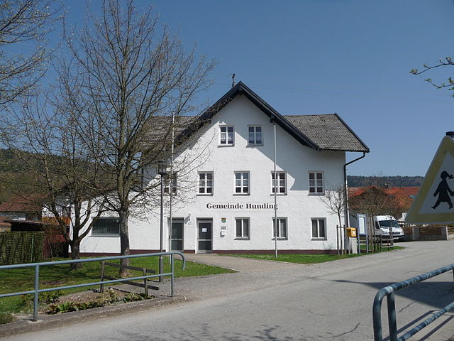
Hunding
- municipality of Germany
Hiking in Hunding
It appears that "Hunding" may refer to a specific location that isn't widely recognized or perhaps has a different name more commonly used. However, if you meant to ask about hiking in a general area known for its outdoor activities, I can provide you with some tips and recommendations based on popular hiking destinations....
- Country:
- Postal Code: 94551
- Local Dialing Code: 09904
- Licence Plate Code: DEG
- Coordinates: 48° 51' 0" N, 13° 11' 0" E
- GPS tracks (wikiloc): [Link]
- AboveSeaLevel: 468 м m
- Area: 14.67 sq km
- Population: 1171
- Web site: [Link]