
Ille-sur-Têt (Ille-sur-Têt)

- commune in Pyrénées-Orientales, France
- Country:

- Postal Code: 66130
- Coordinates: 42° 40' 14" N, 2° 37' 14" E


- GPS tracks (wikiloc): [Link]
- Area: 31.67 sq km
- Population: 5466
- Web site: http://www.ille-sur-tet.com
- Wikipedia en: wiki(en)
- Wikipedia: wiki(fr)
- Wikidata storage: Wikidata: Q689461
- Wikipedia Commons Category: [Link]
- Freebase ID: [/m/03h5hc2]
- GeoNames ID: Alt: [3012848]
- SIREN number: [216600882]
- BnF ID: [152709991]
- VIAF ID: Alt: [153674129]
- OSM relation ID: [20339]
- Library of Congress authority ID: Alt: [n85207874]
- PACTOLS thesaurus ID: [pcrtx5pBPaNoVm]
- INSEE municipality code: 66088
Shares border with regions:


Montalba-le-Château
- commune in Pyrénées-Orientales, France
- Country:
- Postal Code: 66130
- Coordinates: 42° 41' 45" N, 2° 33' 35" E
- GPS tracks (wikiloc): [Link]
- Area: 15.9 sq km
- Population: 148

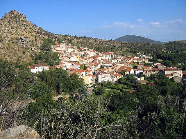
Bélesta
- commune in Pyrénées-Orientales, France
- Country:
- Postal Code: 66720
- Coordinates: 42° 43' 3" N, 2° 36' 27" E
- GPS tracks (wikiloc): [Link]
- AboveSeaLevel: 380 м m
- Area: 20.52 sq km
- Population: 232


Millas
- commune in Pyrénées-Orientales, France
- Country:
- Postal Code: 66170
- Coordinates: 42° 41' 30" N, 2° 41' 44" E
- GPS tracks (wikiloc): [Link]
- Area: 19.12 sq km
- Population: 4218
- Web site: [Link]
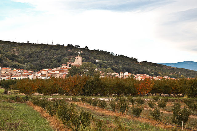

Bouleternère
- commune in Pyrénées-Orientales, France
- Country:
- Postal Code: 66130
- Coordinates: 42° 38' 59" N, 2° 35' 12" E
- GPS tracks (wikiloc): [Link]
- AboveSeaLevel: 180 м m
- Area: 10.63 sq km
- Population: 927


Saint-Michel-de-Llotes
- commune in Pyrénées-Orientales, France
- Country:
- Postal Code: 66130
- Coordinates: 42° 38' 56" N, 2° 37' 26" E
- GPS tracks (wikiloc): [Link]
- Area: 8.64 sq km
- Population: 339

Rodès
- commune in Pyrénées-Orientales, France
- Country:
- Postal Code: 66320
- Coordinates: 42° 39' 26" N, 2° 33' 43" E
- GPS tracks (wikiloc): [Link]
- Area: 18.11 sq km
- Population: 630
- Web site: [Link]


Corbère
- commune in Pyrénées-Orientales, France
- Country:
- Postal Code: 66130
- Coordinates: 42° 39' 11" N, 2° 39' 39" E
- GPS tracks (wikiloc): [Link]
- Area: 7.25 sq km
- Population: 728

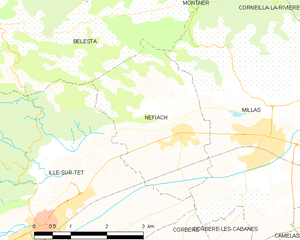
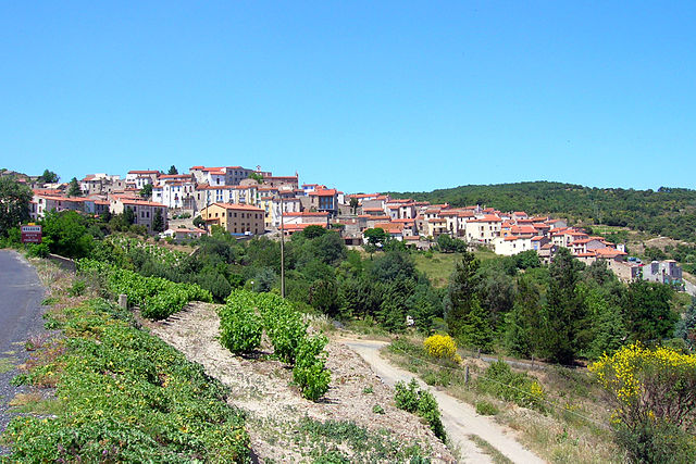
Néfiach
- commune in Pyrénées-Orientales, France
- Country:
- Postal Code: 66170
- Coordinates: 42° 41' 38" N, 2° 40' 1" E
- GPS tracks (wikiloc): [Link]
- Area: 8.81 sq km
- Population: 1262
- Web site: [Link]