Indre (Indre)

- commune in Loire-Atlantique, France
- Country:

- Postal Code: 44620; 44610
- Coordinates: 47° 11' 55" N, 1° 40' 16" E


- GPS tracks (wikiloc): [Link]
- AboveSeaLevel: 8 м m
- Area: 4.72 sq km
- Population: 3935
- Web site: http://www.indre44.fr
- Wikipedia en: wiki(en)
- Wikipedia: wiki(fr)
- Wikidata storage: Wikidata: Q457613
- Wikipedia Commons Category: [Link]
- Freebase ID: [/m/03nwcvt]
- Freebase ID: [/m/03nwcvt]
- GeoNames ID: Alt: [3034697]
- GeoNames ID: Alt: [3034697]
- SIREN number: [214400749]
- SIREN number: [214400749]
- BnF ID: [152602438]
- BnF ID: [152602438]
- VIAF ID: Alt: [150118241]
- VIAF ID: Alt: [150118241]
- PACTOLS thesaurus ID: [pcrtEvH8SiXQ7P]
- PACTOLS thesaurus ID: [pcrtEvH8SiXQ7P]
- MusicBrainz area ID: [b200c184-4cd9-4063-8130-2b7380356ebc]
- MusicBrainz area ID: [b200c184-4cd9-4063-8130-2b7380356ebc]
- INSEE municipality code: 44074
- INSEE municipality code: 44074
Shares border with regions:


Saint-Herblain
- commune in Loire-Atlantique, France
- Country:
- Postal Code: 44800
- Coordinates: 47° 13' 4" N, 1° 38' 54" E
- GPS tracks (wikiloc): [Link]
- Area: 30.02 sq km
- Population: 45786
- Web site: [Link]


Bouguenais
- commune in Loire-Atlantique, France
- Country:
- Postal Code: 44340
- Coordinates: 47° 10' 45" N, 1° 37' 29" E
- GPS tracks (wikiloc): [Link]
- Area: 31.5 sq km
- Population: 18815
- Web site: [Link]
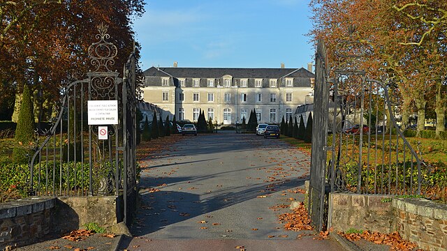
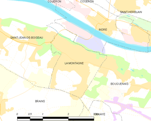
La Montagne
- commune in Loire-Atlantique, France
- Country:
- Postal Code: 44620
- Coordinates: 47° 11' 24" N, 1° 41' 2" E
- GPS tracks (wikiloc): [Link]
- Area: 3.64 sq km
- Population: 6135
- Web site: [Link]


Couëron
- commune in Loire-Atlantique, France
- Country:
- Postal Code: 44220
- Coordinates: 47° 12' 53" N, 1° 43' 26" E
- GPS tracks (wikiloc): [Link]
- Area: 44.03 sq km
- Population: 20573
- Web site: [Link]


Saint-Jean-de-Boiseau
- commune in Loire-Atlantique, France
- Country:
- Postal Code: 44640
- Coordinates: 47° 11' 39" N, 1° 43' 29" E
- GPS tracks (wikiloc): [Link]
- Area: 11.4 sq km
- Population: 5566
- Web site: [Link]