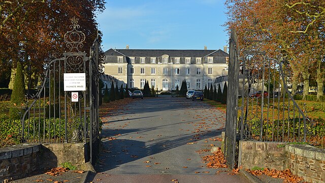
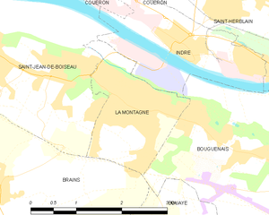
Saint-Jean-de-Boiseau (Saint-Jean-de-Boiseau)
- commune in Loire-Atlantique, France
- Country:

- Postal Code: 44640
- Coordinates: 47° 11' 39" N, 1° 43' 29" E


- GPS tracks (wikiloc): [Link]
- Area: 11.4 sq km
- Population: 5566
- Web site: http://www.saint-jean-de-boiseau.fr
- Wikipedia en: wiki(en)
- Wikipedia: wiki(fr)
- Wikidata storage: Wikidata: Q675750
- Wikipedia Commons Category: [Link]
- Freebase ID: [/m/03nwdlq]
- Freebase ID: [/m/03nwdlq]
- GeoNames ID: Alt: [2979344]
- GeoNames ID: Alt: [2979344]
- SIREN number: [214401663]
- SIREN number: [214401663]
- BnF ID: [15260335x]
- BnF ID: [15260335x]
- VIAF ID: Alt: [168350918]
- VIAF ID: Alt: [168350918]
- Library of Congress authority ID: Alt: [no2006078213]
- Library of Congress authority ID: Alt: [no2006078213]
- SUDOC authorities ID: [031204511]
- SUDOC authorities ID: [031204511]
- INSEE municipality code: 44166
- INSEE municipality code: 44166
Shares border with regions:


La Montagne
- commune in Loire-Atlantique, France
- Country:

- Postal Code: 44620
- Coordinates: 47° 11' 24" N, 1° 41' 2" E


- GPS tracks (wikiloc): [Link]
- Area: 3.64 sq km
- Population: 6135
- Web site: [Link]


Indre
- commune in Loire-Atlantique, France
- Country:

- Postal Code: 44620; 44610
- Coordinates: 47° 11' 55" N, 1° 40' 16" E


- GPS tracks (wikiloc): [Link]
- AboveSeaLevel: 8 м m
- Area: 4.72 sq km
- Population: 3935
- Web site: [Link]


Le Pellerin
- commune in Loire-Atlantique, France
- Country:

- Postal Code: 44640
- Coordinates: 47° 11' 54" N, 1° 45' 14" E


- GPS tracks (wikiloc): [Link]
- Area: 30.65 sq km
- Population: 4964
- Web site: [Link]


Couëron
- commune in Loire-Atlantique, France
- Country:

- Postal Code: 44220
- Coordinates: 47° 12' 53" N, 1° 43' 26" E


- GPS tracks (wikiloc): [Link]
- Area: 44.03 sq km
- Population: 20573
- Web site: [Link]


Brains
- commune in Loire-Atlantique, France
- Country:

- Postal Code: 44830
- Coordinates: 47° 10' 9" N, 1° 43' 18" E


- GPS tracks (wikiloc): [Link]
- Area: 15.31 sq km
- Population: 2741
- Web site: [Link]
